Capelsebrug metro station
Capelsebrug | |||||||||||||||||||||||||
|---|---|---|---|---|---|---|---|---|---|---|---|---|---|---|---|---|---|---|---|---|---|---|---|---|---|
| Rotterdam Metro station | |||||||||||||||||||||||||
 | |||||||||||||||||||||||||
| Coordinates | 51°57′26″N 4°32′58″E / 51.95722°N 4.54944°ECoordinates: 51°57′26″N 4°32′58″E / 51.95722°N 4.54944°E | ||||||||||||||||||||||||
| Owned by | RET | ||||||||||||||||||||||||
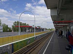
| Platforms | Island platform | ||||||||||||||||||||||||
| Tracks | 2 | ||||||||||||||||||||||||
| History | |||||||||||||||||||||||||
| Opened | 1982 | ||||||||||||||||||||||||
| Services | |||||||||||||||||||||||||
| |||||||||||||||||||||||||
Capelsebrug is a subway station on lines A, B, and C of the Rotterdam Metro. The station is situated in the eastern part of Rotterdam in the Netherlands, at the border with the municipality Capelle aan den IJssel. At Capelsebrug station, lines A and B turn north towards Schenkel station, while line C continues east towards Slotlaan station..
The westbound trains stop at either side of an island platform between two running tracks, while all eastbound trains share one platform.
This station was opened in 1982, and was the eastern terminus of the line (then called the Caland line), until it was extended towards Binnenhof station one year later. In 1994, the Capelle a/d IJssel branch (nowadays line C) was added, connecting Capelsebrug station with De Terp station.