Cape Foulwind

Cape Foulwind is a prominent headland on the West Coast of New Zealand's South Island, overlooking the Tasman Sea. It is located ten kilometres west of the town of Westport. It was previously named Rocky Cape by Abel Tasman, the first European to visit it, in 1642.[1] The present name was bestowed upon this promontory by English explorer James Cook in 1770[2] after his ship Endeavour was blown quite a distance offshore from this point.[1]
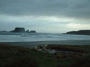
Tauranga Bay at Cape Foulwind is home to a fur seal[1] breeding colony, which is accessible by a well-maintained walking track.[2] That track, the Cape Foulwind Walkway crosses over undulating farmland, and along the edge of a scenic coastal escarpment. The walkway extends from the Cape Foulwind Road to Tauranga Bay.[3]
Starting from endemic Hector's Dolphins, several dolphin species including Orcas, Killer Whales can be observed around the area. Though still in very small numbers, whales such as Southern Right Whales are started making slow comebacks as well.
A large cement works is located close to the cape, taking advantage of the abundant limestone, sand and clay in the immediate area, plus nearby coal mines.[4]
In the lee of the cape, toward the Buller River mouth lies Carters Beach, claimed to be the only safe swimming beach on the West Coast of the South Island.[5]
For the former branch railway line to the quarry see Cape Foulwind Railway.
 Cape Foulwind living up to its name, with the cement works centre foreground. |
 The lighthouse at Cape Foulwind |
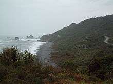
 Cape Foulwind: Looking out on the Tasman Sea |
References
- 1 2 3 "West Coast History". Retrieved 15 June 2016.
- 1 2 "Cape Foulwind and Tauranga Bay". Retrieved 15 June 2016.
- ↑ "Cape Foulwind: Buller, West Coast". Doc.govt.nz. 2006-10-26. Retrieved 2012-10-16.
- ↑ Simon Nathan (10 January 2014). "Westport cement works". Te Ara - the Encyclopedia of New Zealand. Retrieved 15 June 2016.
- ↑ Simon Nathan (12 June 2015). "'West Coast places - Westport'". Te Ara - the Encyclopedia of New Zealand. Retrieved 15 June 2016.
External links
Coordinates: 41°44′40″S 171°28′14″E / 41.74444°S 171.47056°E