Cape Flying Fish

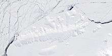
Cape Flying Fish (72°3′S 102°20′W / 72.050°S 102.333°WCoordinates: 72°3′S 102°20′W / 72.050°S 102.333°W) is an ice-covered cape which forms the western extremity of Thurston Island. It was discovered by Rear Admiral Richard E. Byrd and members of the US Antarctic Service in a flight from the Bear in February 1940. It was named by the Advisory Committee on Antarctic Names for the United States Exploring Expedition ship Flying Fish, commanded by Lieutenant William M. Walker, U.S. Navy, which reached a point within 125 miles of this cape; the ship's position on the morning of March 23, 1839 was 70°0′S 100°16′W / 70.000°S 100.267°W.[1]
Cape Flying Fish separates the Amundsen Sea in the west from the Bellingshausen Sea in the east.
Maps
- Thurston Island – Jones Mountains. 1:500000 Antarctica Sketch Map. US Geological Survey, 1967.
- Antarctic Digital Database (ADD). Scale 1:250000 topographic map of Antarctica. Scientific Committee on Antarctic Research (SCAR), 1993–2016.
References
- ↑ "Flying Fish, Cape". Geographic Names Information System. United States Geological Survey. Retrieved 2012-03-28.
![]() This article incorporates public domain material from the United States Geological Survey document "Flying Fish, Cape" (content from the Geographic Names Information System).
This article incorporates public domain material from the United States Geological Survey document "Flying Fish, Cape" (content from the Geographic Names Information System).