Cape (geography)
For other uses, see Cape (disambiguation).

Cape Cod and the islands off the Massachusetts coast, from space
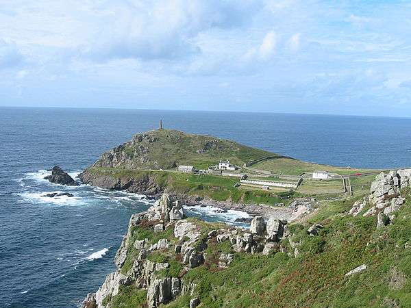
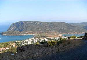
In geography, a cape is a headland or a promontory of large size extending into a body of water, usually the sea.[1] A cape usually represents a marked change in trend of the coastline. Their proximity to the coastline makes them prone to natural forms of erosion, mainly tidal actions. This results in capes having a relatively short geologic lifespan. Capes can be formed by glaciers, volcanoes, and changes in sea level. Erosion plays a large role in each of these methods of formation.
List of some well-known capes
Africa
- Eritrea–Sudan
- Ghana
- Liberia
- Cape Mesurado - The Cape on which Monrovia is located.
- Cape Palmas- Southernmost point in Liberia
- Grand Cape Mount
- Mauritania
- Morocco
- Senegal
- Somalia
- Cape Guardafui- Easternmost point in mainland Africa
- South Africa
- Cape Agulhas- Southernmost point in mainland Africa
- Cape of Good Hope
- Tunisia
- Cap Bon
- Ras Ben Sakka-Northernmost point in mainland Africa
- Boto
Asia
- India
- Philippines
- Russia
- Cape Chelyuskin (Northern tip of mainland Asia)
- Cape Dezhnev - Easternmost point in mainland Asia
- Turkey
- Cape Baba (Western tip of mainland Asia)
- Vietnam
Europe
- Albania
- Bulgaria
- Cyprus
- France
- Germany
- Greece
- Cape Matapan, also known as Cape Tainaron (Southern tip of mainland Europe, on Peloponnesus Peninsula)
- Latvia
- Norway
- Cape Nordkinn (Northern tip of mainland Europe)
- North Cape
- Portugal
- Cabo da Roca (Western tip of mainland Europe)
- Cabo de São Vicente / Sagres Point (Southwestern tip of mainland Europe)
- Spain
- Turkey
- Sarayburnu, İstanbul, the easternmost point of the historical city. Separates the Golden Horn Bay from the Sea of Marmara.
- United Kingdom
North America
- Canada
- Cape Breton Island, Nova Scotia
- Cape Chidley, Newfoundland and Labrador / Nunavut
- Cape Columbia, Nunavut (Canada's northernmost point)
- Cap Diamant, Quebec City
- Cape Race, Newfoundland and Labrador
- Cape Spear, Newfoundland and Labrador (Canada's easternmost point)
- Murchison Promontory, Nunavut (Northern tip of mainland America)
- Greenland
- Cape Farewell (Greenland's southernmost point)
- Cape Morris Jesup- Northernmost point of mainland Greenland.
- Mexico
- United States
- Cape Ann, Massachusetts
- Cape Canaveral, Florida
- Cape Charles, Virginia
- Cape Cod, Massachusetts
- Cape Coral, Florida
- Cape Fear, North Carolina
- Cape Flattery, Washington (Farthest northwest point of the contiguous, lower 48 states)
- Cape Girardeau, Missouri
- Cape Hatteras, North Carolina
- Cape Henlopen, Delaware
- Cape Henry, Virginia
- Cape Lookout, North Carolina
- Cape May, New Jersey
- Cape Prince of Wales, Alaska
- Cape San Blas, Florida
- Cape Sable, Florida- Southernmost point in the mainland United States
Oceania
South America
- Argentina
- Chile
- Venezuela
- Cape San Román (Paraguaná Peninsula's northernmost point)
References
| Wikimedia Commons has media related to Capes (geography). |
- ↑ Whittow, John (1984). Dictionary of Physical Geography. London: Penguin, 1984, p. 80. ISBN 0-14-051094-X.
This article is issued from Wikipedia - version of the 11/30/2016. The text is available under the Creative Commons Attribution/Share Alike but additional terms may apply for the media files.