Campogalliano
| Campogalliano | |
|---|---|
| Comune | |
| Comune di Campogalliano | |
 Campogalliano Location of Campogalliano in Italy | |
| Coordinates: 44°41′N 10°51′E / 44.683°N 10.850°ECoordinates: 44°41′N 10°51′E / 44.683°N 10.850°E | |
| Country | Italy |
| Region | Emilia-Romagna |
| Province / Metropolitan city | Modena (MO) |
| Frazioni | Saliceto Buzzalino, Panzano |
| Area | |
| • Total | 35.0 km2 (13.5 sq mi) |
| Elevation | 43 m (141 ft) |
| Population (Dec. 2004) | |
| • Total | 8,044 |
| • Density | 230/km2 (600/sq mi) |
| Demonym(s) | Campogallianesi |
| Time zone | CET (UTC+1) |
| • Summer (DST) | CEST (UTC+2) |
| Postal code | 41011 |
| Dialing code | 059 |
| Patron saint | St. Ursula |
| Saint day | October 21 |
| Website | Official website |
Campogalliano is a comune (municipality) in the Province of Modena in the Italian region Emilia-Romagna, located about 45 kilometres (28 mi) northwest of Bologna and about 8 kilometres (5 mi) northwest of Modena. As of 31 December 2004, it had a population of 8,044 and an area of 35.0 square kilometres (13.5 sq mi).[1]
Campogalliano borders the following municipalities: Carpi, Correggio, Modena, Rubiera, San Martino in Rio.
Main sights
- Balance Museum
The factory were the Bugatti EB110 was built is in Campogalliano.
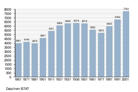
Demographic evolution
References
External links
This article is issued from Wikipedia - version of the 4/18/2016. The text is available under the Creative Commons Attribution/Share Alike but additional terms may apply for the media files.