Campbell, Ohio
| Campbell, Ohio | |
|---|---|
| City | |
|
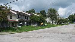
Houses on Jackson Street | |
 Location of Campbell, Ohio | |
 Location of Campbell in Mahoning County | |
| Coordinates: 41°4′38″N 80°35′26″W / 41.07722°N 80.59056°W | |
| Country | United States |
| State | Ohio |
| County | Mahoning |
| Government | |
| • Mayor | Nick Phillips[1] |
| Area[2] | |
| • Total | 3.74 sq mi (9.69 km2) |
| • Land | 3.71 sq mi (9.61 km2) |
| • Water | 0.03 sq mi (0.08 km2) |
| Elevation[3] | 1,030 ft (314 m) |
| Population (2010)[4] | |
| • Total | 8,235 |
| • Estimate (2012[5]) | 8,123 |
| • Density | 2,219.7/sq mi (857.0/km2) |
| Time zone | Eastern (EST) (UTC-5) |
| • Summer (DST) | EDT (UTC-4) |
| ZIP code | 44405 |
| Area code(s) | 330 |
| FIPS code | 39-11066[6] |
| GNIS feature ID | 1056760[3] |
| Website | http://www.campbellohio.gov/ |
Campbell (/ˈkæməl/;[7] KAM-ǝl) is a city in Mahoning County, Ohio, United States. The population was 8,235 at the 2010 census. It is part of the Youngstown-Warren-Boardman, OH-PA Metropolitan Statistical Area.
Campbell was formerly known as the village of East Youngstown, and this designation still appears on real estate deeds for the city. In 1926, the city was renamed for local industrialist James A. Campbell, then chairman of the Youngstown Sheet and Tube Company.[8] A major destination for immigrants from Southern and Eastern Europe, Campbell is sometimes referred to as the "City of Churches," because of the wide variety of religious structures found throughout the community.
Geography
Campbell is located at 41°4′38″N 80°35′26″W / 41.07722°N 80.59056°WCoordinates: 41°4′38″N 80°35′26″W / 41.07722°N 80.59056°W.[9]
According to the United States Census Bureau, the city has a total area of 3.74 square miles (9.69 km2), of which 3.71 square miles (9.61 km2) is land and 0.03 square miles (0.08 km2) is water.[2]
Demographics
| Historical population | |||
|---|---|---|---|
| Census | Pop. | %± | |
| 1910 | 4,972 | — | |
| 1920 | 11,237 | 126.0% | |
| 1930 | 14,673 | 30.6% | |
| 1940 | 13,785 | −6.1% | |
| 1950 | 12,882 | −6.6% | |
| 1960 | 13,406 | 4.1% | |
| 1970 | 12,577 | −6.2% | |
| 1980 | 11,619 | −7.6% | |
| 1990 | 10,038 | −13.6% | |
| 2000 | 9,460 | −5.8% | |
| 2010 | 8,235 | −12.9% | |
| Est. 2015 | 7,982 | [10] | −3.1% |
| Sources:[6][11][12][13] | |||
As of the census[6] of 2000, there were 9,460 people, 3,729 households, and 2,602 families residing in the city. The population density was 2,536.8 people per square mile (979.2/km²). There were 4,099 housing units at an average density of 1,099.2/sq mi (424.3/km²). The racial makeup of the city was 77.21% White, 16.69% African American, 0.10% Native American, 0.21% Asian, 3.48% from other races, and 2.32% from two or more races. Hispanic or Latino of any race were 10.97% of the population.
There were 3,729 households out of which 28.3% had children under the age of 18 living with them, 45.9% were married couples living together, 18.2% had a female householder with no husband present, and 30.2% were non-families. 28.0% of all households were made up of individuals and 16.5% had someone living alone who was 65 years of age or older. The average household size was 2.54 and the average family size was 3.10.
In the city the population was spread out with 25.0% under the age of 18, 8.1% from 18 to 24, 23.9% from 25 to 44, 22.1% from 45 to 64, and 21.0% who were 65 years of age or older. The median age was 39.7 years. For every 100 females there were 86.2 males. For every 100 females age 18 and over, there were 81.9 males.
The median income for a household in the city was $29,803, and the median income for a family was $37,500. Males had a median income of $33,558 versus $20,121 for females. The per capita income for the city was $17,981. About 16.1% of families and 18.3% of the population were below the poverty line, including 29.2% of those under age 18 and 8.2% of those age 65 or over.
76.8% spoke English, 8.7% Greek, 8.5% Spanish, 2.7% Italian, and 1.8% Slovak.[14]
2010 census
As of the census[4] of 2010, there were 8,235 people, 3,393 households, and 2,209 families residing in the city. The population density was 2,219.7 inhabitants per square mile (857.0/km2). There were 3,974 housing units at an average density of 1,071.2 per square mile (413.6/km2). The racial makeup of the city was 69.1% White, 21.2% African American, 0.3% Native American, 0.4% Asian, 5.2% from other races, and 3.8% from two or more races. Hispanic or Latino of any race were 15.8% of the population.
There were 3,393 households of which 29.1% had children under the age of 18 living with them, 39.5% were married couples living together, 19.3% had a female householder with no husband present, 6.3% had a male householder with no wife present, and 34.9% were non-families. 31.2% of all households were made up of individuals and 15.3% had someone living alone who was 65 years of age or older. The average household size was 2.43 and the average family size was 3.03.
The median age in the city was 41.5 years. 23.2% of residents were under the age of 18; 8.7% were between the ages of 18 and 24; 21.7% were from 25 to 44; 26.8% were from 45 to 64; and 19.6% were 65 years of age or older. The gender makeup of the city was 47.4% male and 52.6% female.
Media and culture
Campbell is served by the Hometown Journal, a local weekly newspaper.
Campbell is served by a branch of the Public Library of Youngstown and Mahoning County.
References
- ↑ "Administration". City of Campbell, OH. Retrieved 19 July 2016.
- 1 2 "US Gazetteer files 2010". United States Census Bureau. Archived from the original on 2012-07-14. Retrieved 2013-01-06.
- 1 2 "US Board on Geographic Names". United States Geological Survey. 2007-10-25. Retrieved 2008-01-31.
- 1 2 "American FactFinder". United States Census Bureau. Retrieved 2013-01-06.
- ↑ "Population Estimates". United States Census Bureau. Archived from the original on 2013-06-17. Retrieved 2013-06-17.
- 1 2 3 "American FactFinder". United States Census Bureau. Archived from the original on 2013-09-11. Retrieved 2008-01-31.
- ↑ http://scrippsjschool.org/pronunciation/
- ↑ Overman, William Daniel (1958). Ohio Town Names. Akron, OH: Atlantic Press. p. 22.
- ↑ "US Gazetteer files: 2010, 2000, and 1990". United States Census Bureau. 2011-02-12. Retrieved 2011-04-23.
- ↑ "Annual Estimates of the Resident Population for Incorporated Places: April 1, 2010 to July 1, 2015". Retrieved July 2, 2016.
- ↑ "Number of Inhabitants: Ohio" (PDF). 18th Census of the United States. U.S. Census Bureau. Retrieved 22 November 2013.
- ↑ "Ohio: Population and Housing Unit Counts" (PDF). U.S. Census Bureau. Retrieved 22 November 2013.
- ↑ "Incorporated Places and Minor Civil Divisions Datasets: Subcounty Population Estimates: April 1, 2010 to July 1, 2012". U.S. Census Bureau. Archived from the original on 17 June 2013. Retrieved 25 November 2013.
- ↑ http://www.mla.org/map_data_results&state_id=39&place_id=11066&cty_id=
External links
Municipalities and communities of Mahoning County, Ohio, United States | ||
|---|---|---|
| Cities | 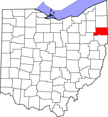 | |
| Villages | ||
| Townships | ||
| CDPs | ||
| Unincorporated communities |
| |
| Footnotes | ‡This populated place also has portions in an adjacent county or counties | |