Camillus (village), New York
| Camillus, New York | |
|---|---|
| Village | |
_highlighted.svg.png) Location in Onondaga County and the state of New York. | |
| Coordinates: 43°2′22″N 76°18′29″W / 43.03944°N 76.30806°WCoordinates: 43°2′22″N 76°18′29″W / 43.03944°N 76.30806°W | |
| Country | United States |
| State | New York |
| County | Onondaga |
| Area | |
| • Total | 0.4 sq mi (1.0 km2) |
| • Land | 0.4 sq mi (1.0 km2) |
| Population (2010) | |
| • Total | 1,213 |
| • Density | 3,100/sq mi (1,200/km2) |
| Time zone | Eastern (EST) (UTC-5) |
| • Summer (DST) | EDT (UTC-4) |
| FIPS code | 36-11902 |
Camillus is a village in Onondaga County, New York, United States. The population was 1,213 at the 2010 census. The village takes its name from the town in which it is located. It is part of the Syracuse Metropolitan Statistical Area.
The village of Camillus is in the town of Camillus, west of Syracuse, New York. It was the home of the world-famous Camillus Cutlery Company.
History
Camillus village was part of the former Central New York Military Tract. The village was one of the first locations settled, around 1790.
A protest against the Fugitive Slave Law was formulated in the village in 1852.
The First Baptist Church of Camillus and Camillus Union Free School are listed on the National Register of Historic Places.[1]
On February 11, 2013, the Camillus Cutlery Company caught on fire and was burned down. The cause of the fire was the result of a spark from a cutting torch, during metal removal, no one was injured or killed as a result of the fire.
Geography
Camillus is located at 43°2′21″N 76°18′28″W / 43.03917°N 76.30778°W (43.039364, -76.307996).[2]
According to the United States Census Bureau, the village has a total area of 0.4 square miles (1.0 km²), of which all is land.
Camillus is southwest of Onondaga Lake and is east of New York State Route 5 and New York State Route 174.
Nine Mile Creek, passing by the village, was a source of water for the Erie Canal.
Demographics
| Historical population | |||
|---|---|---|---|
| Census | Pop. | %± | |
| 1840 | 500 | — | |
| 1860 | 552 | — | |
| 1870 | 598 | 8.3% | |
| 1880 | 477 | −20.2% | |
| 1890 | 487 | 2.1% | |
| 1900 | 567 | 16.4% | |
| 1910 | 763 | 34.6% | |
| 1920 | 808 | 5.9% | |
| 1930 | 1,036 | 28.2% | |
| 1940 | 1,133 | 9.4% | |
| 1950 | 1,225 | 8.1% | |
| 1960 | 1,416 | 15.6% | |
| 1970 | 1,534 | 8.3% | |
| 1980 | 1,298 | −15.4% | |
| 1990 | 1,150 | −11.4% | |
| 2000 | 1,249 | 8.6% | |
| 2010 | 1,213 | −2.9% | |
| Est. 2015 | 1,228 | [3] | 1.2% |
As of the census[5] of 2000, there were 1,249 people, 568 households, and 305 families residing in the village. The population density was 3,188.9 people per square mile (1,236.5/km²). There were 627 housing units at an average density of 1,600.8 per square mile (620.7/km²). The racial makeup of the village was 97.12% White, 0.48% Black or African American, 0.88% Native American, 0.24% Asian, 0.08% from other races, and 1.20% from two or more races. Hispanic or Latino of any race were 0.96% of the population.
There were 568 households out of which 27.5% had children under the age of 18 living with them, 37.3% were married couples living together, 13.4% had a female householder with no husband present, and 46.3% were non-families. 38.4% of all households were made up of individuals and 13.4% had someone living alone who was 65 years of age or older. The average household size was 2.18 and the average family size was 2.93.
In the village the population was spread out with 24.3% under the age of 18, 8.3% from 18 to 24, 31.3% from 25 to 44, 22.8% from 45 to 64, and 13.3% who were 65 years of age or older. The median age was 36 years. For every 100 females there were 94.2 males. For every 100 females age 18 and over, there were 89.2 males.
The median income for a household in the village was $36,681, and the median income for a family was $48,125. Males had a median income of $32,424 versus $26,198 for females. The per capita income for the village was $19,939. About 6.9% of families and 8.0% of the population were below the poverty line, including 14.5% of those under age 18 and 1.2% of those age 65 or over.
References
- ↑ National Park Service (2009-03-13). "National Register Information System". National Register of Historic Places. National Park Service.
- ↑ "US Gazetteer files: 2010, 2000, and 1990". United States Census Bureau. 2011-02-12. Retrieved 2011-04-23.
- ↑ "Annual Estimates of the Resident Population for Incorporated Places: April 1, 2010 to July 1, 2015". Retrieved July 2, 2016.
- ↑ "Census of Population and Housing". Census.gov. Archived from the original on May 11, 2015. Retrieved June 4, 2015.
- ↑ "American FactFinder". United States Census Bureau. Archived from the original on 2013-09-11. Retrieved 2008-01-31.
External links
![]() Media related to Camillus, New York at Wikimedia Commons
Media related to Camillus, New York at Wikimedia Commons
Municipalities and communities of Onondaga County, New York, United States | ||
|---|---|---|
| City | 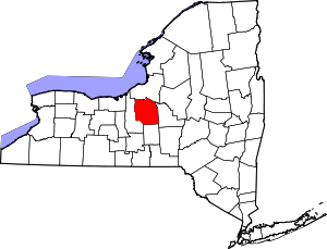 | |
| Towns | ||
| Villages | ||
| CDPs | ||
| Other hamlets |
| |
| Indian reservation | ||
| Footnotes | ‡This populated place also has portions in an adjacent county or counties | |