Cameron Highlands District
| Cameron Highlands Tanah Tinggi Cameron 金马崙高原 கேமரன் மலை | ||||||||
|---|---|---|---|---|---|---|---|---|
| District of Pahang | ||||||||
Clockwise, from top: Tea plantation • Sunbird • All Souls' Church • Time Tunnel museum • Orchid flower • Strawberry fruit | ||||||||
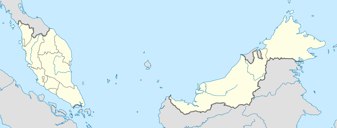 Cameron Highlands Location of Cameron Highlands in Malaysia | ||||||||
| Coordinates: 4°30′N 101°30′E / 4.5°N 101.5°ECoordinates: 4°30′N 101°30′E / 4.5°N 101.5°E | ||||||||
| Country |
| |||||||
| State |
| |||||||
| Discovered | 1885 by Sir William Cameron | |||||||
| Seat | Tanah Rata | |||||||
| Government | ||||||||
| • District officer | Dato Abdul Rahman Bin Hamzah | |||||||
| Area | ||||||||
| • Total | 712 km2 (275 sq mi) | |||||||
| Population (2010)[1] | ||||||||
| • Total | 38,471 | |||||||
| • Density | 54/km2 (140/sq mi) | |||||||
| Time zone | MST (UTC+08:00) | |||||||
| • Summer (DST) | Not observed (UTC) | |||||||
| Postcode | 39xxx | |||||||
| Vehicle registration | C, A | |||||||
| Website |
www | |||||||
.jpg)

_female_(8732049440).jpg)


The Cameron Highlands (Malay: Tanah Tinggi Cameron, Chinese: 金马崙高原, Tamil: கேமரன் மலை) is Malaysia’s most extensive hill station. It occupies an area of 712 square kilometres (275 sq mi). To the north, its boundary touches that of Kelantan; to the west, it shares part of its border with Perak.
Situated at the northwestern tip of Pahang, the “Camerons” is approximately 90 kilometres (56 mi) from Ipoh, roughly 200 kilometres (120 mi) from Kuala Lumpur or about 355 kilometres (221 mi) from Kuantan, the capital of Pahang. It is the smallest constituency in Pahang.
Discovered by Sir William Cameron in 1885, the outpost consists of three districts, namely Ringlet (5,165 hectares), Tanah Rata (2,081 hectares) and Ulu Telom (63,981 hectares). Its eight sub-districts are Ringlet, Tanah Rata (the administrative centre), Brinchang, the Bertam Valley, Kea Farm, Tringkap, Kuala Terla and Kampung Raja. All are nestled at elevations ranging from 1,100 metres (3,600 ft) to 1,600 metres (5,200 ft) above sea level.
The mean annual temperature of the retreat is about 18 °C (64 °F). During the day, the temperature seldom rises over 25 °C (77 °F); at night, it can drop to as low as 9 °C (48 °F) at the higher reaches.[2]
The resort has a diverse population of more than 38,000 people. It comprises Bumiputeras (Malay (7,321); others (5,668)), Chinese (13,099), Indians (6,988), non-Malaysian citizens (5,193), and other nationalities (202).[3] Most of the residents here are entrepreneurs, service industry employees, farm workers, retirees or government servants. The languages spoken are Malay, Mandarin, Tamil and English. Islam, Buddhism, Taoism, Hinduism, Christianity and Sikhism are the main religions of the haven.
Developed in the 1930s, the tableland is one of the oldest tourist spots in Malaysia. Apart from its tea estates, the plateau is also noted for its cool weather, orchards, nurseries, farmlands, waterfalls, rivers, lakes, wildlife, mossy forest, golf course, hotels, places of worship, bungalows, Land Rovers, museum and its aborigines (Orang Asli).
The Cameron Highlands can be accessed by road via Tapah, Simpang Pulai, Gua Musang or Sungai Koyan. Tapah and Simpang Pulai are the two approaches from Perak. Gua Musang and Sungai Koyan are the entryways from Kelantan and Pahang, respectively.
Background
The Cameron Highlands were named after Sir William Cameron, a British surveyor who was commissioned by the then colonial government to map out the Pahang-Perak border area in 1885.[4][5][6]
In a statement concerning his mapping expedition, Cameron mentioned he saw “a sort of vortex on the mountains, while for a (reasonably) wide area we have gentle slopes and plateau land.”[7]
When approached, the late Sir Hugh Low, the Resident of Perak (1887–1889), expressed the wish of developing the region into a "sanatorium, health resort and open farmland”. A narrow path to “Cameron’s Land” was then carved through the jungle. Nothing much happened after that.[8]
Forty years later, the tableland was given another review when Sir George Maxwell (1871–1959) visited the locale to see if it could be turned into a resort. He spent about nine days surveying the territory.[9] On his return from the highlands, Maxwell described the terrain as being “somewhat oval in shape.”[9] After comparing it with Nuwara Eliya in Sri Lanka and Baguio in the Philippines,[9] he decreed that the site should be developed into a hill station.[10]
In mid-1925, an Agricultural Experiment Station was set up to confirm if cinchona, tea, coffee, fruits and vegetables could be grown at the district. In December 1925, a superintendent was appointed to supervise the 200-acre (81-ha) plantation on Mount Beremban.[11] While research at the station was being carried out, the colonial office assigned Captain C.C. Best, a surveyor from the Federated Malay States to trace the Telom River (Malay: Sungei Telom). The Annual Report of the Survey Department (1925) states he explored “the Ulu of the Telom which was the actual area traversed by Cameron” and “he went first to what is known as Cameron Highlands to obtain a basis of comparison and from there crossed over into the Telom Valley. He made a reconnaissance map of the head waters of the Telom and his exploration has established definitely that the area at the Ulu of the Bertang (Bertam?) is incomparably the most suitable for development.”[12]
This report, coupled with the confirmation that tea could also be grown, gave the British the motivation to develop the place.

In 1926,[12] a development committee was formed to zone off the moorlands for agriculture, defence, administration, housing and recreation. Later, a three-million-dollar road[13] was constructed from Tapah to the highlands. It started from the 19th mile Tapah-Pahang Road and ended at Ginting “B” (Tanah Rata).[13]
The three-year contract was awarded to Messrs. Fogden, Brisbane and Company.[13] The first installment of $250,000 was made in 1926.[14] The project commenced on 1 January 1928; it was completed on Friday, 14 November 1930 – 47 days ahead of schedule.[13]
The building of the road was a challenge: the crew not only had to deal with the weather; they also had to cope with the risk of being struck down with malaria. During the construction stage, the manning level varied from 500 to 3,000 workers. Throughout the contract, 375 employees were hospitalised for fever.[13]
Communication between this remote plateau in Pahang and the outer world will be provided by a road 41 miles long from Tapah to the hill station. The first twelve miles of that road have been in existence for some years, and another three miles were added by the F.M.S. Public Works Department comparatively recently. The remaining 26 miles are being constructed by Fogden, Brisbane and Co., and the cost of the work to the F.M.S. Government will be something like $3,000,000.
The Straits Times, 7 June 1928.[15]
The biggest problem faced by the contractor was the haulage of heavy equipment from the lowlands to the upper reaches. This setback was overcome with the use of steam-driven locomotives which were designed for work on steep gradients.[5][16]
When the road was opened in 1931,[17] the British and the locals moved in to settle on the slopes of the mountain. They were soon followed by tea planters and vegetable growers who found the climate to be suitable for the growing of their crops.
On 1 July 1931, Cameron Highlands was made an autonomous sub-district under Kuala Lipis, with its own Deputy District Officer subordinate to the Lipis District Officer.[18]
By the mid-1930s, there was a notable improvement in the constituency: it now had a six-hole golf course,[19] several cottages, three inns, a police post, two boarding schools, a military camp, a dairy, a horse spelling ranch, nurseries, vegetable farms, tea plantations, a Government Rest House and an Agricultural Experiment Station.
The domain continued to grow until the outbreak of the Second World War. During the Japanese Occupation (1942–1945), there was hardly any development in the area. When the Japanese withdrew in August 1945, the place underwent a transformation. This, however, came to a halt during the Malayan Emergency (1948–1960). When the conflict ended, “Cameron’s Land” experienced a constant change in its landscape. Today, the haven is not only the biggest and best known of Malaysia’s hill stations; it is also the highest point in Peninsular Malaysia accessible by car.[20]
Climate
The Cameron Highlands is one of the few places in Malaysia that has a tropical highland climate. Its mean annual temperature is 18 °C (64 °F); its yearly precipitation is more than 2,700 mm (110 in). The lowest temperature recorded here was on Wednesday, 1 February 1978 – the temperature dropped to 7.8 °C (46.0 °F) at an altitude of 1,471.6 metres (4,828 ft).[21]
| Climate data for Cameron Highlands | |||||||||||||
|---|---|---|---|---|---|---|---|---|---|---|---|---|---|
| Month | Jan | Feb | Mar | Apr | May | Jun | Jul | Aug | Sep | Oct | Nov | Dec | Year |
| Average high °C (°F) | 21.4 (70.5) |
22.3 (72.1) |
23.0 (73.4) |
23.3 (73.9) |
23.2 (73.8) |
22.8 (73) |
22.3 (72.1) |
22.0 (71.6) |
21.9 (71.4) |
21.8 (71.2) |
21.7 (71.1) |
21.1 (70) |
22.2 (72) |
| Average low °C (°F) | 14.6 (58.3) |
14.6 (58.3) |
15.2 (59.4) |
15.8 (60.4) |
16.1 (61) |
15.6 (60.1) |
15.2 (59.4) |
15.3 (59.5) |
15.3 (59.5) |
15.3 (59.5) |
15.3 (59.5) |
14.9 (58.8) |
15.3 (59.5) |
| Average rainfall mm (inches) | 95.3 (3.752) |
144.0 (5.669) |
220.6 (8.685) |
257.5 (10.138) |
273.5 (10.768) |
174.4 (6.866) |
173.2 (6.819) |
229.5 (9.035) |
278.4 (10.961) |
373.0 (14.685) |
316.8 (12.472) |
209.8 (8.26) |
2,746 (108.11) |
| Average rainy days (≥ 1.0 mm) | 11 | 11 | 16 | 17 | 18 | 13 | 14 | 16 | 20 | 23 | 21 | 17 | 197 |
| Source: World Meteorological Organization[22] | |||||||||||||
Access
Car
Until the 1990s the only access road to the Cameron Highlands was by route ![]() which begins in Tapah, Perak. In 2004, a new access road was opened — highway
which begins in Tapah, Perak. In 2004, a new access road was opened — highway ![]() — connecting Simpang Pulai (about a kilometre south of Ipoh, Perak) through the northern part of the Highlands and Gua Musang in southern Kelantan before terminating in Kampung Kuala Jenderis in Hulu Terengganu, Terengganu.
— connecting Simpang Pulai (about a kilometre south of Ipoh, Perak) through the northern part of the Highlands and Gua Musang in southern Kelantan before terminating in Kampung Kuala Jenderis in Hulu Terengganu, Terengganu.
By 2010 a third access route was opened — highway ![]() — connecting Tanah Rata to FELDA Sungai Koyan, near Kuala Lipis. With the opening of this route, motorists from the other parts of Pahang (especially Kuantan) are now able to access the "Camerons" without having to leave the state.
— connecting Tanah Rata to FELDA Sungai Koyan, near Kuala Lipis. With the opening of this route, motorists from the other parts of Pahang (especially Kuantan) are now able to access the "Camerons" without having to leave the state.
There is another route to the hill station — the Pahang State Route (C5). It links Sungai Koyan to Raub which is the gateway to another resort — Fraser's Hill.
Public transportation
As with most of western Pahang, the Cameron Highlands is not served by any KTM railway station, the closest being in Kuala Lipis. Nevertheless, there are several bus services that connect the Highlands to the other towns in West Malaysia.
Geography and environment
The Cameron Highlands is unlike any other constituency in Malaysia; it is not only home to hundreds of floral species that are rare to the tropics, but it is also an area with a substantially different ecosystem.

“Moonlight” bungalow is in the foreground. The radio and television station is at the peak of the mountain. Photo credit: Time Tunnel museum.
In 1958, the outpost was declared a reserve for deer. Four years later, it became a venue affording protection to animals and birds.[23]
Located on the Main Range (Banjaran Titiwangsa), about 75 percent of the division is over a 1,000 metres (3,300 ft) above sea level. The humidity is high with no marked dry seasons. Its wettest months are from October to November; its “driest” period is from January to February.
.jpg)
The "Camerons" is one of the few places in Malaysia that serves as a habitat for a wide variety of flora and fauna. There are more than 700 species of plants that grow here. The vegetation changes as one ascends the mountain. The ward is known for its tea growing, vegetable farms and flower nurseries. Its woodlands form the prevailing natural ecosystem within and around the prefecture.
Besides its flora, the district is also noted for being a shelter for a wide variety of animals, birds, reptiles and insects. Of these, the Sumatran serow, mountain peacock-pheasant and Malayan whistling-thrush are listed in the 2004 IUCN Red List of Threatened Species.
Geographically, the resort is located on the highland “spine” of Peninsular Malaysia. Its height varies from 1,070 metres (3,510 ft) to 2,031 metres (6,663 ft).
There are eight mountains at the retreat. They are Mount (Malay: Gunung) Batu Brinchang (2,031 metres (6,663 ft)), Mount Berembun (1,840 metres (6,040 ft)), Mount Irau (2,091 metres (6,860 ft)), Mount Jasar (1,696 metres (5,564 ft)), Mount Mentigi (1,563 metres (5,128 ft)), Mount Perdah (1,576 metres (5,171 ft)) and Mount Siku (1,916 metres (6,286 ft)). Mount Swettenham (1,961 metres (6,434 ft)) is located on its border with Kelantan. At the top of Mount Batu Brinchang is a radio and television station. It was constructed by the British in the early 1950s. Close to it is the mossy forest. The trail to the forest starts from the Sungei Palas Boh Tea Plantation. It takes about 15 minutes to reach the cloud forest by road.
The environment in the Cameron Highlands needs urgent attention and should be safeguarded. Destruction of forests and hills has become a major problem,” said (Malaysian) Natural Resources and Environment Minister G. Palanivel in a statement.
According to The Star, some 40 hectares of virgin forests in Pos Terisu were fell in less than a month with the bulk of the ravaging spanning at least four valleys and hills. Water quality has deteriorated and the risk of erosions and landslides has risen, said the minister.
The Straits Times, 20 May 2013.[24]
The “Camerons” is unique when compared to the other hill stations in Malaysia — it is drained by eight rivers. The main rivers are the Bertam, Telom and Lemoi (Malay: Sungai Bertam, Sungai Telom and Sungai Lemoi). Their high points serve as the water catchment for the Pahang and Perak rivers (Malay: Sungai Pahang and Sungai Perak).
Overall, much of the retreat is still forested (estimated at 71 percent). Jungle trails lead visitors to scenic spots, waterfalls and aboriginal villages. Most of the tracks begin at Tanah Rata. There are more than eight paths to pick and choose from. Depending on its distance, some routes can take as long as five hours to cover.
Apart from its walks, the sanctuary is also known for it aborigines. The aborigines or Orang Asli are basically jungle dwellers. On the surface, their lifestyle has always been made out to be backward. But this has altered over the years. While many have left to take up residence in the nearby towns, there are still some who prefer to treat the woods as their home.
To date, there have been many changes at the resort. During the colonial era, the county was developed to be "a healthy hill station similar to Nuwara Eliya.”[25] Today, it is different.
During the Post-Independence Period (1957–1973), vast tracts of land were cleared for agriculture and infrastructure development. After 1974, more land was cleared for agriculture, housing projects, power plants, logging activities, livestock farming, hotel construction, small-scale industries, human resettlement and road building.
There is no doubt some of the advances have brought on economic benefits. This, however, has come with a price. Over the years, the “development (in this area) has been at the expense of the weather and the environment.”[26]
Landmarks and tourism
During the colonial era, the “Camerons” was a haven for those who were homesick. At present, it is a stopover for those who want to escape from the heat of the lowlands. Over the years, there have been many improvements at the province. Here are some landmarks that have withstood the test of time.
Agricultural Experiment Station (MARDI)
Established in 1925, the Agricultural Experiment Station was set up to determine the types crops that could grown at the tableland.

For a start, studies were carried out on cinchona (Succirubra and Ledgeriana), tea (Dangri, Dhonjan, Rajghur, Charali Assam, Amulguri and Dutea), coffee (Mysore variety), orange, lemon, pomelo, tree tomato, guava, strawberry and three species of grass (Australian blue couch, carpet and Guinea grass).[11] It was confirmed the uplands could support the growing of tea. This gave the British the impetus to develop the place.
In 1971, the station became a part of the Malaysian Agricultural Research and Development Institute (MARDI). Today, it still conducts research on a wide variety of crops that are grown at the district.
All Souls' Church
Located in Taman Sedia, Tanah Rata, the plateau's little Church of England was once acknowledged by the early members of its congregation as The Cameron Highlands Church.

The history of this establishment can be traced back to the 1950s when its services were held at either the Cameron Highlands Hotel (now the Cameron Highlands Resort) or the former Slim School.

In 1958, the church was offered a piece of land that used to adjoin the previous school. The plot, which was owned by Miss Anne Griffith-Jones (1890–1973), was transferred to the Diocese on the understanding that a church would be built on it. To get things going, the British Army donated a sum of RM$1,000 to the church. Further to this, they also gave it a dismantled Nissen hut.[27] It has since served as its roof structure to this day.
The construction of the church commenced in 1958. It was completed that same year. It was given the name “All Souls’ Church” during its consecration on Thursday, 30 April 1959. The Right Rev. Bishop H. W. Baines, the Bishop of Singapore and Malaya, conducted the services.
Bala’s Holiday Chalet (former Tanglin Boarding School)
The inn is one of the oldest buildings at the resort. Built in 1935, it was previously occupied by the Tanglin Boarding School. Founded by Miss Anne Griffith-Jones, the school began with less than 20 pupils. Its curriculum was based on the British education system.

The school continued to grow until the outbreak of the Second World War. It ceased to function during the Japanese Occupation of Malaya. After the war, it reopened.
During the Malayan Emergency (1948–1960), the school became a target for the Malayan National Liberation Army. It was eventually forced to close by the Federal Government for security reasons. In 1950, the property was sold to the British War Office.[28]
Cameron Highlands Golf Club
It began with a six-hole golf course in 1935.[19] In the early days, the club was patronised by the wealthy. Back then, it was common to find tiger paw prints in the bunkers.
Today, the club has changed a lot from what it once used to be. Apart from its improved facilities, it has also undergone a change in name. It presently operates as the Kelab Golf Sultan Ahmad Shah (SAS) Cameron Highlands.
Chefoo School
The first Chefoo School was opened in China in 1881. It moved to the Cameron Highlands in 1952. Initially, the boarding school functioned from the Overseas Missionary Fellowship bungalow. In 1960, it relocated to a six-acre site at Jalan Sultan Abu Bakar. It remained here for four decades.

In June 2001, the school had to close due to a drop in its student intake. The following year, the estate was sold to the Methodist Church in Malaysia. It is now known as the Methodist Centennial Chefoo Centre.
Cluny Lodge (Singapore House)
The three-storied flat was built before the commencement of the Second World War. Located in Tanah Rata, it sits atop a knoll overlooking the town of Brinchang.
The building was bought over by the Singapore Government in the early 1960s. Since then, it has been used by the employees of the Singapore Civil Service as their lodging house.
Foster’s Lakehouse
The inn was once the home of the late Colonel Stanley J. Foster. Constructed in 1966, it took Colonel Foster almost four years to complete it. Situated at the 30th Mile of Ringlet, the Lakehouse is perched on a hill overlooking the Sultan Abu Bakar Lake. Set in an area dubbed "The Valley of Eternal Spring", this establishment has a lush forest as its backdrop.
HSBC Bank Malaysia Berhad
Previously identified as The Hongkong and Shanghai Banking Corporation, HSBC Bank was the first financial institution to function at the Cameron Highlands.

In 1945, its banking services were carried out at the Cameron Highlands Hotel (now the Cameron Highlands Resort). Later, it moved to the British Military Hospital (now S.K. Convent). In 1947, it relocated to the Main Road at Tanah Rata. It has remained here to this day.
Kamunting Road (Jalan Kamunting)
There are five houses located along the main corridor of Kamunting Road (Malay: Jalan Kamunting). They are “Moonlight” bungalow (A47), “Sunlight” mansion (A46), “Unit A43”, the “Lee Villa” (A44) and the Lutheran Mission Home (A45).
The precinct was in the news when Jim Thompson disappeared from the Cameron Highlands on Sunday, 26 March 1967. More than 500 people came here to look for him. They included the police, the army, Orang Asli trekkers, Gurkhas, tourists, residents, mediums, scouts, missionaries, American school students and British servicemen convalescing at the retreat. After searching the area for days, Thompson was not to be found.
Lutheran Mission bungalow
The manor was constructed before the outbreak of the Second World War. It was then known as “Jee Lim Villa”.

Tucked at the far end of Kamunting Road (Malay: Jalan Kamunting), the place gained prominence when Jim Thompson vanished from the Cameron Highlands on Sunday, 26 March 1967.
The police were told he did stop by at the premises at around 4pm. While he was at the chalet, he did not speak to anyone. After taking a look at the garden, he left the site. Later, he was declared as lost.[34][35]
Moonlight bungalow
Located at A47 Kamunting Road (Malay: Jalan Kamunting), the mock Tudor-styled home is still a draw for the many who have had an interest in the life and disappearance of Jim Thompson.
The pre-War unit was constructed in 1933 by Societe Francaise des Mines d’Etain de Takka, a French mining company based in Gopeng, Perak. During the Malayan Emergency (1948–1960), its name was changed from the "French Tekka" bungalow to “Moonlight”. After the Emergency, the land was sold to the Lings. Later, it became the property of an Ipoh lawyer.
Jim Thompson came to the Cameron Highlands with Mrs. Constance (Connie) Mangskau on Friday, 24 March 1967. They stayed at "Moonlight" bungalow with Dr. Ling Tien-Gi, a Singaporean-Chinese chemist and Mrs. Helen Ling, his Caucasian American-born wife.
On Easter Sunday, 26 March they attended the morning services at All Souls' Church. After church, they returned to their bungalow.
At 1:30 pm,[32][33][36][37] Thompson went for a walk but failed to return before 6 pm.
SOLVED! (2nd ed.), pages 21 – 23 [38]
Over the years, the ownership of the bungalow has changed hands many times. Before the present owners moved in, "Moonlight" belonged to a Chinese businessman followed by a resident from Kuala Lumpur. It was later taken over by a Caucasian who then sold it to a hotelier. Today, the house is worth more than a million US dollars.[39] It is now called the Jim Thompson cottage.[40]
Overseas Missionary Fellowship (OMF) bungalow
The lodge was built in 1933 to provide accommodation for Christians who were involved with the preaching of the gospel. From 1952 to 1960, it served as the campus for the former Chefoo School. Thereafter, it became a venue for Christians to gather for their church activities.
Pensionnat Notre Dame (S.K. Convent)
The Convent Primary School was once a boarding school for the children of the resort’s expatriate community. Its history dates back to the time when the hill plain was first developed.
In the late 1920s, the Bishop of Malacca, H.E. Monsignor Emile Barillon wrote to the British government seeking a grant of land at the constituency. His purpose was to oversee a Catholic post comprising a monastery, a convent (Pensionnat Notre Dame), a retreat (Father’s House) and a church. His request was granted on condition a European boarding school was included in the plan.
The construction of the Pensionnat Notre Dame began in 1929. Mr. P.L.M. Nathan, was appointed the project’s architect and structural engineer.[41] The structure was completed in 1934. H.E. Monseigneur Adrian Pierre Devals blessed the building’s foundation on Monday, 9 July 1934. The first Mass was celebrated on Sunday, 26 May 1935. The Hon. Mr. C. C. Brown, the British Resident of Pahang officially opened the complex on Saturday, 27 July 1935.[42] Thereafter, the school continued to grow. In less than three months, the student intake grew from 18 to 70. By 1940, it had more than 240 pupils. This, however, came to a halt during the Second World War (1941–1945). The Japanese turned the place into a hospital.

After the war, the school reopened but it functioned from huts within its compound. The British continued to use the site as a hospital. Known as the British Military Hospital, it was leased from the church to serve as a convalescent depot for the members of the British Army.[43]
When the British withdrew in 1971, the Gothic-styled building was returned to the Catholic community. It was renamed Sekolah Rendah Kebangsaan (S.K. Convent).
Sunlight bungalow
The double-storied mansion was once used by a British company to house its staff. The pre-War abode is located about 50 metres (160 ft) from “Moonlight” bungalow. It is approximately three kilometres from Brinchang or about four kilometres from Tanah Rata.
In 1967, the villa made news when Jim Thompson mysteriously disappeared from the Cameron Highlands. The home was visited by scores of searchers. For days, the wasteland near the unit was carefully checked. At the end of the hunt, Thompson was not to be found.
Tanah Rata Post Office

The post office was officially opened by Tunku Abdul Rahman, the then Chief Minister of Malaya on Friday, 25 June 1956. Located on the Main Road (Malay: Jalan Besar), it is one of the few post offices in the area that provides its customers with a “Poste restante” service.
Ye Olde Smokehouse Inn
Built by William J. Warin in 1939,[44][45] the mock Tudor-styled hotel is renowned for celebrating everything British.
The inn is modelled on its namesake, the Smokehouse in Beck Row, Mildenhall, England, the United Kingdom. The interior is reminiscent of a typical English country house with open fireplaces and wood-panelled walls. Outside, the landscape would pass for an authentic English garden.
The landmark overlooks the Sultan Ahmad Shah golf course on the Tanah Rata-Bringchang road junction. It is still a popular place for visitors to gather for their afternoon tea and scones.
Townships and settlements

The Cameron Highlands is one of the 11 constituencies of Pahang, West Malaysia. Occupying an area of 712 square kilometres (275 sq mi), the district comprises three townships and five settlements. All are nestled at elevations ranging from 1,100 metres (3,600 ft) to 1,600 metres (5,200 ft) above sea level.
| ROAD TO CAMERON HIGHLANDS (TANAH RATA)[46] | ||
|---|---|---|
| TOWN/CITY | DISTANCE | ACCESS |
| Alor Setar (Kedah) | 326 km (203 mi). | Simpang Pulai |
| Gua Musang (Kelantan) | 124 km (77 mi). | -- |
| Hat Yai (Southern Thailand) | 523 km (325 mi). | Simpang Pulai |
| Ipoh (Perak) | 90 km (56 mi). | Simpang Pulai |
| Johor Bahru (Johor) | 541 km (336 mi). | Tapah |
| Kangar (Perlis) | 396 km (246 mi). | Simpang Pulai |
| Kota Bharu (Kelantan) | 307 km (191 mi). | Gua Musang |
| Kuala Lipis (Pahang) | 135 km (84 mi). | Sungai Koyan |
| Kuala Lumpur | 205 km (127 mi). | Tapah |
| Kuala Terengganu | 335 km (208 mi). | Gua Musang |
| Kuantan (Pahang) | 373 km (232 mi). | Sungai Koyan |
| Malacca City (Malacca) | 385 km (239 mi). | Tapah |
| Penang (George Town) | 247 km (153 mi). | Simpang Pulai |
| Raub (Pahang) | 146 km (91 mi). | Sungai Koyan |
| Seremban (Negri Sembilan) | 385 km (239 mi). | Tapah |
| Shah Alam (Selangor) | 205 km (127 mi). | Tapah |
| Simpang Pulai (Perak) | 80 km (50 mi). | -- |
| Singapore | 561 km (349 mi). | Tapah |
| Sungai Koyan (Pahang) | 96 km (60 mi). | -- |
| Tapah (Perak) | 56.6 km (35.2 mi). | -- |
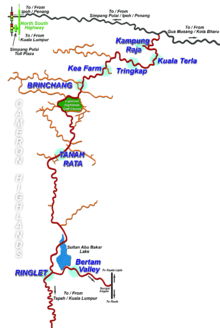
The three townships are Ringlet (1,100 metres (3,600 ft)), Tanah Rata (1,400 metres (4,600 ft)) and Brinchang (1,450 metres (4,760 ft)). The five settlements are the Bertam Valley, Kea Farm, Tringkap, Kuala Terla and Kampung Raja. The eight vicinities are linked via a 34-kilometre-long road that stretches from Ringlet to Kampung Raja.
Below is a brief description of the eight neighbourhoods.
| ROAD TO TANAH RATA[47] | |
|---|---|
| OUTPOST | DISTANCE |
| Bertam Valley | 14 km (8.7 mi). |
| Ringlet | 12.7 km (7.9 mi). |
| Brinchang | 5 km (3.1 mi). |
| Kea Farm | 7.8 km (4.8 mi). |
| Tringkap | 12 km (7.5 mi). |
| Kuala Terla | 17.7 km (11.0 mi). |
| Kampung Raja | 21.9 km (13.6 mi). |
The Bertam Valley is a scenic spot about two kilometres from Ringlet. It is involved with the growing of fruits, flowers and vegetables. It is now the Highlands' new entryway from Pahang via Sungei Koyan from Raub or Kuala Lipis.
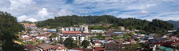
Brinchang is the "Camerons" second biggest town. The majority of its visitors are from Singapore or Malaysia. It is close to the "central market", orchards, nurseries, museum and golf course.
Apart from these attractions, the place is also known for its “Night Market”. The outdoor bazaar is usually held during the Malaysian school holidays or on weekends.
Kampung Raja is a residential area. It is the first colony after the turn off from Simpang Pulai. From here one can proceed to either Ipoh in Perak or to Gua Musang in Kelantan.
Kea Farm is located at an altitude of (1,600 metres (5,200 ft)). It is one of the highest villages in Peninsular Malaysia. It is adjacent to the tea estates and Mount Batu Brinchang (Malay: Gunung Batu Brinchang).
Kuala Terla is a farming commune. Its main activity is the cultivation of fruits, flowers and vegetables. Located about four kilometres from Kampung Raja, it has a mixed population comprising Chinese, Indians and Malays. Most of the residents here have no difficulties communicating in Malay.
Ringlet is the first town after the turn off from Tapah. It is one of the agricultural hubs of the resort. A wide variety of vegetables are grown at this township. The cool climate also favours the growing of passion fruit, strawberries and grapefruit.
Tanah Rata is the administrative centre of the retreat. The police station, government offices, hospital, schools, library, post office, shops, banks, eateries, inns, chalets, bus station and taxi stand are all within walking distance.
Amenities aside, the town is also noted for its intricate network of jungle tracks: trails 4 and 9 lead to the waterfalls; the rest meander to mountains, scenic spots or aboriginal villages.
Most of the walks are fairly well marked. They generally intersect with each other to form a “loop” around the city.
Tringkap is a farming enclave. It is a focal point for the growing of vegetables. A high percentage of its crops are grown on tiered terraces. The bulk of its produce is exported to Singapore.
Politics
Though named as such, the Cameron Highlands parliamentary constituency also covers a few areas that are outside the ward. For instance, the FELDA settlement of Sungai Koyan, which is represented by the Cameron Highlands in the federal parliament is located in the district of Kuala Lipis. The incumbent Member of Parliament is Palanivel Govindasamy, an independent. He was previously from the Malaysian Indian Congress, which is part of the ruling Barisan Nasional coalition but was sacked from the party in 2015 due to infringement of the party's constitution.
The Cameron Highlands itself contributes two seats to the Pahang State Legislative Assembly — Tanah Rata and Jelai. The Tanah Rata constituency covers the entire district of the Cameron Highlands; Jelai constituency covers the western part of Kuala Lipis which includes Sungai Koyan and some other FELDA settlements.
See also
 |
Sungai Siput Kuala Kangsar |
Lojing | Gua Musang | |
| Simpang Pulai Ipoh |
|
Merapoh Padang Tengku | ||
| ||||
| | ||||
| Tapah Kampar |
Raub | Kuala Lipis |
References
Notes
- ↑ "Table 3.6: Total population by ethnic group, sex, administrative district and state, Malaysia, 2010 (PDF). Population Distribution and Basic Demographic Characteristics 2010, Department of Statistics, Malaysia". pp. 67 (in PDF).
- ↑ De Souza, Edward Roy (2010). SOLVED! The "Mysterious" Disappearance of Jim Thompson, the Legendary Thai Silk King (2nd ed). Word Association Publishers. p. 19. ISBN 978-1-59571-505-0. LCCN 2009944204.
- ↑ "Table 3.6: Total population by ethnic group, sex, administrative district and state, Malaysia, 2010 (PDF). Population Distribution and Basic Demographic Characteristics 2010, Department of Statistics, Malaysia". pp. 67 (in PDF).
- ↑ "HISTORY OF CAMERON HIGHLANDS: Need For Continuity Of A Declared Government Policy, The Singapore Free Press and Mercantile Advertiser (1884–1942), Monday, 23 September 1935". p. 3 (Microfilm reel no. NL 3569), National Library, Singapore.
- 1 2 Moore, Wendy Khadijah (2004). Malaysia: A Pictorial History 1400–2004. Archipelago Press. p. 182. ISBN 981-4068-77-2.
- ↑ Barr, Pat (1977). TAMING THE JUNGLE. Martin Secker & Warburg Limited. p. 72. ISBN 0-436-03365-8.
- ↑ "HISTORY OF CAMERON HIGHLANDS: Need For Continuity Of A Declared Government Policy, The Singapore Free Press and Mercantile Advertiser (1884–1942), Monday, 23 September 1935". p. 3 (Microfilm reel no. NL 3569, National Library, Singapore).
- ↑ De Souza, Edward Roy (2010). SOLVED! The "Mysterious" Disappearance of Jim Thompson, the Legendary Thai Silk King (2nd ed). Word Association Publishers. p. 18. ISBN 978-1-59571-505-0. LCCN 2009944204.
- 1 2 3 "CAMERON'S (?) HIGHLANDS. COMPARISONS WITH OTHER STATIONS., The Singapore Free Press and Mercantile Advertiser (1884–1942), Tuesday, 19 May 1925". p. 11.
- ↑ "Cameron Highlands: Malaysia's enduring 'Little England', CNN Travel, Thursday, 27 June 2013".
- 1 2 "CAMERON HIGHLANDS: Government Statement, The Singapore Free Press and Mercantile Advertiser (1884–1942), Friday, 10 June 1927, page 7".
- 1 2 "IN QUEST OF CAMERON'S PLATEAU, The Straits Times, 24 March 1949". p. 8.
- 1 2 3 4 5 "ROAD TO CAMERON'S HIGHLANDS, The Straits Times, Tuesday, 3 March 1931". p. 12.
- ↑ "CAMERON HIGHLANDS: Government Statement, The Singapore Free Press and Mercantile Advertiser (1884–1942), Friday, 10 June 1927". p. 7.
- ↑ "ROAD TO CAMERON'S HIGHLANDS: 70,000 CUBIC YARDS OF GRANITE SHIFTED, The Straits Times, Thursday, 7 June 1928". p. 8.
- ↑ "ROAD TO CAMERON'S HIGHLANDS: $3,000,000 Expended, The Straits Times, Wednesday, 26 November 1930". p. 12.
- ↑ Shennan, Margaret (2000). Out in the Midday Sun: The British in Malaya 1880–1960. John Murray (Publishers) Ltd. p. 128. ISBN 0-7195-5716-X.
- ↑ "Sejarah Cameron Highlands". Pejabat Daerah dan Tanah Cameron Highlands. Retrieved 13 April 2016.
- 1 2 "Cameron Highlands Golf, The Straits Times, Friday, 13 September 1935". p. 14.
- ↑ Day, J. David (1990). Malaysia: Gemstone of Southeast Asia. Tropical Press Sdn. Bhd. p. 69. ISBN 967-73-0042-3.
- ↑ "General Climate Information, Malaysian Meteorological Department".
- ↑ "World Weather Information Service — Cameron Highlands". World Meteorological Organization. Retrieved May 6, 2014.
- ↑ Rodrigo, Jennifer (1996). Malaysia: The Beautiful. New Holland (Publishers) Ltd. p. 19. ISBN 1-85368-744-8.
- ↑ "Cameron Highlands under threat, The Straits Times, Monday, 20 May 2013". p. A9.
- ↑ "Cameron Highlands: Government Statement, The Singapore Free Press and Mercantile Advertiser (1884–1942), Friday, 10 June 1927". p. 7.
- ↑ "Muddy teh tarik, anyone?, The New Paper, Saturday, 15 December 2012". p. 20.
- ↑ Batumalai, Dr. S. (2007). A Bicentenary History of the Anglican Church of the Diocese of West Malaysia (1805–2005). p. 127.
- ↑ "War Office Buys School, The Straits Times, Monday, 20 November 1950". p. 8.
- ↑ "THE HUNT (8th day) CONTINUES, Eastern Sun, Monday, 3 April 1967". p. 2.
- ↑ De Souza, Edward Roy (2010). SOLVED! The "Mysterious" Disappearance of Jim Thompson, the Legendary Thai Silk King (2nd ed). Word Association Publishers. p. 23. ISBN 978-1-59571-505-0. LCCN 2009944204.
- ↑ "Cameron Highlands: Malaysia's enduring 'Little England', CNN Travel, Thursday, 27 June 2013".
- 1 2 "On Thompson's trail, The Malay Mail, Thursday, 21 March 2013". p. 24.
- 1 2 "Cloaked in mist and mystery, New Straits Times, Thursday, 4 December 2014".
- ↑ "Cook: I saw millionaire the day he vanished, The Straits Times, Thursday, 30 March 1967". p. 1.
- ↑ De Souza, Edward Roy (2010). SOLVED! The "Mysterious" Disappearance of Jim Thompson, the Legendary Thai Silk King (2nd ed). Word Association Publishers. p. 27. ISBN 978-1-59571-505-0. LCCN 2009944204.
- ↑ "THE HUNT (8th day) CONTINUES, Eastern Sun, Monday, 3 April 1967". p. 2.
- ↑ "Cameron Highlands: Malaysia's enduring 'Little England', CNN Travel, Thursday, 27 June 2013".
- ↑ De Souza, Edward Roy (2010). SOLVED! The "Mysterious" Disappearance of Jim Thompson, the Legendary Thai Silk King (2nd ed). Word Association Publishers. pp. 21–23. ISBN 978-1-59571-505-0. LCCN 2009944204.
- ↑ De Souza, Edward Roy (2010). SOLVED! The "Mysterious" Disappearance of Jim Thompson, the Legendary Thai Silk King (2nd ed). Word Association Publishers. p. 128. ISBN 978-1-59571-505-0. LCCN 2009944204.
- ↑ "On Thompson's trail, The Malay Mail, Thursday, 21 March 2013". p. 25.
- ↑ "NEW SCHOOL AT CAMERON HIGHLANDS OPENED, The Singapore Free Press and Mercantile Advertiser (1884–1942), Tuesday, 6 August 1935". p. 6.
- ↑ "NEW SCHOOL AT CAMERON HIGHLANDS OPENED, The Singapore Free Press and Mercantile Advertiser (1884–1942), Tuesday, 6 August 1935". p. 6.
- ↑ "The Convalescent Depot, The Straits Times, Tuesday, 3 December 1946". p. 4.
- ↑ "W.J. Warin Dies in Singapore, The Straits Times, Sunday, 11 June 1950". p. 9.
- ↑ Moore, Wendy Khadijah (2004). Malaysia: A Pictorial History 1400–2004. Archipelago Press. p. 185. ISBN 981-4068-77-2.
- ↑ "Driving directions to Tanah Rata, Pahang, Malaysia, Google map". Google Inc. Retrieved 2013-02-15.
- ↑ "Driving directions to Tanah Rata, Pahang, Malaysia, Google map". Google Inc. Retrieved 2013-03-18.
Books
- De Souza, Edward Roy (2010). SOLVED! The "Mysterious" Disappearance of Jim Thompson, the Legendary Thai Silk King (2nd ed). Word Association Publishers. ISBN 978-1-59571-505-0. LCCN 2009944204.
- Moore, Wendy Khadijah (2004). Malaysia: A Pictorial History 1400–2004. Archipelago Press. ISBN 981-4068-77-2.
- Shennan, Margaret (2000). Out in the Midday Sun: The British in Malaya 1880–1960. John Murray (Publishers) Ltd. ISBN 0-7195-5716-X.
- Rodrigo, Jennifer (1996). Malaysia: The Beautiful. New Holland (Publishers) Ltd. ISBN 1-85368-744-8.
- Day, J. David (1990). Malaysia: Gemstone of Southeast Asia. Tropical Press Sdn. Bhd. ISBN 967-73-0042-3.
- Barr, Pat (1977). TAMING THE JUNGLE. Martin Secker & Warburg Limited. ISBN 0-436-03365-8.
News articles
- "General Climate Information". Malaysian Meteorological Department. Retrieved 2013-01-22.
- "Cameron Highlands in terrible shape due to land clearing and water pollution". The Star. 2012-12-11. Retrieved 2013-01-23.
- "Residents: Land clearing rampant in Cameron Highlands in the last four months". The Star. 2012-10-09. Retrieved 2013-01-23.
- "Stop Rape of Camerons". New Straits Times. 2012-08-28. Retrieved 2013-01-23.
- "Cameron Highlands under threat". New Straits Times. 2012-09-19. Retrieved 2013-02-02.
- "Critical pollution issues plague Cameron Highlands". New Straits Times. 2013-05-18. Retrieved 2013-05-20.
- "Arrest the destruction of our pristine hills". New Straits Times. 2013-06-10. Retrieved 2013-06-21.
- "Cameron hills "rape" just tip of the iceberg". Malaysia Chronicle. 2013-05-21. Retrieved 2013-06-21.
- "Task force formed to salvage Cameron Highlands". The Star. 2013-05-20. Retrieved 2013-05-20.
- "Cameron Highlands environmental blueprint mooted". The Star. 2013-06-08. Retrieved 2013-06-21.
- "Table 3.6: Total population by ethnic group, sex, administrative district and state, Malaysia, 2010 (PDF). Population Distribution and Basic Demographic Characteristics 2010. (p. 67 in PDF)." (PDF). Department of Statistics, Malaysia. Retrieved 2013-02-03.
- "Up the highlands, windows down". The Malay Mail. 2013-03-07. Retrieved 2013-03-24.
- "Cameron Highlands: Malaysia's enduring 'Little England'". CNN Travel. 2013-06-27. Retrieved 2013-07-03.
- "80 houses swept away, 3 dead, 1 missing after dam gates opened in Cameron Highlands". The Malaysian Insider. 2013-10-23. Retrieved 2013-12-23.
- "Ringlet dam disaster: Death and destruction on highlands". The Star. 2013-10-24. Retrieved 2013-12-23.
- "Heed lessons from Cameron Highlands tragedy". New Straits Times. 2013-10-28. Retrieved 2013-12-23.
- "Ringlet dam disaster: Palani laments delayed flood reports". The Star. 2013-10-31. Retrieved 2013-12-23.
- "Lake Ringlet is in critical condition". The Star. 2013-11-04. Retrieved 2013-12-23.
- "REACH: Act now or pay deadly price". The Star. 2013-11-05. Retrieved 2013-12-23.
- "Tourist numbers sliding off Cameron Highlands". The Malay Mail. 2013-11-28. Retrieved 2013-12-23.
- "Sharp Decline In Cameron Highlands Tourism". The Star. 2013-11-29. Retrieved 2013-12-23.
- "Pahang govt not carrying out enforcement, says Dawos". New Straits Times. 2014-01-13. Retrieved 2014-01-26.
- "Palanivel: Illegal land clearing must stop". New Straits Times. 2014-01-14. Retrieved 2014-01-26.
- "Environmental experts slam Camerons TOL proposal". The Star. 2014-01-27. Retrieved 2014-01-27.
- "4 dead, 100 homeless but TNB refuses to compensate". Free Malaysia Today. 2014-10-28. Retrieved 2014-11-11.
- "Danger still looms in Bertam Valley". New Straits Times. 2014-11-03. Retrieved 2014-11-11.
- "Cameron Highlands floods: Three dead, five injured". Channel NewsAsia. 2014-11-06. Retrieved 2014-11-11.
- "Reach: Floods and mudslide caused by several factors". The Star. 2014-11-07. Retrieved 2014-11-11.
- "Pahang govt indirectly admits to causing mud flood". Free Malaysia Today. 2014-11-07. Retrieved 2014-11-11.
- "Death certificate for Cameron Highlands — Amar-Singh HSS and Lim Swee Im". The Malaysian Insider. 2014-11-10. Retrieved 2014-11-11.
- "It Will Take RM1 Billion To Save Highlands". Malaysian Digest. 2014-11-14. Retrieved 2014-11-16.
- "Camerons is doomed". New Straits Times. 2014-11-15. Retrieved 2014-11-16.
- "Mud flood slows down flow of tourists to Cameron Highlands". The Rakyat Post. 2014-11-19. Retrieved 2014-12-07.
- "Cameron Highlands — too little, too late". Malaysiakini. 2014-11-20. Retrieved 2014-12-07.
- "Plain ugly greed". New Straits Times. 2014-11-22. Retrieved 2014-12-07.
- "Why reward the destructors of Cameron Highlands?". New Straits Times. 2015-01-30. Retrieved 2015-02-01.
- "DPM upset land clearing in Cameron Highlands still occurs". Borneo Post. 2015-02-04. Retrieved 2015-02-08.
- "REACH claims there are endosulfan contaminated rivers in Cameron Highlands". The Rakyat Post. 2015-02-08. Retrieved 2015-02-08.
- "Don't wait for kids to be born with deformities before acting on Camerons environs issue". The Rakyat Post. 2015-04-02. Retrieved 2015-04-11.
- "Are Malaysians consuming pesticide-laden vege?". The Rakyat Post. 2015-04-09. Retrieved 2015-04-11.
- "Cameron rivers turned into dumps". The Malay Mail. 2015-07-04. Retrieved 2015-08-23.
- "Satellite images can verify deforestation in Cameron Highlands". The Rakyat Post. 2015-10-14. Retrieved 2015-10-27.
- "Banned pesticides still being used in Cameron Highlands". Free Malaysia Today. 2015-12-18. Retrieved 2015-12-20.
- "33 landslide-prone slopes in Cameron Highlands identified". The Sun Daily. 2016-04-12. Retrieved 2016-05-02.
- "RM2.2 billion initiative to save Cameron Highlands". The Sun Daily. 2016-04-19. Retrieved 2016-05-02.
- "Setting up task force is our usual answer". New Straits Times. 2016-07-05. Retrieved 2016-08-06.
- "Slope erosion still causing anxiety in Cameron Highlands". The Malay Mail (online). 2016-08-14. Retrieved 2016-09-10.
External links
- Tourism Malaysia – Cameron Highlands
- Cameron Highlands Website
- Official website of Cameron Highlands District Council
- Official website of Regional Environmental Awareness Cameron Highlands (R.E.A.C.H.)
- Jim Thompson, the Thai Silk King www.YouTube.com
- SOLVED! The "Mysterious" Disappearance of Jim Thompson, the Legendary Thai Silk King by Edward Roy De Souza
- T90 Cameron Highlands Expedition www.YouTube.com
 Cameron Highlands travel guide from Wikivoyage
- Cameron Highlands 10-day weather forecast
Malaysian hill stations | |
|---|---|