Cambridge, Ohio
| Cambridge | |
|---|---|
| City | |
| Cambridge, Ohio | |
|
Downtown Cambridge in 2008 | |
 Location of Cambridge, Ohio | |
 Location of Cambridge in Guernsey County | |
| Coordinates: 40°1′30″N 81°35′12″W / 40.02500°N 81.58667°WCoordinates: 40°1′30″N 81°35′12″W / 40.02500°N 81.58667°W | |
| Country | United States |
| State | Ohio |
| County | Guernsey |
| First Settled | 1798 |
| Incorporated | 1837 |
| Government | |
| • Mayor | Thomas D. Orr |
| Area[1] | |
| • Total | 6.35 sq mi (16.45 km2) |
| • Land | 6.35 sq mi (16.45 km2) |
| • Water | 0 sq mi (0 km2) |
| Elevation[2] | 830 ft (253 m) |
| Population (2010)[3] | |
| • Total | 10,635 |
| • Estimate (2013)[4] | 10,518 |
| • Density | 1,674.8/sq mi (646.6/km2) |
| Time zone | Eastern (EST) (UTC-5) |
| • Summer (DST) | EDT (UTC-4) |
| ZIP codes | 43725, 43750 |
| Area code(s) | 740 |
| FIPS code | 39-10996 |
| GNIS feature ID | 1058167[2] |
| Website | City of Cambridge |


Cambridge is a city in and the county seat of Guernsey County, Ohio, United States.[5] It lies in southeastern Ohio, in the Appalachian Plateau of the Appalachian Mountains. The population was 11,129 at the 2010 census. It is the principal city of the Cambridge Micropolitan Statistical Area and is located adjacent to the intersection of Interstates 70 and 77.
Cambridge is well-known among glass collectors as being the location for the Cambridge Glass, Boyd Glass and Mosser Glass plants. The Cambridge area is also noted for its "S" shaped bridges, dating back to the building of the National Road in 1828.
In 1796, Col. Ebenezar Haase received funds to blaze a road suitable for travel by horse through the Ohio wilderness from a point on the Ohio River opposite Wheeling, Virginia (now Wheeling, West Virginia) to another point opposite Maysville, Kentucky. Where this road, known as Zane's Trace, crossed Wills Creek, a ferry was established in 1798. This was followed by the first bridge authorized by the legislature of the Northwest Territory, built in 1803. The land on which part of Cambridge stands was granted to Zaccheus Biggs and Zaccheus Beatty by the government in 1801. A settlement grew up at the creek crossing. The town of Cambridge was platted there in 1806. Both Cambridge, Maryland and Cambridge, Massachusetts have been speculated by historians as having inspired the naming of the town. Also in 1806, another group of early settlers from the Isle of Guernsey in the English Channel pitched camp in Cambridge, reportedly because the women in the party refused to move on. The county for which Cambridge serves as the county seat was later named in honor of its many settlers from Guernsey.
In 1828, the federally built National Road came through Cambridge. The first railroad arrived in 1854.
The Cambridge, Ohio area experienced massive flooding in late June 1998.[6]
Tom Orr is the current Mayor of Cambridge.[7] He replaced Sam Salupo.
President of Council is Fred Barnhart, who replaces former mayor Rob Blagojevich, who replaced Fred Shimp.
Geography
Cambridge is located along Wills Creek; its tributary Leatherwood Creek flows into Wills Creek in the southern part of the city.[8]
According to the United States Census Bureau, the city has a total area of 6.35 square miles (16.45 km2), all land.[1]
Demographics
| Historical population | |||
|---|---|---|---|
| Census | Pop. | %± | |
| 1840 | 766 | — | |
| 1850 | 1,041 | 35.9% | |
| 1860 | 1,452 | 39.5% | |
| 1870 | 2,193 | 51.0% | |
| 1880 | 2,883 | 31.5% | |
| 1890 | 4,361 | 51.3% | |
| 1900 | 8,241 | 89.0% | |
| 1910 | 11,327 | 37.4% | |
| 1920 | 13,104 | 15.7% | |
| 1930 | 16,129 | 23.1% | |
| 1940 | 15,044 | −6.7% | |
| 1950 | 14,739 | −2.0% | |
| 1960 | 14,652 | −0.6% | |
| 1970 | 13,656 | −6.8% | |
| 1980 | 13,450 | −1.5% | |
| 1990 | 11,748 | −12.7% | |
| 2000 | 11,520 | −1.9% | |
| 2010 | 10,635 | −7.7% | |
| Est. 2015 | 10,402 | [9] | −2.2% |
| U.S. Decennial Census[10] | |||
2010 census
As of the census[3] of 2010, there were 10,635 people, 4,651 households, and 2,604 families residing in the city. The population density was 1,674.8 inhabitants per square mile (646.6/km2). There were 5,313 housing units at an average density of 836.7 per square mile (323.1/km2). The racial makeup of the city was 92.7% White, 3.4% African American, 0.3% Native American, 0.3% Asian, 0.3% from other races, and 3.0% from two or more races. Hispanic or Latino of any race were 1.2% of the population.
There were 4,651 households of which 30.3% had children under the age of 18 living with them, 33.9% were married couples living together, 16.9% had a female householder with no husband present, 5.2% had a male householder with no wife present, and 44.0% were non-families. 38.2% of all households were made up of individuals and 17% had someone living alone who was 65 years of age or older. The average household size was 2.23 and the average family size was 2.94.
The median age in the city was 38.8 years. 24.6% of residents were under the age of 18; 8.7% were between the ages of 18 and 24; 24.6% were from 25 to 44; 24.8% were from 45 to 64; and 17.3% were 65 years of age or older. The gender makeup of the city was 46.6% male and 53.4% female.
2000 census
As of the census of 2000, there were 11,520 people, 4,924 households, and 2,954 families residing in the city. The population density was 2,055.1 people per square mile (792.9/km²). There were 5,585 housing units of an average density of 996.3 per square mile (384.4/km²). The racial makeup of the city was 92.84% White, 3.91% African American, 0.33% Native American, 0.37% Asian, 0.47% from other races, and 2.07% from two or more races. Hispanic or Latino of any race were 0.96% of the population.
There were 4,924 households out of which 30.5% had children under the age of 18, 39.2% were married couples living together, 16.3% had a female householder with no husband present, and 40.0% were non-families. 35.3% of all households were made up of individuals and 15.9% had someone living alone who was 65 years of age or older. The average household size was 2.28 and the average family size was 2.92.
The population of the city was spread out with 25.9% under the age of 18, 9.2% from 18 to 24, 26.5% from 25 to 44, 20.9% from 45 to 64, and 17.5% who were 65 years of age or older. The median age was 36 years. For every 100 females there were 85.8 males and every 100 females aged 18 and over, there were 79.9 males.
The median income for a household in the city was $24,102, and the median income for a family was $30,780. Males had a median income of $26,368 versus $20,596 for females. The per capita income for the city was $14,452. About 18.1% of families and 30.2% of the population were below the poverty line, including 29.5% of those under age 18 and 12.2% of those age 65 or over.
Arts and culture
- The Living Word, an annual Passion Play
- Salt Fork Arts and Crafts Festival, Arts festival held annually in the city park around August
- Georgetown Vineyards
- Pritchard-Laughlin Civic Center
Parks and recreation
- Salt Fork State Park and Lodge, home of the biggest inland beach in Ohio.
- Salt Fork Lake
- Seneca Lake
- The Wilds, a natural wildlife preserve
Education

Public schools
Cambridge Public Schools are part of the Cambridge City School District. The district has three elementary schools, one middle school and one high school. Students attend Cambridge High School.[11]
Private schools
- St. Benedict School site
Notable people
- William Lawrence Boyd - boyhood home of the actor in silent movies who also portrayed western character Hopalong Cassidy in 66 films.
- Dom Capers - defensive coordinator for the Green Bay Packers; former defensive coordinator for the Miami Dolphins and Pittsburgh Steelers, also the first head coach of the NFL Houston Texans and first head coach of the Carolina Panthers
- Doug Donley - former wide receiver for the Dallas Cowboys and Chicago Bears
- Tom Eyen - American experimental playwright, lyricist, and theatre director, author of Dreamgirls for which he won the 1981 Tony Award for Best Book of a Musical
- Geno Ford - Former Ohio Mr. Basketball, Ohio University player and coach; current Bradley University basketball head coach
- William Oxley Thompson - fifth president of The Ohio State University
- John Herschel Glenn, Jr. - United States Senator, Chairman of the Senate Committee on Governmental Affairs, NASA Astronaut, NASA Payload Specialist, United States Navy & United States Marine Corps Colonel, World War II & Korean War Veteran, first American astronaut to orbit the earth
References
- 1 2 "US Gazetteer files 2010". United States Census Bureau. Archived from the original on 2012-07-14. Retrieved 2013-01-06.
- 1 2 "US Board on Geographic Names". United States Geological Survey. 2007-10-25. Retrieved 2008-01-31.
- 1 2 "American FactFinder". United States Census Bureau. Retrieved 2013-01-06.
- ↑ "Population Estimates". United States Census Bureau. Retrieved 2014-12-21.
- ↑ "Find a County". National Association of Counties. Archived from the original on 2011-05-31. Retrieved 2011-06-07.
- ↑ The Flood of June 28, 1998
- ↑ http://www.cambridgeoh.org/mayors_office.htm
- ↑ Ohio Atlas & Gazetteer. Yarmouth, Me.: DeLorme. 1991. p. 61. ISBN 0-89933-233-1.
- ↑ "Annual Estimates of the Resident Population for Incorporated Places: April 1, 2010 to July 1, 2015". Retrieved July 2, 2016.
- ↑ United States Census Bureau. "Census of Population and Housing". Archived from the original on May 11, 2015. Retrieved December 21, 2014.
- ↑ "Cambridge City School District". Cambridge City School District. Retrieved August 4, 2012.
External links
| Wikimedia Commons has media related to Cambridge, Ohio. |
| Wikisource has the text of a 1911 Encyclopædia Britannica article about Cambridge, Ohio. |
Municipalities and communities of Guernsey County, Ohio, United States | ||
|---|---|---|
| City | 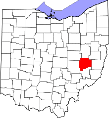 | |
| Villages | ||
| Townships | ||
| CDPs | ||
| Unincorporated communities | ||
| Footnotes | ‡This populated place also has portions in an adjacent county or counties | |