Dorchester County, Maryland
Coordinates: 38°25′N 76°05′W / 38.42°N 76.08°W
| Dorchester County, Maryland | ||
|---|---|---|
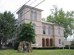 Dorchester County Courthouse | ||
| ||
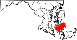 Location in the U.S. state of Maryland | ||
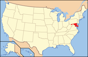 Maryland's location in the U.S. | ||
| Founded | 1669 | |
| Named for | Earl of Dorset | |
| Seat | Cambridge | |
| Largest city | Cambridge | |
| Area | ||
| • Total | 983 sq mi (2,546 km2) | |
| • Land | 541 sq mi (1,401 km2) | |
| • Water | 442 sq mi (1,145 km2), 45% | |
| Population (est.) | ||
| • (2015) | 32,384 | |
| • Density | 33/sq mi (13/km²) | |
| Congressional district | 1st | |
| Time zone | Eastern: UTC-5/-4 | |
| Website |
www | |

Dorchester County is a county located in the U.S. state of Maryland. As of the 2010 census, the population was 32,618.[1] Its county seat is Cambridge.[2][3] The county was formed in 1669 and named for the Earl of Dorset, a family friend of the Calverts (the founding family of the Maryland colony).[4]
Dorchester County comprises the Cambridge, MD Micropolitan Statistical Area, which is also included in the Washington-Baltimore-Arlington, DC-MD-VA-WV-PA Combined Statistical Area. It is located on the Eastern Shore of Maryland.
Dorchester County is the largest county on the Eastern Shore. It is bordered by the Choptank River to the north, Talbot County to the northwest, Caroline County to the northeast, Wicomico County to the southeast, Sussex County, Delaware, to the east, and the Chesapeake Bay to the west. Dorchester County uses the slogan, "The Heart of Chesapeake Country," due to its geographical location and the heart-like shape of the county on a map.
History
Many of the residents of Dorchester County make their living as farmers or working on the water. The Chesapeake Bay and its tributaries provide harvests of crabs, oysters, and many fish species to both commercial and recreational fisherman. Dorchester County, Maryland was the birthplace of Harriet Tubman, known widely for her work of guiding slaves to freedom.[5]
Dorchester County has been hit by two deadly tornadoes. The first one occurred on June 23, 1944 in Cambridge, where 2 people were killed and 33 were injured. The other was on May 8, 1984 in Hurlock, where one death and 6 injuries were reported.[6] Both storms caused between 500,000 and 5 million dollars in damage.[7][8]
Law and government
Dorchester County operates under the Charter Home Rule form of government and the affairs of the County are managed by five County Council Members, one from each of the five Council districts defined within the County. Meetings of the County Council are held weekly. The agenda and the minutes of each week’s proceedings are public record.[9]
Law enforcement
The county is policed by the Dorchester County Sheriff's Office (DCSO), the Maryland State Police, and the DNR Police. The DCSO is a full service agency, currently headed by Sheriff James W. Phillips Jr.[10]
Geography
According to the U.S. Census Bureau, the county has a total area of 983 square miles (2,550 km2), of which 541 square miles (1,400 km2) is land and 442 square miles (1,140 km2) (45%) is water.[11] It is the largest county in Maryland by total area.
Adjacent counties
- Caroline County (north)
- Sussex County, Delaware (northeast)
- Wicomico County (east)
- Somerset County (southeast)
- Talbot County (northwest)
National protected area
Demographics
| Historical population | |||
|---|---|---|---|
| Census | Pop. | %± | |
| 1790 | 15,875 | — | |
| 1800 | 16,346 | 3.0% | |
| 1810 | 18,108 | 10.8% | |
| 1820 | 17,759 | −1.9% | |
| 1830 | 18,686 | 5.2% | |
| 1840 | 18,843 | 0.8% | |
| 1850 | 18,877 | 0.2% | |
| 1860 | 20,461 | 8.4% | |
| 1870 | 19,458 | −4.9% | |
| 1880 | 23,110 | 18.8% | |
| 1890 | 24,843 | 7.5% | |
| 1900 | 27,962 | 12.6% | |
| 1910 | 28,669 | 2.5% | |
| 1920 | 27,895 | −2.7% | |
| 1930 | 26,813 | −3.9% | |
| 1940 | 28,006 | 4.4% | |
| 1950 | 27,815 | −0.7% | |
| 1960 | 29,666 | 6.7% | |
| 1970 | 29,405 | −0.9% | |
| 1980 | 30,623 | 4.1% | |
| 1990 | 30,236 | −1.3% | |
| 2000 | 30,674 | 1.4% | |
| 2010 | 32,618 | 6.3% | |
| Est. 2015 | 32,384 | [12] | −0.7% |
| U.S. Decennial Census[13] 1790-1960[14] 1900-1990[15] 1990-2000[16] 2010-2015[1] | |||
2000 census
As of the census[17] of 2000, there were 30,674 people, 12,706 households, and 8,500 families residing in the county. The population density was 55 people per square mile (21/km²). There were 14,681 housing units at an average density of 26 per square mile (10/km²). The racial makeup of the county was 69.45% White, 28.39% Black or African American, 0.23% Native American, 0.66% Asian, 0.00% Pacific Islander, 0.39% from other races, and 0.89% from two or more races. 1.26% of the population was Hispanic or Latino of any race. 20.1% were of American, 12.7% English, 9.8% German and 8.2% Irish ancestry.
There were 12,706 households out of which 27.30% had children under the age of 18 living with them, 47.50% were married couples living together, 15.50% had a female householder with no husband present, and 33.10% were non-families. 28.20% of all households were made up of individuals and 13.50% had someone living alone who was 65 years of age or older. The average household size was 2.36 and the average family size was 2.86.
In the county the population was spread out with 23.30% under the age of 18, 6.70% from 18 to 24, 26.80% from 25 to 44, 25.50% from 45 to 64, and 17.70% who were 65 years of age or older. The median age was 41 years. For every 100 females there were 89.80 males. For every 100 females age 18 and over, there were 86.40 males.
The median income for a household in the county was $34,077, and the median income for a family was $41,917. Males had a median income of $29,014 versus $22,284 for females. The per capita income for the county was $18,929. 13.80% of the population and 10.10% of families were below the poverty line. 18.10% of those under the age of 18 and 14.20% of those 65 and older were living below the poverty line.[18]
As of 2010 the racial makeup of the county was 66.16% Non-Hispanic whites, 27.70% blacks, 0.34% Native Americans, 0.92% Asians, 0.03% Pacific Islanders, 0.09% Non-Hispanics from some other race, 1.64% Non-Hispanics reporting two or more races and 3.64% Hispanic or Latino.
2010 census
As of the 2010 United States Census, there were 32,618 people, 13,522 households, and 8,894 families residing in the county.[19] The population density was 60.3 inhabitants per square mile (23.3/km2). There were 16,554 housing units at an average density of 30.6 per square mile (11.8/km2).[20] The racial makeup of the county was 67.6% white, 27.7% black or African American, 0.9% Asian, 0.3% American Indian, 1.4% from other races, and 1.9% from two or more races. Those of Hispanic or Latino origin made up 3.5% of the population.[19] In terms of ancestry, 17.0% were American, 13.9% were English, 11.4% were German, and 11.1% were Irish.[21]
Of the 13,522 households, 28.7% had children under the age of 18 living with them, 44.6% were married couples living together, 16.0% had a female householder with no husband present, 34.2% were non-families, and 28.4% of all households were made up of individuals. The average household size was 2.37 and the average family size was 2.88. The median age was 43.3 years.[19]
The median income for a household in the county was $45,151 and the median income for a family was $56,662. Males had a median income of $40,814 versus $30,184 for females. The per capita income for the county was $25,139. About 9.5% of families and 13.4% of the population were below the poverty line, including 19.4% of those under age 18 and 9.2% of those age 65 or over.[22]
Education
Public schools
- Dorchester County School of Technology
- Choptank Elementary School
- Hurlock Elementary School
- Maple Elementary School
- Sandy Hill Elementary School
- South Dorchester K-8
- Vienna Elementary School
- Warwick Elementary School
- Mace's Lane Middle School
- North Dorchester Middle School
- Cambridge South Dorchester High School
- North Dorchester High School
Sister counties
-
 - Düren (district), since 2005
Media
The local newspapers are The Daily Banner and The Dorchester Star (a free, weekly publication). A regional newspaper, The Star Democrat, serves several counties including Dorchester.
Dorchester County is included in the coverage area of local television stations WBOC, WMDT and WRDE. It also receives coverage from television stations based in Baltimore and Washington, D.C.. WBOC's Tyler Butler is based in Cambridge, at the station's Mid-Shore Bureau.
Communities
City
- Cambridge (county seat)
Towns
Census-designated places
See also
References
- 1 2 "State & County QuickFacts". United States Census Bureau. Retrieved August 24, 2013.
- ↑ Dorchester County, Maryland - Government. Msa.maryland.gov. Retrieved on 2014-04-28.
- ↑ "Find a County". National Association of Counties. Retrieved 2011-06-07.
- ↑ Gannett, Henry (1905). The Origin of Certain Place Names in the United States. Govt. Print. Off. p. 108.
- ↑ Footner, Hulbert. Maryland Man and the Eastern Shore.
- ↑ http://www.tornadoproject.com/alltorns/worstts.htm
- ↑ http://www.docs.lib.noaa.gov/rescue/nwr/073/nwr-073-01-0001.pdf
- ↑ http://www.tornadohistoryproject.com
- ↑ Dorchester County, Maryland - Overview & History
- ↑ Dorchester County, Maryland - Dorchester County Sheriff's Department
- ↑ "2010 Census Gazetteer Files". United States Census Bureau. August 22, 2012. Retrieved September 12, 2014.
- ↑ "County Totals Dataset: Population, Population Change and Estimated Components of Population Change: April 1, 2010 to July 1, 2015". Retrieved July 2, 2016.
- ↑ "U.S. Decennial Census". United States Census Bureau. Retrieved September 12, 2014.
- ↑ "Historical Census Browser". University of Virginia Library. Retrieved September 12, 2014.
- ↑ "Population of Counties by Decennial Census: 1900 to 1990". United States Census Bureau. Retrieved September 12, 2014.
- ↑ "Census 2000 PHC-T-4. Ranking Tables for Counties: 1990 and 2000" (PDF). United States Census Bureau. Retrieved September 12, 2014.
- ↑ "American FactFinder". United States Census Bureau. Retrieved 2008-01-31.
- ↑ Dorchester County QuickFacts from the US Census Bureau
- 1 2 3 "DP-1 Profile of General Population and Housing Characteristics: 2010 Demographic Profile Data". United States Census Bureau. Retrieved 2016-01-22.
- ↑ "Population, Housing Units, Area, and Density: 2010 - County". United States Census Bureau. Retrieved 2016-01-22.
- ↑ "DP02 SELECTED SOCIAL CHARACTERISTICS IN THE UNITED STATES – 2006-2010 American Community Survey 5-Year Estimates". United States Census Bureau. Retrieved 2016-01-22.
- ↑ "DP03 SELECTED ECONOMIC CHARACTERISTICS – 2006-2010 American Community Survey 5-Year Estimates". United States Census Bureau. Retrieved 2016-01-22.
External links
- Dorchester County Government
- Dorchester County Tourism
- Dorchester County Economic Development
 Geographic data related to Dorchester County, Maryland at OpenStreetMap
 |
Talbot County | Caroline County | Sussex County, Delaware | |
| Chesapeake Bay | |
Wicomico County | ||
| ||||
| | ||||
| Somerset County |
Municipalities and communities of Dorchester County, Maryland, United States | ||
|---|---|---|
| City | | |
| Towns | ||
| CDP | ||
| Other communities | ||
| Footnotes | ‡This populated place also has portions in an adjacent county or counties | |
| State | .svg.png) | |
|---|---|---|
| County departments | ||
| Municipal departments | ||
| Sheriff's offices | ||
| Universities | ||