Calperum Station (reserve)
| Calperum Station South Australia | |
|---|---|
 Calperum Station | |
| Nearest town or city | Renmark |
| Coordinates | 33°49′0″S 140°34′0″E / 33.81667°S 140.56667°ECoordinates: 33°49′0″S 140°34′0″E / 33.81667°S 140.56667°E |
| Established | 1993[1] |
| Area | 2,386 km2 (921.2 sq mi)[2] |
| Visitation | At least 2,700 (shared with Taylorville Station) (in 2011-12)[2] |
| Managing authorities | Austland Services Pty Ltd on behalf of the Director of National Parks |
| Website | Calperum Station |
| Footnotes |
Coordinates[2] Managing authorities[2] |
Calperum Station is a protected area located in the east of South Australia about 10 kilometres (6.2 mi) north west of the town of Renmark and about 250 kilometres (160 mi) east of the Adelaide city centre. It is a protected area which is under the control of the Australian government rather than the Government of South Australia and which is managed by a private organisation under contract. Calperum Station is part of an area whose habitat has been listed as "critical" for the survival of the bird species, black-eared miner. It is also part of a larger reserve system known as the Riverland Biosphere Reserve.
Nomenclature
Calperum Station as a protected area is referred in various sources either as "Calperum Station" or as a "reserve."[3][4]
Description
Location, size and vegetation
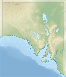
The reserve is located in the east of South Australia on the north side of the Murray River about 10 kilometres (6.2 mi) to the north of the town of Renmark and about 250 kilometres (160 mi) east of the Adelaide city centre. It is bounded to its western side by the Taylorville Station reserve and the Gluepot Reserve.[2][5] The reserve covers an area of 2,386 square kilometres (921 sq mi) and is described in 2008 as follows:[2][1]
Some 95% of Calperum Station is covered by Mallee vegetation communities growing on the east-west red brown dunes of the Loxton-Parilla Sands. The remaining 5% is occupied by the Murray River floodplain which includes 4 wetlands: Merreti; Woolpolool; Clover; and Woolpolool Swamp, which are part of the 30,600 hectare ‘Riverland’ Ramsar site.
Purpose
The purpose of the reserve is the protection of "Listed Critical Habitat" for the bird species, black-eared miner, in conjunction with both the Taylorville Station reserve and the Gluepot Reserve.[2][6] The reserve along with the Taylorville Station reserve is reported as being "important for the conservation of the nationally vulnerable malleefowl (Leipoa ocellata), the regionally vulnerable bush stone-curlew (Burhinus grallarius) and the nationally vulnerable southern bell frog (Litoria ramiformis)."[2] The reserve is also reported as being one of the "key components of the Riverland (formerly Bookmark) Biosphere Reserve."[2]
History
Calperum Station as a pastoral lease consists of three separate leases - Calperum, Calperum Road and Yubalia. These were purchased in 1993 by the Chicago Zoological Society using funds obtained both from the McCormack Foundation and the Australian Government.[1] The leases were subsequently transferred by deed of assignment to the Director of National Parks to hold in trust. Since 2003, the reserve is managed along with the Taylorville Station reserve under contract by the Australian Landscape Trust Association Inc. (ALT).[7] During the financial year 2013-14, the pastoral leases along with those for the Taylorville Station reserve were transferred to Austland Services Pty Ltd which is a company owned by ALT and who "will continue to manage the properties in accordance with the trust arrangements."[8][9]
Management
As of 2014, the reserve and the Taylorville Station reserve were managed as one unit by Austland Services Pty Ltd.[9] The management agreement with the Director of National Parks requires that the reserve is to be used for "a model for the implementation of the UNESCO Biosphere Reserve Action Plan."[1]
Protected area status
As of 2012, Calperum Station has not been classified as an IUCN protected area. It is reported that the reserve is being "managed for a broader, additional set of objectives, including environmentally sustainable development such as tourism."[2]
See also
Citations and references
Citations
References
- "Listed Critical Habitat - Manorina melanotis (Black-eared Miner) - Gluepot Reserve, Taylorville Station and Calperum Station, excluding the area of Calperum Station south and east of Main Wentworth Road.". Australian Government, Department for the Environment (DoE). 2004. Retrieved 4 October 2015.
- "Fire Management Plan, Bookmark Mallee 2009-2019" (PDF). Department for Environment and Heritage. 2009. Retrieved 28 September 2015.
- "State of the Parks Report Annual Report 2011-12 Supplementary Information" (PDF). Australian Government, Director of National Parks (DNP). 2012. Retrieved 4 October 2015.
- "State of the Parks Report, Director of National Parks Annual Report 2013–14". Australian Government, Director of National Parks (DNP). 2014. Retrieved 4 October 2015.
- "Danggali Wilderness Protection Area and Conservation Park Management Plan 2011" (PDF). Department of Environment and Natural Resources (DEWNR). 2011. Retrieved 3 November 2014.
- "Review of Land Management Services delivered under contractual arrangements between Director of National Parks and Austland Services Pty Ltd" (PDF). Brian Gilligan. 2008. Retrieved 16 September 2015.
External links
- Australian Government official webpage
- Australian Landscape Trust official webpage
- Entry for Calperum Station on Protected Planet