California Street (San Francisco)


California Street is a major thoroughfare in San Francisco, California. Fifty-four blocks of California Street, from Van Ness Avenue westward to 32nd Avenue, comprised the last major leg of the final 1928 alignment of the Lincoln Highway, the first road across America, leading out to the highway's western terminus in Lincoln Park.
Description
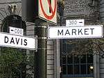
California Street is one of the longest streets in San Francisco, and includes a number of important landmarks. It runs in an approximately straight 5.2 mi (8.4 km) east-west line from the Financial District to Lincoln Park in the far Northwest corner of the City. It begins at the intersection of Market Street and Spear Street in front of the Hyatt Regency Embarcadero Center, one block from the Ferry Building, then travels over Nob Hill, through Lower Pacific Heights, Laurel Heights, and the Lake District. The street makes a slight bend in at the intersection of Cornwall Street and 7th Avenue, then parallels the edge of the Presidio of San Francisco through the Richmond District until its dead-end terminus at 32nd Avenue, at Lincoln Park. The route has four to six lanes for its entire length, and a cable car line on the Eastern portion from Market to Van Ness Avenue.
Landmarks and points of interest
- Embarcadero Center
- 50 California Street
- 101 California Street
- 150 California Street
- 345 California Center (Mandarin Oriental Hotel)
- 465 California Street, (Merchants Exchange Building (San Francisco))
- 555 California Street (Bank of America Center)
- 580 California Street
- 650 California Street (Hartford Building)
- 600 Stockton (Ritz Carlton hotel)
- 905 California Street (Stanford Court Hotel)
- 800 Powell Street (University Club)
- Fairmont Hotel
- 999 California Street (Mark Hopkins Hotel )
- 1000 California Street (Pacific-Union Club), the former Flood Mansion
- 1075 California Street (Huntington Hotel)
- 1111 California Street (Masonic Auditorium)
- Huntington Park
- Grace Cathedral
- California Pacific Medical Center
See also
External links
| Wikimedia Commons has media related to California Street. |
- Photo tour of Market Street A photo tour of Market Street complete with narrative text.
- JB Monaco Market Street Photo Gallery
Coordinates: 37°47′30″N 122°24′42″W / 37.791761°N 122.411739°W
| Numbered streets |
|  |
|---|---|---|
| North–south streets | ||
| East–west streets | ||
| Diagonal streets | ||
| Alleyways | ||