California State Route 94
| ||||
|---|---|---|---|---|
|
SR 94 highlighted in red | ||||
| Route information | ||||
| Defined by Streets and Highways Code § 394 | ||||
| Maintained by Caltrans | ||||
| Length: | 63.324 mi[1] (101.910 km) | |||
| Existed: | 1933[2] – present | |||
| Major junctions | ||||
| West end: |
| |||
| East end: |
| |||
| Location | ||||
| Counties: | San Diego | |||
| Highway system | ||||
| ||||


State Route 94 (SR 94) is a highway in the U.S. state of California that is 63.324 miles (101.910 km) long. The western portion, known as the Martin Luther King Jr. Freeway, begins at Interstate 5 (I-5) in downtown San Diego and continues to the end of the freeway portion past SR 125 in Spring Valley. The non-freeway segment of SR 94 that continues east through the mountains to I-8 near Boulevard is known as Campo Road.
The Campo road served as a wagon road providing access to eastern San Diego County as well as Imperial County. The road was added to the state highway system in 1933, and signs for Route 94 were posted along local roads later that decade. Efforts to convert the western half of the route to a freeway got underway in the 1950s, and the freeway was complete by 1962 west of the road that became SR 125. Construction continued east to Avocado Road over the next few years. Various proposals for widening the highway have come from the California Department of Transportation (Caltrans), but local opposition resulted in the delay or cancellation of many of these proposals.
Route description
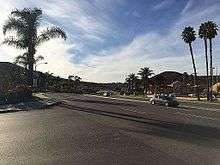
SR 94 is an east–west freeway that begins at the eastern end of the one-way couplet of F and G streets in southeast San Diego. The freeway continues through an interchange with I-5 just east of downtown. Following this, the route goes through the neighborhoods of Sherman Heights, Grant Hill, Stockton, and Mount Hope, where there is an interchange with SR 15. Shortly thereafter, SR 94 intersects I-805 in Chollas View before continuing east through Emerald Hills and Chollas Creek into the city of Lemon Grove. Passing by the Marketplace at the Grove Mall, the freeway forms the boundary between Lemon Grove to the south and La Mesa to the north, up to the SR 125 interchange where SR 94 turns east. At this point, SR 94 leaves both cities and enters unincorporated Spring Valley and Casa de Oro.[3]
The freeway becomes an undivided highway at Via Mercado in Rancho San Diego. SR 94 continues through Rancho San Diego by turning southeast at the Jamacha Road and Campo Road intersection, where SR 54 and CR S17 turn northeast. As Campo Road, SR 94 crosses the Sweetwater River before entering a less-developed area, winding through the communities of Jamul, Dulzura and intersecting the north end of SR 188 north of Tecate. After passing through the communities of Potrero, Campo, and the Campo Indian Reservation, SR 94 continues east onto old U.S. Route 80 (US 80) briefly before turning north on Ribbonwood Road west of Boulevard. The route ends by connecting to I-8 near Manzanita.[3]

SR 94 is part of the California Freeway and Expressway System;[4] west of SR 188, it is part of the National Highway System,[5] a network of highways that are essential to the country's economy, defense, and mobility.[6] SR 94 is eligible for the State Scenic Highway System,[7] but it is not officially designated as a scenic highway by the California Department of Transportation.[8] In 2014, SR 94 had an annual average daily traffic (AADT) of 440 vehicles at Live Oak Springs Road, and 179,000 vehicles between I-805 and 47th Street, the latter of which was the highest AADT for the highway.[9]
History
Campo Road
SR 94 was built along the routing of an old stagecoach road that was part of the primary road from San Diego to Yuma, Arizona. A trip to East County in the 19th century along the road would last two days. James Pascoe surveyed the route through Campo for the county in 1869 that was 25 miles (40 km) shorter than the existing route through Warner's Pass. The road was known for its curves, climbs, and boulders, making travel difficult. The first automobile went on the road in 1904.[10][11] By 1913, an unpaved automobile road extended to Campo from San Diego,[12] and work took place to improve the condition of the road in 1916.[13] A year later, the road continued east to join with the state highway leading into Imperial County.[14] In 1927, the Potrero bridge was replaced, after a storm washed it out.[15] By 1928, the paving of the Campo road was about 43 percent complete.[16] In February of the next year, the progress was at 74 percent; the total cost was $122,474[17] (about $30 million in 2015 dollars).[18] The Sweetwater bridge was finished in March at a cost of $60,000[19] (about $4 million in 2015 dollars).[18] The Campo road was the only road through the Peninsular Ranges to stay open for the entirety of the next winter; other roads were closed due to snow, leading to increased traffic along this road. This was largely due to the lower elevation of the road, at only 4,000 feet (1,200 m).[20]
Designation and initial construction
In 1931, the County Board of Supervisors agreed to submit the Campo road for consideration as a secondary state highway.[21] The state considered the inclusion of the Campo road into the system in 1932.[22] The California State Legislature defined Route 200 in 1933 as a route from San Diego to west of Jacumba, going through the town of Campo.[2] The San Diego Chamber of Commerce sent a representative to ask the state for funding for paving the Campo highway in 1935,[23] and the road was paved that year.[24] The Chamber also asked for the war department to declare the road a military highway to receive federal assistance for its improvement.[25] Signs were posted for SR 94 in 1937,[26] and by 1938, SR 94 was signed along Broadway and Lemon Grove Boulevard (later Federal Boulevard) before continuing east to Campo.[27][28][29]
The next year, the California Highway Commission declined to have the Campo road improved.[30] However, the Highway 94 association, as well as the Campo-Potrero and Highway 80 chambers of commerce raised concerns about the safety of the children going to school in the buses along the road.[31] In 1952, the Southern California committee of the state Chamber of Commerce recommended to the California Highway Commission that Route 94 be widened to four lanes from the Wabash Freeway to Jamacha.[32] In June 1953, the Commission approved an eight-lane freeway for Route 94 from Home Avenue in San Diego to Palm Avenue around La Mesa.[33] The local Board of Education also gave their approval, which was required because the freeway would be built on land that was for a proposed school.[34] But the next month, State Senator Fred Kraft criticized the proposal because he believed that it would be too expensive and would not reduce congestion in the long term.[35] Approval extended to the junction with US 80 by October 1953; the part from 18th Street to Wabash Boulevard followed in November 1954.[36] Later that year, a toll road that would have tunneled under the Laguna Mountains and bypassed Route 94 was proposed by the county Board of Supervisors.[37] The state allocated $3.48 million (about $81 million in 2015 dollars)[18] for making SR 94 a freeway from College Avenue to Campo Road in October 1954.[38]
Construction began on the first part of the SR 94 freeway just west of Lemon Grove by May 1955.[39] The contract for the College Avenue to Campo Road portion was given out in October, for $2.9 million[40] (about $63 million in 2015 dollars).[18] Preparation for bidding on the portion from the Wabash Freeway to near Euclid Avenue took place towards the end of the year;[41] construction was underway by May 1956, as was planning for the portion west of there to the intersection of 18th and F streets and the future interchange with US 101.[42] The San Diego City Council requested that an overpass be constructed at 22nd Street to provide improved access;[43] an underpass for the road was eventually built.[3] The freeway from Wabash Boulevard and 56th was completed on March 18, 1957; metal-weakened plane joints were used for the construction, which the California Division of Highways considered "experimental" at the time. East of College Avenue, some unwanted cracks developed in the roadway during the joint pouring process, and were repaired with epoxy.[44] At one point in 1958, SR 94 was considered as a possible extension of US 90, a route proposed to run along the southern border of the United States to Florida, by the South Bay Highway Association.[45] By August, SR 94 from Palm Avenue to Jamacha was being planned.[46]
The western end of SR 94 connecting to US 101 was put up for the bidding process in late 1958.[47] Construction on the interchange with US 101 began in 1961.[48] By January 1962, the freeway was mostly complete west of La Mesa and the freeway connection to US 80.[49] The part of the freeway from 25th to 17th streets was completed in November.[50] In the 1964 state highway renumbering, SR 94 was officially designated from I-5 to I-8 near Jacumba, and SR 125 was designated from SR 94 near La Mesa north to SR 56.[51]
Expansion and naming
Land acquisition for the construction of the SR 94 freeway through Spring Valley had begun by 1965.[52] The next year, a plan to reroute and widen portions of SR 94 from the Sweetwater River to I-8 was underway, with a Caltrans proposal to remove the "Frenchy's" or "Three Springs" curve.[53] In March 1968, the San Diego Highway Development Association considered the construction of the freeway from SR 125 to Jamacha Junction a priority.[54] The state announced in August that the Spring Valley widening project would be funded earlier than anticipated, due to the state of the economy.[55] Meanwhile, a $1.8 million (about $21 million in 2015 dollars)[18] contract to widen SR 94 to eight lanes from Wabash Boulevard to Waite Drive in Lemon Grove was awarded in October.[56] The freeway from Kenwood Drive to Avocado Boulevard in Spring Valley was completed in July 1970.[57]

An improved interchange with SR 125 was being planned in 1974, which would connect to the existing freeway extending to Avocado Boulevard.[58] Construction began in October, and continued into late 1975, at a cost of $11 million (about $78 million in 2015 dollars);[18] the road was predicted to reduce traffic at the intersection of Campo Road and Bancroft Drive, and interchanges at Spring Street and Lemon Grove Avenue were to be built.[59] The Lemon Grove Avenue interchange was open by January 30, 1976,[60] and parts of the interchange with Spring Street and SR 125 was open by July 20.[61]
By 1977, much of the SR 94 freeway was congested, with 85,000 to 95,000 trips per day on the freeway according to Caltrans. It was hoped that the construction of SR 54 to the south and SR 125 would reduce traffic by 20,000 trips per day.[62] Onramp meters were installed in 1978 to throttle traffic entering the freeway with a centralized computer system; this resulted in reduced congestion on the freeway, according to motorists.[63] In 1987, the bridge over the Sweetwater River that had been used for 58 years was replaced by a new bridge, at a cost of $2.3 million[64] (about $6 million in 2015 dollars);[18] construction had been delayed by nine months due to concern over environmental harm to the least Bell's vireo.[65]
The highway was designated the Martin Luther King Jr. Freeway by the California State Legislature in September 1989, after a two-year struggle to find a suitable tribute to King in the San Diego area.[66] Nevertheless, the measure did not include funding for the signs, and as a result, they were not installed until 1998, when they were funded by the San Diego Association of Governments with $1.4 million (about $2 million in 2015 dollars)[18] from a local sales tax.[67]
In 1995, a U.S. Border Patrol checkpoint was opened near Dulzura, to combat human and drug trafficking that used SR 94, as well as fatal traffic accidents resulting from such smuggling.[68] Two years later, following a proposal to widen SR 94 from Otay Lakes Road to SR 188 to address the high rate of accidents, local residents raised concerns about this proposal.[69] In July 1998, the Back Country Coalition sued Caltrans concerning the short length of the environmental impact report as well as not soliciting comments from the public; opponents pushed for a ban of all trucks on the highway.[70] Caltrans agreed to hold another hearing in an out-of-court settlement, as well as to pay $20,000 for the attorneys.[71] In March 1999, Caltrans agreed to delay the construction for several years to evaluate the environmental impact.[72] During the early 2000s, the interchange with SR 125 was reconstructed to allow for the extension of the latter freeway south to SR 54, which was finished in 2003.[73]
In late 2006, the Jamul Indian tribe prepared to construct a casino, but many expressed concerns about the amount of traffic that would now travel on SR 94.[74] In 2007, Caltrans declared that the construction required a permit to connect to SR 94 and to construct on the state right-of-way.[75] At the end of the year, the tribe had started construction on the driveway to the casino, while Caltrans stated that it lacked the information needed to determine if the proposed traffic signal should be approved.[76] In late 2009, the tribe filed a lawsuit against Caltrans over the inability to get approval to connect the driveway with the highway.[77] The tribe made the claim that they were a sovereign nation and did not need the approval, but this was rejected by the court. Caltrans and the tribe came to an agreement in 2009, where the tribe would provide its own studies and pay for environmental mitigation.[78]
Future
Caltrans has plans to add a ramp from southbound SR 125 to SR 94 to improve the interchange; it is in the environmental planning stages, and is estimated to cost $71 million.[79] Also in the planning stages are high-occupancy toll lanes between the I-5 and I-805 interchanges,[80] and rerouting part of SR 94 east of the junction with Jamacha Boulevard while improving some interchanges.[81]
Major intersections
Except where prefixed with a letter, postmiles were measured on the road as it was in 1964, based on the alignment that existed at the time, and do not necessarily reflect current mileage. R reflects a realignment in the route since then, M indicates a second realignment, L refers an overlap due to a correction or change, and T indicates postmiles classified as temporary (for a full list of prefixes, see the list of postmile definitions).[82] Segments that remain unconstructed or have been relinquished to local control may be omitted. The entire route is in San Diego County.
| Location | Postmile [1][9][82] | Exit [83] | Destinations | Notes | |
|---|---|---|---|---|---|
| San Diego | 1.42 | Western terminus; westbound exit and eastbound entrance; west end of SR 94 | |||
| 1.42 | 1A | Westbound exit and eastbound entrance; I-5 south exit 15B | |||
| 1.85 | 1B | 25th Street | Westbound exit and eastbound entrance | ||
| 2.21 | 1C | 28th Street | Signed as exit 1 eastbound | ||
| 2.68 | 1D | 32nd Street, Broadway | No eastbound exit | ||
| 3.17 | 2A/C | Signed as exits 2A (south) and 2C (north) eastbound; westbound exit to SR 15 north is via exit 3; SR 15 north exits 2B-C, south to 94 west exit 2 | |||
| 3.62 | 2B | Home Avenue | Eastbound exit and westbound entrance | ||
| 4.09 | 3 | Eastbound exit to I-805 north is via exit 2C; I-805 exit 13A, south to 94 west (via SR 15) exit 14 | |||
| 4.63 | 47th Street | Entrance ramps only | |||
| 5.14 | 4A | Euclid Avenue | Signed as exit 4 westbound | ||
| 5.79 | 4B | Kelton Road | Signed as exit 5 westbound | ||
| 6.16 | 5 | Federal Boulevard | Westbound exit is via a U-turn at exit 5 | ||
| 7.29 | 6A | College Grove Way | Westbound exit and entrance | ||
| Lemon Grove | 7.76 | 6B | College Avenue, Broadway | Signed as exit 6 eastbound; no eastbound entrance | |
| 8.27 | 7 | Massachusetts Avenue | |||
| 8.93 | 8 | Lemon Grove Avenue | |||
| Lemon Grove–La Mesa line | T10.11 | 9 | Signed as exits 9A (south) and 9B (north); SR 125 exit 15, south to 94 east exit 17A | ||
| La Mesa | R10.88 | 9C | Spring Street – La Mesa | ||
| Spring Valley | R11.08 | 10A | Bancroft Drive | ||
| R11.80 | 10B | Kenwood Drive – Casa de Oro | |||
| R12.75 | 11 | Sweetwater Springs Boulevard – Casa de Oro | |||
| R13.33 | 12 | Avocado Boulevard, Calavo Drive | |||
| East end of freeway | |||||
| | 14.33 | ||||
| | 14.86 | ||||
| | 24.57 | Otay Lakes Road – Otay Lakes, Chula Vista, National City | |||
| | 38.97 | ||||
| | 52.15 | ||||
| | 64.23 | Old Highway 80 – Live Oak Springs, San Diego | Former US 80 west | ||
| Boulevard | 64.82 | Old Highway 80 – Jacumba, El Centro, Yuma | Former US 80 east | ||
| | 65.38 | East end of SR 94; I-8 exit 65 | |||
| | 65.38 | Ribbonwood Road | Continuation beyond I-8 | ||
| 1.000 mi = 1.609 km; 1.000 km = 0.621 mi | |||||
See also
 California Roads portal
References
- 1 2 California Department of Transportation (October 2014). "Log of Bridges on State Highways". Sacramento: California Department of Transportation. Retrieved June 21, 2015.
- 1 2 California State Assembly. "An act to amend sections 2, 3 and 5 and to add two sections to be numbered 6 and 7 to an act entitled 'An act to provide for the acquisition of rights of way for and the construction, maintenance...". Fiftieth Session of the Legislature. Statutes of California. State of California. Ch. 767.
- 1 2 3 Thomas Brothers (2009). San Diego County Road Atlas (Map). 1:22,800. Chicago: Rand McNally. pp. 429–430, 1270–1272, 1289–1290, 1293–1294, 1298–1300. OCLC 263420904.
- ↑ California State Legislature. "Section 250–257". Streets and Highways Code. Sacramento: California State Legislature. Retrieved April 8, 2011.
- ↑ Federal Highway Administration (March 25, 2015). National Highway System: California (South) (PDF) (Map). Scale not given. Washington, DC: Federal Highway Administration. Retrieved May 25, 2015.
- ↑ Natzke, Stefan; Neathery, Mike & Adderly, Kevin (June 20, 2012). "What is the National Highway System?". National Highway System. Washington, DC: Federal Highway Administration. Retrieved July 1, 2012.
- ↑ California State Legislature. "Section 260-284". Streets and Highways Code. Sacramento: California State Legislature. Retrieved June 21, 2015.
- ↑ California Department of Transportation (September 7, 2011). "Officially Designated State Scenic Highways and Historic Parkways". Sacramento: California Department of Transportation.
- 1 2 California Department of Transportation (2014). "All Traffic Volumes on CSHS". Sacramento: California Department of Transportation. Retrieved July 10, 2016.
- ↑ "Stage Once Crossed Otay, Janal". The San Diego Union. July 28, 1968. p. G2. OCLC 13155544.
- ↑ Krueger, Anne (January 16, 2010). "Route to Backcountry Seen as Path to History". San Diego Union-Tribune. p. NC2. OCLC 25257675.
- ↑ Judge, W. Elliot (1913). California (Map). 1:760,320. San Francisco: W. Elliot Judge. Retrieved June 21, 2015.
- ↑ "Road Condition Rapidly Improving". The San Diego Union. July 16, 1916. p. 3. OCLC 13155544.
- ↑ Automobile Club of Southern California (1917). California (Map). 1:1,160,000. Los Angeles: Automobile Club of Southern California. OCLC 32102746. Retrieved June 21, 2015.
- ↑ "Detour Near Del Mar is Opened to Traffic; Campo Road Blocked". Evening Tribune. San Diego. March 7, 1927. p. 1. OCLC 37687666.
- ↑ "Board Votes Pay for Road Contractor". Evening Tribune. San Diego. December 3, 1928. p. 2. OCLC 37687666.
- ↑ "Money Voted for Roads by Board". Evening Tribune. San Diego. February 4, 1929. p. 11. OCLC 37687666.
- 1 2 3 4 5 6 7 8 United States nominal Gross Domestic Product per capita figures follow the Measuring Worth series supplied in Johnston, Louis; Williamson, Samuel H. (2016). "What Was the U.S. GDP Then?". MeasuringWorth. Retrieved April 10, 2016. These figures follow the figures as of 2015.
- ↑ "Board Votes to Accept Bridge". Evening Tribune. San Diego. March 4, 1929. p. 15. OCLC 37687666.
- ↑ Mansfield, Richard (April 8, 1929). "'Old Campo Road' Hornbeck's Pride; State's Lone 'All-Year-Clear' Sierra Highway, Claim". Evening Tribune. p. 7. OCLC 37687666.
- ↑ "District Must Pay for Jail Lodgings". Evening Tribune. San Diego. June 9, 1931. p. 9. OCLC 37687666.
- ↑ "May Include SD Roads in State System". Evening Tribune. San Diego. October 14, 1932. p. 3. OCLC 37687666.
- ↑ "Chamber Acts to Get County Road Funds". Evening Tribune. San Diego. January 18, 1935. p. 2. OCLC 37687666.
- ↑ "A Major Highway Lost in the Past". San Diego Union-Tribune. July 14, 2008. p. EZ7. OCLC 25257675.
- ↑ "Campo Road as Military Route, Plea". Evening Tribune. San Diego. February 7, 1935. p. 6. OCLC 37687666.
- ↑ "State Changes Highway Number". The San Diego Union. November 20, 1937. p. 12. OCLC 13155544.
- ↑ California Division of Highways (1938). Road Map of the State of California (Map). Scale not given. Sacramento: California Division of Highways. San Diego inset. Retrieved June 21, 2015.
- ↑ California Division of Highways (1938). Road Map of the State of California (Map). [1:1,463,040]. Sacramento: California Division of Highways.
- ↑ Automobile Club of Southern California (1948). San Diego County (Map). 1:261,730. Los Angeles: Automobile Club of Southern California.
- ↑ "Highway Board Views Park Link". The San Diego Union. June 24, 1939. p. 1. OCLC 13155544.
- ↑ "Improvement Urged on Highway 94 Section". The San Diego Union. August 30, 1939. p. 6A. OCLC 13155544.
- ↑ "Road Improvement Plans Sent to Group". The San Diego Union. July 20, 1952. p. A23. OCLC 13155544.
- ↑ "Commission Sets July 29 for Protests". The San Diego Union. June 19, 1953. p. A11. OCLC 13155544.
- ↑ "Board Approves Freeway Route". The San Diego Union. July 2, 1953. p. B1. OCLC 13155544.
- ↑ "Sen. Kraft Opposes Freeway 94 Route". The San Diego Union. July 25, 1953. p. A11. OCLC 13155544.
- ↑ Dekema, J. (November–December 1955). "Freeways in District XI". California Highways and Public Works. 34 (11–12): 4–8. OCLC 7511628.
- ↑ "New Low-Level Survey Before Board". The San Diego Union. November 15, 1953. p. A19. OCLC 13155544.
- ↑ "San Diego County Gets $16,139,000 For Road Projects". The San Diego Union. October 25, 1954. p. A13. OCLC 13155544.
- ↑ "County's 5th State Road Job Finished". The San Diego Union. May 15, 1955. p. A42. OCLC 13155544.
- ↑ "State Awards Contracts for Highway Work". The San Diego Union. October 27, 1955. p. A11. OCLC 13155544.
- ↑ "State to Seek Bids on Freeway". The San Diego Union. December 24, 1955. p. A7. OCLC 13155544.
- ↑ "Plans Take Shape on Freeway Link". The San Diego Union. May 13, 1956. p. A42. OCLC 13155544.
- ↑ "City Will Request Route 94 Overpass". The San Diego Union. January 25, 1957. p. B1. OCLC 13155544.
- ↑ Luckenbach, R.B.; Smith, C.; Estep, Al (July–August 1957). "San Diego Freeways". California Highways and Public Works. 8 (7–8): 45–48. OCLC 7511628.
- ↑ "Highway 94 Proposed as Florida Link". The San Diego Union. January 18, 1958. p. A8. OCLC 13155544.
- ↑ "Local Highway Jobs Reported Awaiting Funds". The San Diego Union. August 12, 1958. p. A14. OCLC 13155544.
- ↑ Dekema, Jacob (November–December 1958). "Report from District XI". California Highways and Public Works. 37 (11–12): 40, 46. OCLC 7511628.
- ↑ "Street Detours to Start Today in Road Work". The San Diego Union. July 30, 1961. p. A24. OCLC 13155544.
- ↑ "New Freeway Construction Stepped Up in San Diego". The San Diego Union. January 5, 1962. p. C4. OCLC 13155544.
- ↑ "State 94 Freeway Work Pressed". The San Diego Union. November 20, 1962. p. A19. OCLC 13155544.
- ↑ California State Assembly. "An act to add Section 253 and Article 3 (commencing with Section 300) to Chapter 2 of Division 1 of, and to repeal Section 253 and Article 3 (commencing with Section 300) of Chapter 2 of Division 1 of, the...". 1963 Session of the Legislature. Statutes of California. State of California. Ch. 385.
- ↑ "Freeways Abreast of Business Needs". The San Diego Union. January 8, 1965. p. C5. OCLC 13155544.
- ↑ "Elimination of Curve Due on State 94". The San Diego Union. January 3, 1966. p. B3. OCLC 13155544.
- ↑ Clance, Homer (March 19, 1968). "18 Highway Projects Get Top Priority". The San Diego Union. p. C1. OCLC 13155544.
- ↑ "$17 Million More Set for Area Road Jobs". The San Diego Union. August 22, 1968. p. B1. OCLC 13155544.
- ↑ "Job to Widen Route 94 Let". The San Diego Union. October 31, 1968. p. B8. OCLC 13155544.
- ↑ "Freeway 94 Area to Open". The San Diego Union. July 10, 1970. p. B2. OCLC 13155544.
- ↑ "Bid Opening Set on State 94". The San Diego Union. June 21, 1974. p. B2. OCLC 13155544.
- ↑ Sexton, Ruby (September 14, 1975). "I-15 Freeway is Final Link Yet to Finish". The San Diego Union. p. B9. OCLC 13155544.
- ↑ "Lemon Grove State 94 Interchange Opened". The San Diego Union. January 30, 1976. p. B3. OCLC 13155544.
- ↑ "New State 94 Interchange is Open". The San Diego Union. July 20, 1976. p. B3. OCLC 13155544.
- ↑ Clance, Homer (December 31, 1977). "Freeway Loop Called Answer to Congestion". The San Diego Union. pp. B1, B2. OCLC 13155544.
- ↑ Gulotta, Carol (January 11, 1981). "Traffic-Control Lights to Shine on I-8 Ramps". The San Diego Union. p. B3. OCLC 13155544.
- ↑ Jackson, Irene (June 30, 1987). "Historic Bridge Reopens to More Sedate Clientele". The San Diego Union. p. B5. OCLC 13155544.
- ↑ Carrier, Lynne (November 23, 1985). "Tiny Bird May be a Mighty Roadblock". Evening Tribune. San Diego. p. C1. OCLC 37687666.
- ↑ Acuna, Armando (November 21, 1989). "California 94 Renamed to Honor Martin Luther King". Los Angeles Times. OCLC 3638237. Retrieved July 8, 2012.
- ↑ Powell, Ronald (January 19, 1999). "Freeway Name Up to Speed". San Diego Union-Tribune. p. B1. OCLC 25257675.
- ↑ Sanchez, Leonel (June 17, 1985). "Checkpoint Near Dulzura Mostly Quiet on First Day". San Diego Union-Tribune. p. B7. OCLC 25257675.
- ↑ Harpster, David (September 13, 1997). "Opponents of Route 94 Project Hold Protest Rally". San Diego Union-Tribune. p. B1. OCLC 25257675.
- ↑ Arner, Mark (July 2, 1998). "Group Sues for More Study of Route 94 Passing Lanes". San Diego Union-Tribune. p. B1. OCLC 25257675.
- ↑ Arner, Mark (July 13, 2014). "New Hearing on Adding Passing Lanes to Route 94 Set for Dec. 2". San Diego Union-Tribune. p. B3. OCLC 25257675.
- ↑ Harpster, Dave (March 26, 1999). "Environment Studies Delay Route 94 Work". San Diego Union-Tribune. p. B1. OCLC 25257675.
- ↑ Krueger, Anne (May 7, 2003). "Route 125 Connection". San Diego Union-Tribune. p. B1. OCLC 25257675.
- ↑ Barfield, Chet (September 14, 2006). "Casino Plan Gets Neighborly Criticism". San Diego Union-Tribune. p. B1. OCLC 25257675.
- ↑ Soto, Onell (May 19, 2007). "Casino Still a Ways Off". San Diego Union-Tribune. p. B1. OCLC 25257675.
- ↑ Soto, Onell (December 17, 2007). "Driveway is Prelude to Casino". San Diego Union-Tribune. p. B1. OCLC 25257675.
- ↑ Soto, Onell (October 9, 2008). "Jamul Tribe Sues, Claims Caltrans is Meddling". San Diego Union-Tribune. p. B1. OCLC 25257675.
- ↑ "A Secret Deal on Route 94". San Diego Union-Tribune. April 26, 2009. p. F2. OCLC 25257675.
- ↑ California Department of Transportation (January 2016). "State Route 94 / SR-125 Interchange Project Fact Sheet" (PDF). California Department of Transportation. Retrieved July 10, 2016.
- ↑ California Department of Transportation (March 2016). "State Route 94 Express Lanes Project Fact Sheet". California Department of Transportation. Archived from the original (PDF) on July 10, 2016. Retrieved July 10, 2016.
- ↑ California Department of Transportation (May 2016). "State Route 94 Improvement Project Fact Sheet" (PDF). California Department of Transportation. Retrieved July 10, 2016.
- 1 2 California Department of Transportation. "State Truck Route List". Sacramento: California Department of Transportation. Archived from the original (XLS file) on June 30, 2015. Retrieved June 30, 2015.
- ↑ Kals, Sunny (July 5, 2007). "State Route 94 Freeway Interchanges Eastbound" (PDF). California Numbered Exit Uniform System. Sacramento: California Department of Transportation. Retrieved March 5, 2009.
Howe, Don (September 21, 2006). "State Route 94 Freeway Interchanges Westbound" (PDF). California Numbered Exit Uniform System. Sacramento: California Department of Transportation. Retrieved March 5, 2009.
External links
- California @ AARoads.com – State Route 94
- Caltrans: Route 94 highway conditions
- California Highways: SR 94