California State Route 142
| ||||
|---|---|---|---|---|
 | ||||
| Route information | ||||
| Defined by Streets and Highways Code § 442 | ||||
| Maintained by Caltrans | ||||
| Length: | 11.467 mi[1] (18.454 km) | |||
| Major junctions | ||||
| West end: |
| |||
| East end: |
| |||
| Highway system | ||||
| ||||

State Route 142 (SR 142), also known as Carbon Canyon Road for most of its length, runs southwest from State Route 71 in Chino Hills, through Olinda Village to its intersection with Lambert Road and Valencia Avenue in Brea. At the intersection, the highway turns south onto Valencia Avenue and ends at State Route 90, Imperial Highway. The eastern portion of the route is known as Chino Hills Parkway.
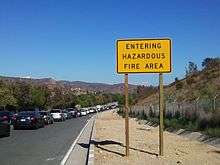
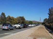
It is signed as a scenic route from the Orange-San Bernardino County line to Peyton Drive in Chino Hills. It is a popular shortcut between the Inland Empire and the business centers of Brea and surrounding Orange County; however, the road has multiple tight curves, so travel is not recommended for long vehicles, such as big rigs.
Route description
SR 142 is part of the California Freeway and Expressway System[2] and is eligible for the State Scenic Highway System.[3] However, it has not been designated by Caltrans as a scenic highway.[4]
SR 142 begins in the city of Brea as Valencia Avenue at a junction with SR 90. The road heads northeast to an intersection with Carbon Canyon Road, which assumes the designation of SR 142 and continues east through Carbon Canyon Regional Park. SR 142 continues into the community of Olinda before crossing into the Sleepy Hollow area of the city of Chino Hills in San Bernardino County.[5]
SR 142 continues northeast through Chino Hills to an intersection, where it continues eastbound on Chino Hills Parkway. The highway ends at an interchange with SR 71 on the border of Chino Hills and Chino, near the California Institution for Men, a state prison.[6]
History
In 1933, a road from Brea to Chino was added to the state highway system.[7] It was designated as Route 177 in 1935.[8] In the 1964 state highway renumbering, this became part of SR 142.[9] A routing from Chino to Upland was added to the state highway system as Route 274 in 1959,[10] and was added to SR 142 in the 1964 renumbering from SR 71 to SR 30 (later SR 210),[9][11] but no highway has been built along that route.
Major intersections
Except where prefixed with a letter, postmiles were measured on the road as it was in 1964, based on the alignment that existed at the time, and do not necessarily reflect current mileage. R reflects a realignment in the route since then, M indicates a second realignment, L refers an overlap due to a correction or change, and T indicates postmiles classified as temporary (for a full list of prefixes, see the list of postmile definitions).[1] Segments that remain unconstructed or have been relinquished to local control may be omitted. The numbers reset at county lines; the start and end postmiles in each county are given in the county column.
| County | Location | Postmile [1][12][13] | Destinations | Notes | |
|---|---|---|---|---|---|
| Orange ORA R0.75[14]-6.35 | Brea | R0.75 | Valencia Avenue south | Continuation beyond SR 90 | |
| R0.75 | West end of SR 142/overlap with Valencia Avenue | ||||
| R1.45 | Rose Ave, Birch Street | ||||
| R1.85 | Lambert Road, Valencia Avenue north | East end of overlap with Valencia Avenue; west end of overlap with Carbon Canyon Road | |||
| San Bernardino SBD 0.00-5.78 | Chino Hills | 3.90 | Chino Hills Parkway west | East end of overlap with Carbon Canyon Road; west end of overlap with Chino Hills Parkway | |
| 5.78 | Interchange; east end of SR 142/overlap with Chino Hills Parkway; SR 71 exit 8 | ||||
| 5.78 | Chino Hills Parkway east | Continuation beyond SR 71 | |||
| 1.000 mi = 1.609 km; 1.000 km = 0.621 mi | |||||
References
- 1 2 3 California Department of Transportation. "State Truck Route List". Sacramento: California Department of Transportation. Archived from the original (XLS file) on June 30, 2015. Retrieved June 30, 2015.
- ↑ CA Codes (shc:250-257)
- ↑ CA Codes (shc:260-284)
- ↑ California Department of Transportation, Officially Designated Scenic Highways. Retrieved 2010-03-26
- ↑ Orange County Road Atlas (Map). Thomas Brothers. 2008.
- ↑ San Bernardino County Road Atlas (Map). Thomas Brothers. 2008.
- ↑ California State Assembly. "An act to amend sections 2, 3 and 5 and to add two sections to be numbered 6 and 7 to an act entitled 'An act to provide for the acquisition of rights of way for and the construction, maintenance...". Fiftieth Session of the Legislature. Statutes of California. State of California. Ch. 767.
- ↑ California State Assembly. "An act...relating to State highways". Fifty-first Session of the Legislature. Statutes of California. State of California. Ch. 274.
- 1 2 California State Assembly. "An act to add Section 253 and Article 3 (commencing with Section 300) to Chapter 2 of Division 1 of, and to repeal Section 253 and Article 3 (commencing with Section 300) of Chapter 2 of Division 1 of, the...". 1963 Session of the Legislature. Statutes of California. State of California. Ch. 385.
- ↑ California State Assembly. "An act to amend Sections 306, 320, 332, 351, 362, 365, 369, 374, 382, 388, 397, 407, 408, 409, 410, 415, 422, 435, 440, 446, 453, 456, 460, 467, 470, 476, 487, 492, 493, 494, 506, 521, 528, and 529...". 1959 Session of the Legislature. Statutes of California. State of California. Ch. 1062.
- ↑ California State Assembly. "An act to amend Sections 14076.2 and 103113 of, and to repeal Section 14451 of, the Government Code, to amend Section 20300 of, and to amend the heading of Article 16 (commencing with Section 20300) of Chapter 1 of Part 3...". 1999–2000 Session of the Legislature. Statutes of California. State of California. Ch. 724.
- ↑ California Department of Transportation, Log of Bridges on State Highways, July 2007
- ↑ California Department of Transportation, All Traffic Volumes on CSHS, 2005 and 2006
- ↑ It is noted that at the time of renumbering of the California State Highways, Route 142 began at the corner of Imperial Highway and Carolina Avenue (now Kraemer Boulevard), continued north on Carolina Avenue to Birch Street, then east on Birch Street to Valencia Avenue. It turned north on Valencia Avenue and followed the same route as the present. The beginning postmile is R0.75 instead of 0.00 because of the realignment and the resulting shortening of the route.
| Wikimedia Commons has media related to California State Route 142. |