| Image |
[1] |
Landmark name |
Location |
City or town |
Summary |
|---|
 |
505 |
Almaden Vineyards |
1530 Blossom Hill Rd.
37°14′21″N 121°53′41″W / 37.2391°N 121.8947°W / 37.2391; -121.8947 (Almaden Vineyards) |
San Jose |
|
|
800 |
Arroyo de San Joseph Cupertino |
Monta Vista High School
37°18′56″N 122°03′28″W / 37.31545°N 122.057667°W / 37.31545; -122.057667 (Arroyo de San Joseph Cupertino) |
Cupertino |
|
|
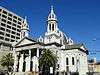
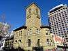
910 |
Cathedral Basilica of St. Joseph |
90 S Market St.
37°20′03″N 121°53′27″W / 37.334036°N 121.890816°W / 37.334036; -121.890816 (Cathedral Basilica of St. Joseph) |
San Jose |
|
|
904 |
Charles Copeland Morse House |
981 Fremont St.
37°21′07″N 121°56′44″W / 37.352069°N 121.945506°W / 37.352069; -121.945506 (Charles Copeland Morse House) |
Santa Clara |
Also on the NHRP list as NPS-82002266
|
|
834 |
Eadweard Muybridge and the development of motion pictures |
Stanford University, Campus Dr W across from Stanford Driving Range
37°25′29″N 122°10′57″W / 37.4246°N 122.1824°W / 37.4246; -122.1824 (Eadweard Muybridge and the development of motion pictures) |
Palo Alto |
|
|
416 |
Edwin Markham Home |
Kelley Park, 1600 Senter Rd.
|
San Jose |
|
|
945 |
First successful introduction of the honeybee to California |
San Jose Municipal Airport, 1661 Airport Blvd.
37°21′N 121°55′W / 37.35°N 121.92°W / 37.35; -121.92 (First successful introduction of the honeybee to California) |
San Jose |
|
|
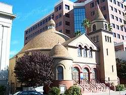
902 |
First Unitarian Church of San Jose |
160 N. Third St.
37°20′23″N 121°53′24″W / 37.339728°N 121.889903°W / 37.339728; -121.889903 (First Unitarian Church of San Jose) |
San Jose |
|
|
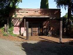
458 |
Forbes Flour Mill |
Forbes Mill Museum
37°13′20″N 121°58′49″W / 37.222101°N 121.980174°W / 37.222101; -121.980174 (Forbes Flour Mill) |
Los Gatos |
|
|
433 |
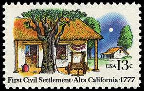
First site of El Pueblo de San José de Guadalupe |
San Jose City Hall
37°21′00″N 121°54′13″W / 37.3501°N 121.9037°W / 37.3501; -121.9037 (First site of El Pueblo de San José de Guadalupe) |
San Jose |
|
|
1017 |
Gilroy Yamato Hot Springs |
37°06′30″N 121°28′39″W / 37.108333°N 121.4775°W / 37.108333; -121.4775 (Gilroy Yamato Hot Springs) |
Gilroy |
Also on the NHRP list as NPS-95000996
|
|
447 |
Gubserville |
1481 Saratoga Ave.
37°17′44″N 121°59′16″W / 37.295667°N 121.987783°W / 37.295667; -121.987783 (Gubserville) |
San Jose |
|
|
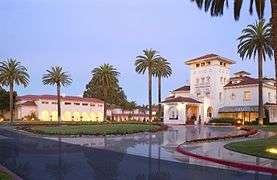
888 |
Hayes Mansion |
200 Edenvale Ave.
37°15′44″N 121°49′15″W / 37.262314°N 121.820767°W / 37.262314; -121.820767 (Hayes Mansion) |
San Jose |
|
|
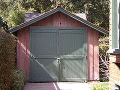
976 |
HP Garage |
367 Addison Ave.
37°26′35″N 122°09′17″W / 37.44307°N 122.15481°W / 37.44307; -122.15481 (HP Garage) |
Palo Alto |
Also on the NHRP list as NPS-07000307
|
|
895 |
Hostess House |
27 Mitchell Ln.
37°26′35″N 122°09′56″W / 37.442933°N 122.165483°W / 37.442933; -122.165483 (Hostess House) |
Palo Alto |
Also on the NHRP list as NPS-76000528
|
|
857 |
John Adams Squire House |
900 University Ave.
37°27′12″N 122°09′12″W / 37.4533°N 122.1532°W / 37.4533; -122.1532 (John Adams Squire House) |
Palo Alto |
|
|
524 |
Juana Briones de Miranda Home |
4157 Old Adobe Rd.
37°23′32″N 122°08′22″W / 37.39225°N 122.13955°W / 37.39225; -122.13955 (Juana Briones de Miranda Home) |
Palo Alto |
|
|
903 |
Kotani-En |
15891 Ravine Rd.
|
Los Gatos |
|
|
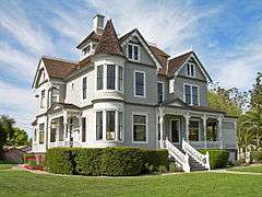
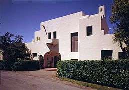
913 |
Lou Henry Hoover House |
623 Mirada Rd.
37°25′07″N 122°10′03″W / 37.4185°N 122.1675°W / 37.4185; -122.1675 (Lou Henry Hoover House) |
Palo Alto |
|
|
644 |
Martin Murphy Home and Estate |
Martin Murphy, Jr. Historical Park
|
Sunnyvale |
|
|
969 |
Mayfield Farm |
La Selva Dr. between Military Way and Magnolia Dr.
37°24′59″N 122°07′49″W / 37.4164°N 122.1303°W / 37.4164; -122.1303 (Mayfield Farm) |
Palo Alto |
|
|
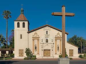
338 |
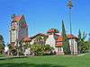
Mission Santa Clara de Asis |
Mission Church, University of Santa Clara
37°20′57″N 121°56′30″W / 37.349269°N 121.9416°W / 37.349269; -121.9416 (Mission Santa Clara de Asis) |
Santa Clara |
|
|
813 |
Montgomery Hill |
Evergreen College
37°17′53″N 121°45′39″W / 37.2981°N 121.7607°W / 37.2981; -121.7607 (Montgomery Hill) |
San Jose |
|
|
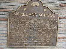
489 |
Moreland School |
4335 Payne Ave.
37°18′03″N 121°58′45″W / 37.3009°N 121.9792°W / 37.3009; -121.9792 (Moreland School) |
San Jose |
|
|
339 |
New Almaden Mine |
On N-bound old Hwy 101
37°14′54″N 121°47′20″W / 37.2482°N 121.7888°W / 37.2482; -121.7888 (New Almaden Mine) |
San Jose |
|
|
339-1 |
New Almaden Mine |
Bulmore Park, Almaden Rd and Almaden Way
37°10′27″N 121°49′28″W / 37.17415°N 121.8245°W / 37.17415; -121.8245 (New Almaden Mine) |
San Jose |
|
|
854 |
Old Post Office |
110 S. Market St.
37°20′01″N 121°53′25″W / 37.333488°N 121.890364°W / 37.333488; -121.890364 (Old Post Office) |
San Jose |
|
|
250 |
Old site of Mission Santa Clara de Asis and Old Spanish Bridge |
Central Expressway and De la Cruz Blvd.
37°21′59″N 121°56′29″W / 37.3665°N 121.941483°W / 37.3665; -121.941483 (Old site of Mission Santa Clara de Asis and Old Spanish Bridge) |
Santa Clara |
|
|
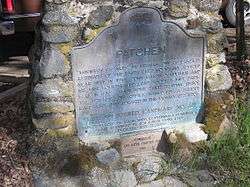
448 |
Patchen |
Old Santa Cruz Hwy and Mountain Charlie Rd.
37°08′53″N 121°58′27″W / 37.148133°N 121.9743°W / 37.148133; -121.9743 (Patchen) |
Holy City |
|
|
733 |
Paul Masson Mountain Winery |
Mountain Winery
37°15′37″N 122°03′54″W / 37.260372°N 122.064936°W / 37.260372; -122.064936 (Paul Masson Mountain Winery) |
Saratoga |
Also on the NHRP list as NPS-83001239
|
|
434 |
Pellier Park, site of City Gardens |
100 block of W St James St.
37°20′16″N 121°53′45″W / 37.337733°N 121.895917°W / 37.337733; -121.895917 (Pellier Park, site of City Gardens) |
San Jose |
|
|
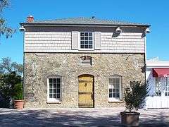
866 |
Peralta Adobe |
900 University Ave.
37°20′11″N 121°53′41″W / 37.336403°N 121.894753°W / 37.336403; -121.894753 (Peralta Adobe) |
San Jose |
Also on the NHRP list as NPS-73000454
|
|
836 |
Pioneer Electronics Research Laboratory |
SE corner of Channing Ave. and Emerson St.
37°26′29″N 122°09′28″W / 37.4414°N 122.1578°W / 37.4414; -122.1578 (Pioneer Electronics Research Laboratory) |
Palo Alto |
|
|
898 |
Roberto-Suñol Adobe |
770 Lincoln Ave.
37°18′57″N 121°54′23″W / 37.31575°N 121.90645°W / 37.31575; -121.90645 (Roberto-Suñol Adobe) |
San Jose |
|
|
417 |
San Jose State College |
San Jose State University
37°20′08″N 121°52′52″W / 37.335556°N 121.881111°W / 37.335556; -121.881111 (San Jose State College) |
San Jose |
|
|
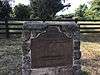
260 |
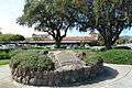
Santa Clara Campaign Treaty Site |
Civic Center Park
37°21′08″N 121°57′13″W / 37.3522°N 121.9537°W / 37.3522; -121.9537 (Santa Clara Campaign Treaty Site) |
Santa Clara |
|
|
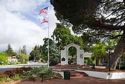
435 |
Saratoga |
Hwys 9 and 85
37°15′33″N 122°01′51″W / 37.2592°N 122.0309°W / 37.2592; -122.0309 (Saratoga) |
Saratoga |
|
|
461 |
Site of California's First State Capitol |
City Park Plaza
37°19′58″N 121°53′23″W / 37.332717°N 121.8896°W / 37.332717; -121.8896 (Site of California's First State Capitol) |
San Jose |
|
|
1000 |
Site of invention of the first commercially practicable integrated circuit |
844 E Charleston Rd.
37°25′18″N 122°06′12″W / 37.421783°N 122.1033°W / 37.421783; -122.1033 (Site of invention of the first commercially practicable integrated circuit) |
Palo Alto |
|
|
952 |
Site of the world's first broadcasting station |
First and San Fernando Sts.
37°20′03″N 121°53′22″W / 37.33405°N 121.88945°W / 37.33405; -121.88945 (Site of the world's first broadcasting station) |
San Jose |
|
|
259 |
Vasquez Tree and site of 21-Mile-House |
Tennant Ave. and Monterey Hwy.
37°06′47″N 121°38′38″W / 37.1131°N 121.6438°W / 37.1131; -121.6438 (Vasquez Tree and site of 21-Mile-House) |
Morgan Hill |
|
|
868 |
Winchester Mystery House |
525 S. Winchester Blvd.
37°19′06″N 121°57′03″W / 37.318361°N 121.950761°W / 37.318361; -121.950761 (Winchester Mystery House) |
San Jose |
Also on the NHRP list as NPS-74000559
|
|
249 |
Women's Club Adobe |
3260 The Alameda between Benton and Franklin Sts.
37°21′07″N 121°56′27″W / 37.352033°N 121.9408°W / 37.352033; -121.9408 (Women's Club Adobe) |
Santa Clara |
|