Calhoun County, Iowa
| Calhoun County, Iowa | |
|---|---|
|
| |
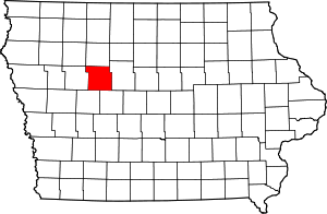 Location in the U.S. state of Iowa | |
 Iowa's location in the U.S. | |
| Founded | 1855 |
| Named for | John C. Calhoun |
| Seat | Rockwell City |
| Largest city | Lake City |
| Area | |
| • Total | 572 sq mi (1,481 km2) |
| • Land | 570 sq mi (1,476 km2) |
| • Water | 2.1 sq mi (5 km2), 0.4% |
| Population | |
| • (2010) | 9,670 |
| • Density | 17/sq mi (7/km²) |
| Congressional district | 4th |
| Time zone | Central: UTC-6/-5 |
| Website |
www |

Calhoun County is a county located in the U.S. state of Iowa. As of the 2010 census, the population was 9,670.[1] Its county seat is Rockwell City.[2]
History
Calhoun County was formed on January 15, 1851 from open land originally named Fox County. It was renamed in 1853 after the seventh US Vice President secessionist John C. Calhoun. When the tracks of the Illinois Central Railroad were laid through the county in 1870, the county seat was moved from Lake City to Rockwell City. The first train reached Rockwell City on August 7, 1882 and the population count doubled in the same year. The first courthouse, built of wood, burned to the ground in 1884 and the county government moved into a nearby hotel. In 1913, the current courthouse was built.
On July 6, 1893, Pomeroy was struck by a tornado that measured F5 on the Fujita scale. With a damage path 500 yards (460 m) wide and 55 miles (89 km) long, the tornado destroyed about 80% of the homes in Pomeroy. The tornado killed 71 people and injured 200.
Geography
According to the U.S. Census Bureau, the county has a total area of 572 square miles (1,480 km2), of which 570 square miles (1,500 km2) is land and 2.1 square miles (5.4 km2) (0.4%) is water.[3]
Major highways
Adjacent counties
- Pocahontas County (north)
- Webster County (east)
- Greene County (southeast)
- Carroll County (southwest)
- Sac County (west)
Demographics
| Historical population | |||
|---|---|---|---|
| Census | Pop. | %± | |
| 1860 | 147 | — | |
| 1870 | 1,602 | 989.8% | |
| 1880 | 5,595 | 249.3% | |
| 1890 | 13,107 | 134.3% | |
| 1900 | 18,569 | 41.7% | |
| 1910 | 17,090 | −8.0% | |
| 1920 | 17,783 | 4.1% | |
| 1930 | 17,605 | −1.0% | |
| 1940 | 17,584 | −0.1% | |
| 1950 | 16,925 | −3.7% | |
| 1960 | 15,923 | −5.9% | |
| 1970 | 14,287 | −10.3% | |
| 1980 | 13,542 | −5.2% | |
| 1990 | 11,508 | −15.0% | |
| 2000 | 11,115 | −3.4% | |
| 2010 | 9,670 | −13.0% | |
| Est. 2015 | 9,818 | [4] | 1.5% |
| U.S. Decennial Census[5] 1790-1960[6] 1900-1990[7] 1990-2000[8] 2010-2013[1] | |||
2010 census
The 2010 census recorded a population of 9,670 in the county, with a population density of 16.96/sq mi (6.55/km2). There were 5,108 housing units, of which 4,242 were occupied.[9]
2000 census

As of the census[10] of 2000, there were 11,115 people, 4,513 households, and 3,014 families residing in the county. The population density was 20 people per square mile (8/km²). There were 5,219 housing units at an average density of 9 per square mile (4/km²). The racial makeup of the county was 98.06% White, 0.69% Black or African American, 0.20% Native American, 0.18% Asian, 0.01% Pacific Islander, 0.34% from other races, and 0.52% from two or more races. 0.90% of the population were Hispanic or Latino of any race.
There are 4,513 households out of which 27.80% have children under the age of 18 living with them, 57.90% were married couples living together, 6.60% had a female householder with no husband present, and 33.20% were non-families. 30.50% of all households were made up of individuals and 17.80% had someone living alone who was 65 years of age or older. The average household size was 2.31 and the average family size was 2.87.
In the county the population was spread out with 23.10% under the age of 18, 6.40% from 18 to 24, 24.80% from 25 to 44, 23.70% from 45 to 64, and 22.10% who were 65 years of age or older. The median age was 42 years. For every 100 females there were 98.10 males. For every 100 females age 18 and over, there were 97.60 males.
The median income for a household in the county was $33,286, and the median income for a family was $41,583. Males had a median income of $28,787 versus $20,095 for females. The per capita income for the county was $17,498. 10.10% of the population and 7.10% of families were below the poverty line. Out of the total population, 13.50% of those under the age of 18 and 8.50% of those 65 and older were living below the poverty line.
Communities
Cities
Unincorporated communities
Townships
Calhoun County is divided into sixteen townships:
Population ranking
The population ranking of the following table is based on the 2010 census of Calhoun County.[11]
† county seat
| Rank | City/Town/etc. | Municipal type | Population (2010 Census)
|
|---|---|---|---|
| 1 | Lake City | City | 1,727 |
| 2 | † Rockwell City | City | 1,709 |
| 3 | Manson | City | 1,690 |
| 4 | Pomeroy | City | 662 |
| 5 | Farnhamville (partially in Webster County) | City | 371 |
| 6 | Lohrville | City | 368 |
| 7 | Twin Lakes | CDP | 334 |
| 8 | Lytton (mostly in Sac County) | City | 315 |
| 9 | Somers | City | 113 |
| 10 | Knierim | City | 60 |
| 11 | Rinard | City | 52 |
| 12 | Jolley | City | 41 |
| 13 | Yetter | City | 34 |
See also
References
- 1 2 "State & County QuickFacts". United States Census Bureau. Retrieved July 14, 2014.
- ↑ "Find a County". National Association of Counties. Archived from the original on 2011-05-31. Retrieved 2011-06-07.
- ↑ "US Gazetteer files: 2010, 2000, and 1990". United States Census Bureau. 2011-02-12. Retrieved 2011-04-23.
- ↑ "County Totals Dataset: Population, Population Change and Estimated Components of Population Change: April 1, 2010 to July 1, 2015". Retrieved July 2, 2016.
- ↑ "U.S. Decennial Census". United States Census Bureau. Archived from the original on May 11, 2015. Retrieved July 14, 2014.
- ↑ "Historical Census Browser". University of Virginia Library. Retrieved July 14, 2014.
- ↑ "Population of Counties by Decennial Census: 1900 to 1990". United States Census Bureau. Retrieved July 14, 2014.
- ↑ "Census 2000 PHC-T-4. Ranking Tables for Counties: 1990 and 2000" (PDF). United States Census Bureau. Retrieved July 14, 2014.
- ↑ "Population and Housing Occupancy Status: 2010 - State -- County". United States Census Bureau American FactFinder. Retrieved March 8, 2011.
- ↑ "American FactFinder". United States Census Bureau. Archived from the original on 2013-09-11. Retrieved 2008-01-31.
- ↑ "Archived copy". Archived from the original on 2013-12-21. Retrieved 2013-02-10.
External links
| Wikimedia Commons has media related to Calhoun County, Iowa. |
 |
Pocahontas County | | ||
| Sac County | |
Webster County | ||
| ||||
| | ||||
| Carroll County | Greene County |
Municipalities and communities of Calhoun County, Iowa, United States | ||
|---|---|---|
| Cities | ||
| Townships | ||
| CDP | ||
| Other unincorporated communities | ||
| Footnotes | ‡This populated place also has portions in an adjacent county or counties | |

Coordinates: 42°23′10″N 94°38′50″W / 42.38611°N 94.64722°W