Caledon River
| Mohokare | |
| River | |
| Countries | Lesotho, South Africa |
|---|---|
| State | Free State |
| City | Maseru |
| Source | Mont-aux-Sources |
| - location | SW of Phuthaditjhaba, Drakensberg |
| - elevation | 2,100 m (6,890 ft) |
| Mouth | Orange River |
| - location | Near Bethulie |
| - elevation | 1,267 m (4,157 ft) |
| - coordinates | LS 30°31′21″S 26°4′21″E / 30.52250°S 26.07250°ECoordinates: LS 30°31′21″S 26°4′21″E / 30.52250°S 26.07250°E |
| Length | 480 km (298 mi) |
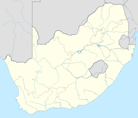 Location of the Caledon River mouth
| |
The Caledon River (Sotho: Mohokare) is located in south-east Africa, rising in the Drakensberg Mountains in Lesotho, flowing southwestward and then westward before joining the Orange River near Bethulie in southern Free State.
Geography
The origin of the River Caledon is in the former bantustan of QwaQwa, near the border with Lesotho, southwest of Witsieshoek. It then flows south-west through Lesotho's capital city, Maseru. It forms the border between South Africa and Lesotho before entering South Africa's Free State province (north of Wepener). It then flows westward before joining the Orange River near Bethulie in southern Free State, just before the Gariep Dam. Its total length is about 300 miles (480 km) and its valley experiences great temperature swings.[1] The land falling into the wedge between these two rivers forms the 22,000 hectare Tussen-die-Riviere Nature Reserve.[2]
River
The river is the primary source of water for Maseru, the capital of Lesotho, which stands on the river. During periods of low rainfall water shortages can ensue. To combat this, several reservoirs have been created with structures such as the Muela Dam and the Meulspruit Dam.[3] In 2003 water was released from here to avert drought.[4]
The Caledon Valley is important in the history of the Basotho people. The area was exceptionally fertile and could be farmed without irrigation. This made it desirable and was one of the causes of the conflict between the Basotho and the Boers.[5] Maize is grown on a large scale in the Caledon Valley.[1]
Dams in South Africa
- Armenia Dam, on the tributary Leeu River
- Egmont Dam, on the tributary Witspruit River
- Knellpoort Dam, on the tributary Riet Spruit
- Koppieskraal Dam
- Meulspruit Dam
- Moperri Dam
- Welbedacht Dam, a major water source for Bloemfontein and surroundings, situated inside the Caledon Nature Reserve
See also
References
- 1 2 "Caledon River". Encyclopedia Britannica. Encyclopedia Britannica. Retrieved 26 November 2016.
- ↑ "Tussen Die Riviere Game Reserve". SA Places. Retrieved 26 November 2016.
- ↑ Caledon River - Dams
- ↑ Drought
- ↑ Coplan, David B. (2001). "A river runs through it: The meaning of the Lesotho‐free state border". African Affairs. 100 (398): 81–116. doi:10.1093/afraf/100.398.81.