Calderitas, Quintana Roo
| Calderitas | ||
|---|---|---|
| Village | ||
| ||
 | ||
| Coordinates: 18°33′16″N 88°15′30″W / 18.55444°N 88.25833°W | ||
| Country |
| |
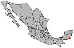
| State | Quintana Roo | |
| Municipality | Othon P. Blanco | |
| Elevation | 9 m (30 ft) | |
| Population (2010[1]) | ||
| • Village | 5,326 | |
| • Urban | 5,326 | |
| Time zone | CST (UTC-6) | |

Caderitas is a city on the east coast of the Yucatán Peninsula in Mexico.
The city of Calderitas is situated on the western side of Chetumal Bay, near the mouth of the Río Hondo, just northeast of Chetumal. Because of its close proximity to the Caribbean coastline, it is vulnerable to tropical cyclones; Hurricane Janet and Hurricane Dean, both Category 5 storms, made landfall near Calderitas in 1955 and 2007 respectively. This is a small but growing Mayan Village with a Mayor and a Mayan Council of Elders. The growth of Chetumal will influence this town greatly in a few years. The only local Beach is in this town as well as one opened Mayan Ruin and a boat ramp.[2][3]
References
- ↑ 2010 census tables: INEGI Archived May 2, 2013, at the Wayback Machine.
- ↑ Wood Martinez Elisabet J
- ↑ Carrillo, Manuel. Dean pummels Mexican resorts, Reuters Canada, 2007-08-21. Accessed 2007-08-21.
Coordinates: 18°33′16″N 88°15′30″W / 18.55444°N 88.25833°W
This article is issued from Wikipedia - version of the 11/18/2016. The text is available under the Creative Commons Attribution/Share Alike but additional terms may apply for the media files.