Caesars Head
| Caesars Head | |
|---|---|
 Caesars Head | |
| Highest point | |
| Elevation | 3,215 feet (980 m) |
| Coordinates | 35°6′20″N 82°37′39″W / 35.10556°N 82.62750°WCoordinates: 35°6′20″N 82°37′39″W / 35.10556°N 82.62750°W [1] |
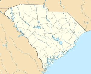
Caesars Head is a mountain within Caesars Head State Park in northern Greenville County, South Carolina within Cleveland. The summit has an elevation of 3,215 feet (980 m).[1] The radio tower for TV station WYFF is nearby.
Climate
| Climate data for Caesars Head, South Carolina (3200 ft) | |||||||||||||
|---|---|---|---|---|---|---|---|---|---|---|---|---|---|
| Month | Jan | Feb | Mar | Apr | May | Jun | Jul | Aug | Sep | Oct | Nov | Dec | Year |
| Record high °F (°C) | 73 (23) |
73 (23) |
80 (27) |
86 (30) |
89 (32) |
91 (33) |
97 (36) |
99 (37) |
98 (37) |
84 (29) |
79 (26) |
70 (21) |
99 (37) |
| Average high °F (°C) | 44.5 (6.9) |
47.7 (8.7) |
56.7 (13.7) |
65.5 (18.6) |
71.3 (21.8) |
76.7 (24.8) |
79.3 (26.3) |
78.1 (25.6) |
72.9 (22.7) |
63.6 (17.6) |
54.9 (12.7) |
47.3 (8.5) |
63.21 (17.33) |
| Average low °F (°C) | 26.8 (−2.9) |
29.0 (−1.7) |
36.5 (2.5) |
44.3 (6.8) |
52.1 (11.2) |
59.8 (15.4) |
63.4 (17.4) |
62.4 (16.9) |
56.9 (13.8) |
46.6 (8.1) |
38.1 (3.4) |
30.5 (−0.8) |
45.53 (7.51) |
| Record low °F (°C) | −19 (−28) |
−2 (−19) |
4 (−16) |
17 (−8) |
28 (−2) |
34 (1) |
50 (10) |
45 (7) |
28 (−2) |
24 (−4) |
−1 (−18) |
−5 (−21) |
−19 (−28) |
| Average precipitation inches (mm) | 5.81 (147.6) |
5.06 (128.5) |
6.77 (172) |
5.27 (133.9) |
6.55 (166.4) |
6.67 (169.4) |
6.93 (176) |
6.00 (152.4) |
6.31 (160.3) |
5.50 (139.7) |
6.38 (162.1) |
6.54 (166.1) |
73.79 (1,874.4) |
| Average snowfall inches (cm) | 2.7 (6.9) |
2.1 (5.3) |
1.4 (3.6) |
0.0 (0) |
0.0 (0) |
0.0 (0) |
0.0 (0) |
0.0 (0) |
0.0 (0) |
0.0 (0) |
0.4 (1) |
1.3 (3.3) |
7.9 (20.1) |
| Average precipitation days (≥ 0.01) | 9 | 8 | 10 | 9 | 11 | 13 | 15 | 13 | 10 | 8 | 9 | 10 | 125 |
| Source: Western Regional Climate Center[2] | |||||||||||||
References
- 1 2 "Geographic Names Information System". United States Geological Survey. Retrieved 2008-01-31.
- ↑ "CAESARS HEAD, SOUTH CAROLINA (381256) Period of Record Monthly Climate Summary". Western Regional Climate Center. Retrieved September 28, 2014.
External links
This article is issued from Wikipedia - version of the 11/23/2016. The text is available under the Creative Commons Attribution/Share Alike but additional terms may apply for the media files.