Cadiz, Kentucky
| Cadiz, Kentucky | |
|---|---|
| City | |
|
The courthouse in Cadiz burned twice during the American Civil War. This courthouse was demolished in 2008 to make way for a new justice center that opened in October 2009. | |
 Location of Cadiz, Kentucky | |
| Coordinates: 36°52′4″N 87°49′3″W / 36.86778°N 87.81750°WCoordinates: 36°52′4″N 87°49′3″W / 36.86778°N 87.81750°W | |
| Country | United States |
| State | Kentucky |
| County | Trigg |
| Government | |
| • Type | Mayor-council government |
| • Mayor | Todd King |
| Area | |
| • Total | 3.5 sq mi (9.0 km2) |
| • Land | 3.5 sq mi (9.0 km2) |
| • Water | 0.0 sq mi (0.0 km2) |
| Elevation | 423 ft (129 m) |
| Population (2010) | |
| • Total | 2,558 |
| • Density | 685.4/sq mi (264.6/km2) |
| Time zone | Central (CST) (UTC-6) |
| • Summer (DST) | CDT (UTC-5) |
| ZIP code | 42211 |
| Area code(s) | 270 & 364 |
| FIPS code | 21-11692 |
| GNIS feature ID | 0517318 |
| Website | http://cadiz.ky.gov |

Cadiz (local /ˈkeɪdɪz/[1]) is a home rule-class city[2] in and the county seat of Trigg County, Kentucky, United States.[3] The population was 2,373 at the 2000 census. It is part of the Clarksville metropolitan area.
Cadiz is an old town located close to the Land Between the Lakes, a popular recreation area, and was a base of Union and Confederate operations during the Civil War. It permits the sale of alcoholic beverages.
Etymology
William Henry Perrin's 1884 History of Trigg County does not explain the Spanish name of the town, but does say that in May 1820 the county commission chose Robert Baker's land as its seat. He relinquished his stable yard and the surrounding 50 acres (200,000 m2). From August to October, the commission platted out the town in blocks and gave it the name Cadiz.[4] Rennick's Kentucky Place Names repeats the local tradition that a Spaniard in the surveying party successfully suggested his hometown.[1]
Geography
Cadiz is located at 36°52′4″N 87°49′3″W / 36.86778°N 87.81750°W (36.867781, -87.817374).[5]
According to the United States Census Bureau, the city has a total area of 3.5 square miles (9.1 km2), all land.
Demographics
| Historical population | |||
|---|---|---|---|
| Census | Pop. | %± | |
| 1830 | 112 | — | |
| 1840 | 450 | 301.8% | |
| 1860 | 706 | — | |
| 1870 | 680 | −3.7% | |
| 1880 | 646 | −5.0% | |
| 1890 | 890 | 37.8% | |
| 1900 | 881 | −1.0% | |
| 1910 | 1,005 | 14.1% | |
| 1920 | 897 | −10.7% | |
| 1930 | 1,114 | 24.2% | |
| 1940 | 1,228 | 10.2% | |
| 1950 | 1,280 | 4.2% | |
| 1960 | 1,980 | 54.7% | |
| 1970 | 1,987 | 0.4% | |
| 1980 | 1,661 | −16.4% | |
| 1990 | 2,148 | 29.3% | |
| 2000 | 2,373 | 10.5% | |
| 2010 | 2,558 | 7.8% | |
| Est. 2015 | 2,626 | [6] | 2.7% |
As of the census[8] of 2010, there were 2,558 people, 1,541 households, and 648 families residing in the city. The population density was 685.4 people per square mile (264.8/km²). There were 1,541 housing units at an average density of 315.7 per square mile (122.0/km²). The racial makeup of the city was 79.2% White, 17.2% African American, 0.13% Native American, 0.66% Asian, 0.04% Pacific Islander, 0.39% from other races, and 2.3% from two or more races. Hispanic or Latino of any race were 0.98% of the population.
There were 1,541 households out of which 30.1% had children under the age of 18 living with them, 44.5% were married couples living together, 15.8% had a female householder with no husband present, and 35.7% were non-families. 32.9% of all households were made up of individuals and 18.7% had someone living alone who was 65 years of age or older. The average household size was 2.29 and the average family size was 2.89.
In the city the population was spread out with 25.4% under the age of 18, 8.0% from 18 to 24, 24.9% from 25 to 44, 21.8% from 45 to 64, and 20.7% who were 65 years of age or older. The median age was 39 years. For every 100 females there were 82.5 males. For every 100 females age 18 and over, there were 77.9 males.
The median income for a household in the city was $29,872, and the median income for a family was $37,736. Males had a median income of $30,357 versus $18,929 for females. The per capita income for the city was $13,404. About 17.5% of families and 19.9% of the population were below the poverty line, including 29.2% of those under age 18 and 18.7% of those age 65 or over.
Notable people
- Roger Vinson, United States District Court judge
- Joe Bolton, poet
- Charles Tyler, musician
- Boots Randolph, musician
Crime
Cadiz boasts one of the lowest crime rates in Kentucky. The total crime risk index score for Cadiz is 34, which is 37 points below the statewide crime risk score of 71 and 66 points below the national crime risk score of 100. "Homefair City Profile".
Schools
Students in Cadiz attend Trigg County Public Schools which are located on a single campus on Main Street.
Climate
Cadiz has a humid subtropical climate and four distinct seasons. The warmest month of the year is July, with an average high temperature of 90 °F. The coldest month is January, with an average high temperature of 44 °F.
| Monthly Normal and Record High and Low Temperatures for Cadiz, KY[9] | ||||||||||||
| Month | Jan | Feb | Mar | Apr | May | Jun | Jul | Aug | Sep | Oct | Nov | Dec |
|---|---|---|---|---|---|---|---|---|---|---|---|---|
| Rec High °F | 80 | 82 | 87 | 91 | 94 | 102 | 104 | 104 | 107 | 95 | 83 | 78 |
| Norm High °F | 44 | 49 | 59 | 70 | 78 | 85 | 90 | 88 | 82 | 71 | 59 | 48 |
| Norm Low °F | 25 | 29 | 38 | 46 | 55 | 63 | 68 | 66 | 59 | 47 | 38 | 29 |
| Rec Low °F | -20 | -10 | -8 | 21 | 29 | 39 | 47 | 43 | 31 | 20 | 7 | -14 |
| Precip (in) | 3.80 | 4.48 | 4.60 | 4.40 | 5.07 | 4.22 | 4.03 | 3.17 | 3.50 | 3.26 | 4.86 | 4.69 |
References
- 1 2 Rennick, Robert. Kentucky Place Names, p. 45. University Press of Kentucky (Lexington), 1987. Accessed 22 Jul 2013.
- ↑ "Summary and Reference Guide to House Bill 331 City Classification Reform" (PDF). Kentucky League of Cities. Retrieved December 30, 2014.
- ↑ "Find a County". National Association of Counties. Archived from the original on 2011-05-31. Retrieved 2011-06-07.
- ↑ "Western Kentucky History". Retrieved 2007-07-01.
- ↑ "US Gazetteer files: 2010, 2000, and 1990". United States Census Bureau. 2011-02-12. Retrieved 2011-04-23.
- ↑ "Annual Estimates of the Resident Population for Incorporated Places: April 1, 2010 to July 1, 2015". Retrieved July 2, 2016.
- ↑ "Census of Population and Housing". Census.gov. Archived from the original on April 22, 2013. Retrieved June 4, 2015.
- ↑ "American FactFinder". United States Census Bureau. Archived from the original on 2013-09-11. Retrieved 2008-01-31.
- ↑ "Cadiz Weather". The Weather Channel. Retrieved 2009-07-01.
External links
- cadiz.ky.gov - Official website
- Trigg County Public Schools, Kentucky
- Tourism website - gocadiz.com
- WKDZ Radio (Local radio station)
- The Cadiz Record (weekly newspaper)
Municipalities and communities of Trigg County, Kentucky, United States | ||
|---|---|---|
| City | 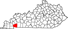 | |
| CDP | ||
| Other unincorporated community | ||
| Ghost town | ||
| Footnotes | ‡This populated place also has portions in an adjacent county or counties | |