Cabarrus County, North Carolina
| Cabarrus County, North Carolina | ||
|---|---|---|
 Old Cabarrus County Courthouse | ||
| ||
 Location in the U.S. state of North Carolina | ||
 North Carolina's location in the U.S. | ||
| Founded | 1792 | |
| Named for | Stephen Cabarrus | |
| Seat | Concord | |
| Largest city | Concord | |
| Area | ||
| • Total | 364 sq mi (943 km2) | |
| • Land | 362 sq mi (938 km2) | |
| • Water | 2.7 sq mi (7 km2), 0.7% | |
| Population (est.) | ||
| • (2015) | 196,762 | |
| • Density | 492/sq mi (190/km²) | |
| Congressional districts | 8th, 12th | |
| Time zone | Eastern: UTC-5/-4 | |
| Website |
www | |

Cabarrus /kʌˈbærʌs/ [1] County is a county located in the south-central part of the U.S. state of North Carolina. As of the 2010 census, the population was 178,011.[2] The county seat is Concord,[3] which was incorporated in 1803.
Cabarrus County is included in the Charlotte-Concord-Gastonia, NC-SC Metropolitan Statistical Area.
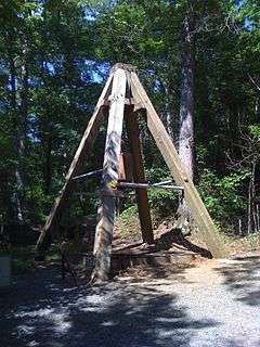
Among its significant historic sites is the Reed Gold Mine, a National Historic Landmark. The first gold discovered in the United States was found here in 1799, resulting in a gold rush in the early 1800s. So much gold was mined that President Andrew Jackson established the US Mint to control it.
This was an area of cotton cultivation in the antebellum era and industrialization through cotton mills in the late 19th century. Coleman Manufacturing Company, started in 1897, is believed to be the first cotton mill in the nation to be built, owned and operated by African Americans. It was owned by W.C. Coleman, John C. Dancy (collector of customs), and partners primarily from Wilmington, North Carolina, although investors also came from capitalists in the county.
History
The county was formed on December 29, 1792 from Mecklenburg County. Located in the Piedmont, it was named after Stephen Cabarrus of Chowan County, speaker of the North Carolina House of Commons.
Beginning about 1750, the county was settled mainly by immigrants: Germans on the eastern side and Scotch-Irish in the western area of the county. When it came time to choose a location for the county seat and county government, each ethnic group wanted the county seat located close to their populations and could not reach agreement on a site. Stephen Cabarrus wrote to the citizens pleading with them to come together in peace to choose a location for their county seat. A central area of the county was chosen in 1796 and aptly named Concord, a derivative of two French words "with" and "peace." Representative Paul Barringer introduced a bill into the state legislature to incorporate Concord; it passed on December 17, 1806.[4] The town of Concord was begun on land owned by Samuel Huie and wife Jane Morrison Huie.[5]
The first substantiated gold find in America was in 1799 by young Conrad Reed while playing in Little Meadow Creek, located on the Reed farm in southeastern Cabarrus County. According to research, Conrad's find was a gold chunk approximately the size of a shoe and weighing 17 pounds.[6]:11 His father John Reed took the nugget into Concord to a silversmith, who informed Reed that the rock did not have any value. The elder Reed returned home with it, holding it for three years until a trip in 1802 to Fayetteville, where he sold the "nugget" to a jeweler for $3.50. Over time John Reed learned that the jeweler sold the large nugget for several thousand dollars. Reed returned to Fayetteville insisting on more just compensation. This discovery and news of the sale spurred the beginning of gold mining in the area.[7]
John Reed, or Johannes Rieth as he is known in records of the Staatsarchiv at Marburg, Germany, was one of thousands of Hessian soldiers brought over by British troops to fight against rebellious colonists in the American Revolution. Reed deserted, as did many other Hessians. He traveled from Georgia to North Carolina, where he settled in an ethnic German community sometime around 1787 and began farming.[8]
Reed first developed placer mining on his property, then underground mining, and became wealthy from the gold. His facility became known as Reed's Gold Mine. Large amounts of gold were being discovered at the Reed Gold Mine and in other mines in the United States; these mine owners began to use their gold to create currency. In order for the government to retain control of the production of currency and keep a stabilized economic structure, President Andrew Jackson signed into legislation the authorization to create branches of the US Mint. The Charlotte Mint was built to handle the gold coming from the rich gold veins of North Carolina, including Reed's.[9]
The Reed Gold Mine was designated a National Historic Landmark, as it was the first gold mine in the country. Gold was mined in North Carolina into the early 20th century. Today visitors at the site can explore some of the mine's reconstructed tunnels.[10]
Located in the Piedmont region, the county became a site of industrialization with cotton mills constructed in the late 19th century. Among the owners of the new mills in the area were men of the rising black middle-class of Wilmington, North Carolina, such as Warren C. Coleman, John C. Dancy (appointed as collector of customs at the port), and others. They organized Coleman Manufacturing Company in 1897, on a site about two miles from Concord. They built and operated what is believed to have been the first cotton mill in the nation to be owned by blacks.[11] They hoped to promote economic security for people of color. Richard B. Fitzgerald was its first president. But the Wilmington Insurrection of 1898, with white attacks on blacks, their homes and businesses, destroyed much of what the people had built there since the war. In 1900 Dancy was among more than 2000 blacks who left the city permanently after the riot, resulting in its becoming majority white. He moved to Washington, DC, appointed as the federal Recorder of Deeds.[12]
Old Courthouse
The old Cabarrus County Courthouse was finished in 1876. Recognized as significant in the 20th century, it was listed on the National Register of Historic Places in 1974. The Confederate soldiers monument is located on the front lawn area.
Geography
According to the U.S. Census Bureau, the county has a total area of 364 square miles (940 km2), of which 362 square miles (940 km2) is land and 2.7 square miles (7.0 km2) (0.7%) is water.[13]
Cabarrus County is situated in the gently rolling countryside of the Carolina Piedmont There are no significantly high peaks or points, although the eastern half of the county contains the westernmost foothills of the Uwharrie Mountains. Altitude ranges from approximately 500–800 feet above sea level. No large or navigable rivers flow through the county; the nearest navigable waterway is the Yadkin River in nearby Rowan County. Land slope is generally toward the southeast. The longest waterway within the county is Rocky River, which rises in Iredell County and empties into the Pee Dee below Norwood in Stanly County. Weather is temperate with hot summers and mild to chilly winters. Severe weather occurs occasionally, with thunderstorms in the warmer months of the year and ice storms and snowfalls occurring on occasion in winter. From zero to three accumulating snowfalls may be expected in an average winter. Snow generally melts between accumulating snowfalls, and there is no consistent snowpack. An average of four inches (102 mm) of snow and 46 inches (1,200 mm) of rain falls each year. At summer solstice, the length of day is approximately 14 hours and 33 minutes, with visible light lasting 15 hours and 32 minutes.
This county is very country and rural. It has many farm lands within the county. Some schools within the county still have BYTSD (bring your tractor to school day).
Adjacent counties
- Rowan County - north
- Stanly County - east
- Union County - south
- Mecklenburg County - west
- Iredell County - northwest
Major highways
Demographics
| Historical population | |||
|---|---|---|---|
| Census | Pop. | %± | |
| 1800 | 5,094 | — | |
| 1810 | 6,158 | 20.9% | |
| 1820 | 7,248 | 17.7% | |
| 1830 | 8,810 | 21.6% | |
| 1840 | 9,259 | 5.1% | |
| 1850 | 9,747 | 5.3% | |
| 1860 | 10,546 | 8.2% | |
| 1870 | 11,954 | 13.4% | |
| 1880 | 14,964 | 25.2% | |
| 1890 | 18,142 | 21.2% | |
| 1900 | 22,456 | 23.8% | |
| 1910 | 26,240 | 16.9% | |
| 1920 | 33,730 | 28.5% | |
| 1930 | 44,331 | 31.4% | |
| 1940 | 59,393 | 34.0% | |
| 1950 | 63,783 | 7.4% | |
| 1960 | 68,137 | 6.8% | |
| 1970 | 74,629 | 9.5% | |
| 1980 | 85,895 | 15.1% | |
| 1990 | 98,935 | 15.2% | |
| 2000 | 131,063 | 32.5% | |
| 2010 | 178,011 | 35.8% | |
| Est. 2015 | 196,762 | [14] | 10.5% |
| U.S. Decennial Census[15] 1790-1960[16] 1900-1990[17] 1990-2000[18] 2010-2013[2] | |||
As of the census[19] of 2000, there were 131,063 people, 49,519 households, and 36,545 families residing in the county. The population density was 360 people per square mile (139/km²). There were 52,848 housing units at an average density of 145 per square mile (56/km²). The racial makeup of the county was 83.26% White, 12.18% Black or African American, 0.34% Native American, 0.91% Asian, 0.02% Pacific Islander, 2.30% from other races, and 0.99% from two or more races. 5.05% of the population were Hispanic or Latino of any race.
There were 49,519 households out of which 34.90% had children under the age of 18 living with them, 59.20% were married couples living together, 10.50% had a female householder with no husband present, and 26.20% were non-families. 21.80% of all households were made up of individuals and 8.00% had someone living alone who was 65 years of age or older. The average household size was 2.60 and the average family size was 3.03.
In the county the population was spread out with 25.80% under the age of 18, 8.10% from 18 to 24, 32.50% from 25 to 44, 22.10% from 45 to 64, and 11.60% who were 65 years of age or older. The median age was 35 years. For every 100 females there were 97.00 males. For every 100 females age 18 and over, there were 94.10 males.
The median income for a household in the county was $46,140, and the median income for a family was $53,692. Males had a median income of $36,714 versus $26,010 for females. The per capita income for the county was $21,121. About 4.80% of families and 7.10% of the population were below the poverty line, including 8.30% of those under age 18 and 9.60% of those age 65 or over.
Agriculture has played an important part in the economic life of the county for over 200 years. In the late 19th and early 20th centuries, textiles became a vital part of the local economy, especially in the northern portion of the county. Today, the local economy has a more varied base.
Communication is via an Interstate highway, Interstate 85, which travels southwest to northeast across the county's northern portion, and several U.S. and state highways. These principal highways include U.S. highways 52, 29, 601, and NC highways 73, 24/27, 200, 49, and 3. Concord Regional Airport (airport code JQF) is located seven miles (11 km) west of Concord. Commercial flights to the area are accessed through the airports at Charlotte, or at Greensboro, North Carolina. Passenger rail service to Kannapolis is available via Amtrak. Both wired and wireless telephone services are nearly universally available in the county. Cable television is available in much of the county. Cabarrus County is within the Greater Charlotte area for broadcast communications.
Most residents of Cabarrus County are Caucasian of Scots-Irish, German, or English-Welsh extraction. A minority population of African American residents inhabit the county.
Religion
The different religious denominations represented in the county are mainly Protestant. A small Jewish synagogue, Temple Or Olam exists in the area as well as two Catholic churches, St. James The Greater Catholic Church located in Concord and St. Joseph's Catholic Church in Kannapolis. Eastern Orthodox and Islamic congregations are available in nearby Charlotte.[20]
Law and government
| Year | Republican | Democratic |
|---|---|---|
| 2016 | 57.7% 53,789 | 38.1% 35,510 |
| 2012 | 59.3% 49,557 | 39.3% 32,849 |
| 2008 | 58.8% 45,924 | 40.5% 31,546 |
| 2004 | 67.1% 40,780 | 32.6% 19,803 |
| 2000 | 66.2% 32,704 | 33.0% 16,284 |
| 1996 | 55.8% 23,035 | 35.0% 14,447 |
| 1992 | 51.7% 21,281 | 32.9% 13,513 |
| 1988 | 67.7% 22,524 | 32.1% 10,686 |
| 1984 | 72.5% 22,528 | 27.3% 8,477 |
| 1980 | 59.2% 15,143 | 38.2% 9,768 |
| 1976 | 50.6% 12,455 | 48.9% 12,049 |
| 1972 | 76.4% 18,384 | 22.2% 5,336 |
| 1968 | 52.3% 13,226 | 21.8% 5,501 |
| 1964 | 52.5% 13,178 | 47.5% 11,921 |
| 1960 | 64.4% 15,678 | 35.6% 8,680 |
Cabarrus County is a member of the regional Centralina Council of Governments. Cabarrus County is governed by a five-member Board of Commissioners, elected at-large in countywide elections to serve four-year staggered terms. This election method favors choices of the majority of the population; the minorities have no opportunity to elect a candidate of their choice. The county's operations are managed by a "County Manager".[21]
Cabarrus County Land Records is a division of Tax Administration, a department of Cabarrus County Government. Land Records is responsible for creating and maintaining property records for all parcels in the county. Cabarrus County Land Records along with Cabarrus County Information Technology Services developed CLaRIS (Cabarrus County Land Records Information System), and award winning public access and inquiry system for citizens to look at and use land records data.[22]
The Stonewall Jackson Youth Development Center, a juvenile correctional facility of the North Carolina Department of Public Safety serving boys, is located an unincorporated area in the county, near Concord.[23]
Cabarrus County has voted Republican in every presidential election since at least 1960.
Education
The Cabarrus County School System services all of the county with the exception of parts of Kannapolis, which operates its own school district. The system is generally regarded as one of the better school districts in the state, with high student achievement and low instances of violence and other problems.
The county is also home to Barber-Scotia College, the Cabarrus College of Health Sciences (a four-year college), and a branch of Rowan-Cabarrus Community College. UNC Charlotte, although in Mecklenburg County, is located near Harrisburg and is easily accessible to Cabarrus residents via Highway 49.
Cabarrus County citizens are served by the Cabarrus County Public Library system, which comprises four library locations and a fifth structure to be built in the town of Midland.
Attractions
Essential services, including Carolinas Medical Center-NorthEast with a 24-hour emergency department and trauma center, are available in Concord. There are no VA hospitals or military installations in the county.
The state's largest tourist attraction, Concord Mills Mall, is located in Cabarrus County. The Great Wolf Lodge is located near the mall on the opposite side of Interstate 85.
The county is home to Reed Gold Mine, site of the first gold discovery in the United States in 1799.
NASCAR
Self-branded as the Center of American Motorsports, Cabarrus County is rich in NASCAR history.
The western part of the county is home to a large racing complex in Concord, including Charlotte Motor Speedway, which hosts three NASCAR Sprint Cup Series events a year, The Dirt Track at Charlotte Motor Speedway, and zMAX Dragway, which now hosts the NHRA Full Throttle Drag Racing Series twice a year. Concord Speedway (formerly Concord Motorsport Park), located southeast of Concord in Midland, hosts weekly NASCAR Whelen All-American Series races in the early spring through fall.
The county is also home to several major race shops, including Hendrick Motorsports, Roush Fenway Racing, Richard Petty Motorsports, and Chip Ganassi Racing in Concord, Stewart-Haas Racing in Kannapolis, and JTG Daugherty Racing and Wood Brothers Racing in Harrisburg.
A state of the art and first of its kind wind tunnel, Windshear, opened July 18, 2008 in Concord. It offers aerodynamic testing facilities to NASCAR and Formula One racing teams and automobile manufacturers.
Media
The area is served by the Concord-Kannapolis Independent Tribune in print and online and The Weekly Post, a weekly newspaper. Radio station WTIX 1410 AM serves the area with a Classic Country music format. WTIX broadcasts from a tower on US Highway 29 North near Poplar Tent Road in Concord and has studios in the Hidden Plaza at 308 Church Street North in Concord.
Communities

Cities
- Concord (county seat)
- Kannapolis
- Locust
Towns
Townships
The county is divided into twelve townships, which are both numbered and named:
- 1. Harrisburg
- 2. Poplar Tent
- 3. Odell
- 4. Kannapolis
- 5. New Gilead
- 6. Rimertown
- 7. Gold Hill
- 8. Mt Pleasant
- 9. Georgeville
- 10. Midland
- 11. Central Cabarrus
- 12. Concord
Other communities
- Georgeville
- Odell School
- Rimertown
There has been a push for incorporation in the Odell School community, which is located in the northwestern corner of the county. The current residents hope to incorporate as a means to avoid annexation by the city of Kannapolis.
See also
- Carolina Gold Rush
- Georgia Gold Rush
- National Register of Historic Places listings in Cabarrus County, North Carolina
References
- ↑ Talk Like A Tarheel, from the North Carolina Collection's website at the University of North Carolina at Chapel Hill. Retrieved 2013-02-08.
- 1 2 "State & County QuickFacts". United States Census Bureau. Retrieved October 18, 2013.
- ↑ "Find a County". National Association of Counties. Archived from the original on 2011-05-31. Retrieved 2011-06-07.
- ↑ Horton, Clarence E., Jr. An Historical Sketch of Olde Concord, 1796-1860, pp.1-6
- ↑ Huie, Marsha, www.MarshaHuie.com
- ↑ Williams, David, 1993, The Georgia Gold Rush: Twenty-Niners, Cherokees, and Gold Fever, Columbia: University of South Carolina Press, ISBN 1570030529
- ↑ Roberts, Bruce. The Carolina Gold Rush pp. 5-7
- ↑ Schwalm, M.A. A Hessian Immigrant Finds Gold: The Story of John Reed, pp. 1-8
- ↑ Birdsall, Clair M. The United States Branch Mint at Charlotte, North Carolina: Its History and Coinage pp. 1-3
- ↑ "Reed Gold Mine," , North Carolina Historic Sites, accessed 26 Feb 2014.
- ↑ Edmonds, Helen G. The Negro and Fusion Politics in North Carolina, 1894-1901 (1951/reprint 2013) pp 89-92. Quote, p. 92: Dancy wrote: "This is the first genuine cotton mill yet built and controlled by colored men in the history of the country. It stands two miles from Concord, North Carolina, in the midst of a plot of about 140 acres of fertile soil. ...There is no good reason why there should not be a splendid town there governed by ourselves in the near future."
- ↑ Edmonds (1951/2013), "The Negro and Fusion Politics," p. 92
- ↑ "2010 Census Gazetteer Files". United States Census Bureau. August 22, 2012. Retrieved January 12, 2015.
- ↑ "County Totals Dataset: Population, Population Change and Estimated Components of Population Change: April 1, 2010 to July 1, 2015". Retrieved July 2, 2016.
- ↑ "U.S. Decennial Census". United States Census Bureau. Archived from the original on May 11, 2015. Retrieved January 12, 2015.
- ↑ "Historical Census Browser". University of Virginia Library. Retrieved January 12, 2015.
- ↑ Forstall, Richard L., ed. (March 27, 1995). "Population of Counties by Decennial Census: 1900 to 1990". United States Census Bureau. Retrieved January 12, 2015.
- ↑ "Census 2000 PHC-T-4. Ranking Tables for Counties: 1990 and 2000" (PDF). United States Census Bureau. April 2, 2001. Retrieved January 12, 2015.
- ↑ "American FactFinder". United States Census Bureau. Archived from the original on 2013-09-11. Retrieved 2008-01-31.
- ↑ InfoGroup Company. 2013 Polk City Directory, Concord, NC.Business Section, pp. 10-12.
- ↑ Cabarrus County Board of Commissioners, Retrieved 1/31/2014
- ↑ http://www.cabarruscounty.us/claris. Retrieved June 25, 2015. Missing or empty
|title=(help) - ↑ "Youth Development Centers." North Carolina Department of Juvenile Justice and Delinquency Prevention. Retrieved on August 8, 2010. "Contact Information: 1484 Old Charlotte Road Concord, N.C. 28027"
External links
 |
Iredell County | Rowan County | | |
| Mecklenburg County | |
Stanly County | ||
| ||||
| | ||||
| Union County |
Municipalities and communities of Cabarrus County, North Carolina, United States | ||
|---|---|---|
| Cities | 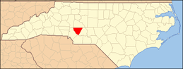 | |
| Towns | ||
| Unincorporated communities | ||
| Footnotes | ‡This populated place also has portions in an adjacent county or counties | |
|  | ||||||||||||||||||||
|
| |||||||||||||||||||||
Coordinates: 35°23′N 80°33′W / 35.39°N 80.55°W