Button Islands (Andaman)
 Button Islands | |
| Geography | |
|---|---|
| Location | Bay of Bengal |
| Coordinates | 12°16′12″N 93°02′42″E / 12.270°N 93.045°ECoordinates: 12°16′12″N 93°02′42″E / 12.270°N 93.045°E |
| Archipelago | Andaman Islands |
| Adjacent bodies of water | Indian Ocean |
| Total islands | 3 |
| Major islands | |
| Area | 0.517 km2 (0.200 sq mi)[1] |
| Highest elevation | 50 m (160 ft)[2] |
| Highest point | Middle Button hill |
| Administration | |
| District | South Andaman |
| Island group | Andaman Islands |
| Island sub-group | Ritchie’s Archipelago |
| Tehsil | Port Blair Tehsil |
| Demographics | |
| Demonym | Hindi |
| Population | 0 (2011) |
| Pop. density | 0.00 /km2 (0 /sq mi) |
| Ethnic groups | Hindu, Andamanese |
| Additional information | |
| Time zone | |
| PIN | 744202[3] |
| Telephone code | 031927 [4] |
| Official website |
www |
| ISO Code | IN-AN-00[5] |
| Literacy | 84.4% |
| Avg. summer temperature | 30.2 °C (86.4 °F) |
| Avg. winter temperature | 23.0 °C (73.4 °F) |
| Sex ratio | 1.2♂/♀ |
| unit_pref | Metric |
| Census Code | 35.639.0004 |
| Official Languages | Hindi, English |
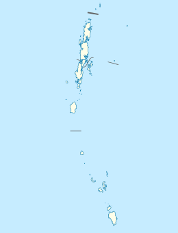
Button Islands are a group of islands of the Andaman Islands. It belongs to the South Andaman administrative district, part of the Indian union territory of Andaman and Nicobar Islands.[6]
History
Several lighthouses were established on the islands.
There is a lighthouse at the tallest hill 48 m (157 ft) on North button island, established 1983.
[7]
There is a lighthouse at the tallest hill 50 m (164 ft) on Middle button island, established 1983.
[8]
There is a lighthouse at the tallest hill 36 m (118 ft) on south button island, established 1983.
[9]
Geography
The islands belong to the Ritchie’s Archipelago and are located north of Outram Island. Besides a variety of submerged corals, Dolphin, Dugong and Blue whale are important marine animals for conservation. These islands also forms abode to many species of avifauna and fishes. Coral dominate the islands as submerged fringing types. [10]
Administration
Politically, Button Islands are part of Port Blair Taluk.[11] Rani Jhansi Marine National Park is located in the vicinity of the islands.
References
- ↑ "Islandwise Area and Population - 2011 Census" (PDF). Government of Andaman.
- ↑ "Sailing Directions (enroute) | India and the Bay of Bengal" (PDF) (173). National Geospatial-intelligence Agency, United States Government. 2014. Retrieved 2016-09-23.
- ↑ "A&N Islands - Pincodes". 22 September 2016. Archived from the original on 23 March 2014. Retrieved 22 September 2016.
- ↑ "STD Codes of Andaman and Nicobar". allcodesindia.in. Retrieved 2016-09-23.
- ↑ Registration Plate Numbers added to ISO Code
- ↑ "Village Code Directory: Andaman & Nicobar Islands" (PDF). Census of India. Retrieved 2011-01-16.
- ↑ "Government of India, Directorate General of Lighthouses and Lightships.". www.dgll.nic.in. Retrieved 2016-10-18.
- ↑ "Government of India, Directorate General of Lighthouses and Lightships.". www.dgll.nic.in. Retrieved 2016-10-18.
- ↑ "Government of India, Directorate General of Lighthouses and Lightships.". www.dgll.nic.in. Retrieved 2016-10-18.
- ↑
- ↑ "DEMOGRAPHIC – A&N ISLANDS" (PDF). andssw1.and.nic.in. Retrieved 2016-09-23.
| Wikimedia Commons has media related to Button Islands. |
 Andaman and Nicobar Islands travel guide from Wikivoyage