Busselton Regional Airport
| Busselton Regional Airport | |||||||||||
|---|---|---|---|---|---|---|---|---|---|---|---|
 | |||||||||||
| IATA: BQB – ICAO: YBLN | |||||||||||
| Summary | |||||||||||
| Airport type | Public | ||||||||||
| Owner | Shire of Busselton | ||||||||||
| Location | Busselton, Western Australia | ||||||||||
| Elevation AMSL | 55 ft / 17 m | ||||||||||
| Coordinates | 33°41′14″S 115°24′01″E / 33.68722°S 115.40028°ECoordinates: 33°41′14″S 115°24′01″E / 33.68722°S 115.40028°E | ||||||||||
| Website | www.busselton.wa.gov.au | ||||||||||
| Map | |||||||||||
 YBLN Location in Western Australia | |||||||||||
| Runways | |||||||||||
| |||||||||||
Busselton Regional Airport (IATA: BQB[2], ICAO: YBLN) is located 6.5 km (4.0 mi) from Busselton's town centre. Busselton is located in the South West of Western Australia, about 220 km (140 mi) south of Perth in the heart of the Margaret River wine region.
Facilities
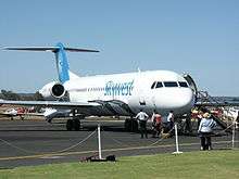
Busselton Regional Airport has a single runway (03/21) and both ends are suitable for continuous landings by BAe 146 aircraft. Precision Approach Path Indicator (PAPI) is available for both ends and the runway lights can be activated by radio (Pilot Controlled Lighting). Two illuminated windsocks are on site.
See also
References
- ↑ YBLN – Busselton (PDF). AIP En Route Supplement from Airservices Australia, effective 10 November 2016, Aeronautical Chart
- ↑ Accident history for BQB at Aviation Safety Network
External links
This article is issued from Wikipedia - version of the 12/4/2016. The text is available under the Creative Commons Attribution/Share Alike but additional terms may apply for the media files.