Burlington, Massachusetts
| Burlington, Massachusetts | ||
|---|---|---|
| Town | ||
|
Town Hall | ||
| ||
| Motto: "Where Technology Goes To Work"[1] | ||
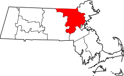
 Location in Middlesex County in Massachusetts | ||
| Coordinates: 42°30′17″N 71°11′46″W / 42.50472°N 71.19611°WCoordinates: 42°30′17″N 71°11′46″W / 42.50472°N 71.19611°W | ||
| Country | United States | |
| State | Massachusetts | |
| County | Middlesex | |
| Settled | 1641 | |
| Incorporated | 1799 | |
| Government | ||
| • Type | Representative town meeting | |
| Area | ||
| • Total | 11.9 sq mi (30.8 km2) | |
| • Land | 11.8 sq mi (30.6 km2) | |
| • Water | 0.1 sq mi (0.2 km2) | |
| Elevation | 218 ft (66 m) | |
| Population (2010) | ||
| • Total | 24,498 | |
| • Density | 2,100/sq mi (800/km2) | |
| Time zone | Eastern (UTC-5) | |
| • Summer (DST) | Eastern (UTC-4) | |
| ZIP code | 01803 | |
| Area code(s) | 339 / 781 | |
| FIPS code | 25-09840 | |
| GNIS feature ID | 0618219 | |
| Website | Town of Burlington, Massachusetts | |


Burlington is a town in Middlesex County, Massachusetts, United States. The population was 24,498 at the 2010 census.[2]
History

It is believed that Burlington takes its name from the English town of Bridlington, Yorkshire but this has never been confirmed[n 1] . It was first settled in 1641 and was officially incorporated on February 28, 1799; several of the early homesteads are still standing, such as the Francis Wyman House, dating from 1666. The town is sited on the watersheds of the Ipswich, Mystic, and Shawsheen rivers. In colonial times up through the late 19th century, there was industry in the mills along Vine Brook, which runs from Lexington to Bedford and then empties into the Shawsheen River.

Burlington is now a suburban industrial town at the junction of the Boston-Merrimack corridor, but for most of its history it was almost entirely agricultural, selling hops and rye to Boston and supplementing that income with small shoe-making shops. Early railroad expansion passed the town by (although the town was serviced by the Middlesex Turnpike), limiting its early development, and Burlington continued to cure hams for the Boston market and produce milk, fruit, and vegetables.
This picture changed drastically, however, as soon as Route 128 was built. The highway kicked off an enormous expansion, and between 1955 and 1965 Burlington was the fastest growing town in the state. In one five-year period, its population tripled as residential and commercial retail development exploded creating the town's present character.
Burlington has graduated many prominent athletes, including four Olympians, and others who have gone to have successful careers in the NHL, NFL, and Major League Baseball.
Geography
Located in the Greater Boston Area of eastern Massachusetts, Burlington is bordered by Bedford on the west, Billerica on the north, Wilmington on the northeast, Woburn on the southeast, and Lexington on the south. Burlington is 12 miles (19 km) south of Lowell, 12 miles (19 km) northwest of Boston, 36 miles (58 km) southeast of Fitchburg, and 224 miles (360 km) from New York City. and Its highest point is Greenleaf Mountain (290 feet (88 m) above sea level), the lowest point is the Great Meadow 150 feet (46 m) above sea level. The elevation at Town Hall is 220 feet (67 m) above sea level. The largest body of water is the 500-million-US-gallon (1,900,000 m3) Mill Pond Reservoir in the eastern part of the town.
According to the United States Census Bureau, the town has a total area of 11.9 square miles (31 km2), of which 11.8 square miles (31 km2) is land and 0.1 square miles (0.26 km2), or 0.59%, is water.
Demographics
| Historical population | ||
|---|---|---|
| Year | Pop. | ±% |
| 1850 | 545 | — |
| 1860 | 606 | +11.2% |
| 1870 | 626 | +3.3% |
| 1880 | 711 | +13.6% |
| 1890 | 617 | −13.2% |
| 1900 | 593 | −3.9% |
| 1910 | 591 | −0.3% |
| 1920 | 885 | +49.7% |
| 1930 | 1,722 | +94.6% |
| 1940 | 2,275 | +32.1% |
| 1950 | 3,250 | +42.9% |
| 1960 | 12,852 | +295.4% |
| 1970 | 21,980 | +71.0% |
| 1980 | 23,486 | +6.9% |
| 1990 | 23,302 | −0.8% |
| 2000 | 22,876 | −1.8% |
| 2010 | 24,498 | +7.1% |
| * = population estimate. Source: United States Census records and Population Estimates Program data.[3][4][5][6][7][8][9][10][11][12] | ||
As of the census[13] of 2010,[14] there were 24,498 people, 9,668 households, and 6,374 families residing in the town. The population density was 1,936.4 people per square mile (747.9/km²). There were 8,445 housing units at an average density of 2,087.7 per square mile (276.1/km²). The racial makeup of the town was 79.2% White, 3.3% Black or African American, 0.1% Native American, 13.4% Asian, 0.02% Pacific Islander, 0.32% from other races, and 0.86% from two or more races. Hispanic or Latino of any race were 2.4% of the population.
There were 8,289 households out of which 32.6% had children under the age of 18 living with them, 65.2% were married couples living together, 9.1% had a female householder with no husband present, and 23.1% were non-families. 19.1% of all households were made up of individuals and 7.7% had someone living alone who was 65 years of age or older. The average household size was 2.76 and the average family size was 3.18.
In the town the population was spread out with 23.6% under the age of 18, 6.3% from 18 to 24, 31.1% from 25 to 44, 25.2% from 45 to 64, and 13.9% who were 65 years of age or older. The median age was 38 years. For every 100 females there were 97.0 males. For every 100 females age 18 and over, there were 93.7 males.
In 2014, the median household income of the town stood at $95,465. The per capita income was $41,849 and 4.7% of the population lived below the poverty line.[15] According to an earlier estimate from 2007,[16] the median income for a household in the town was $86,052, and the median income for a family was $99,123. Males had a median income of $55,635 versus $36,486 for females. About 1.3% of families and 1.9% of the population were below the poverty line, including 2.8% of those under age 18 and 1.8% of those age 65 or over.
Foreign-born population
As of 2014, 19.5% of the residents of Burlington were born outside of the United States.[17]
Arts and culture
Points of interest
- The Burlington Town Common and Simonds Park are in the center of town and there are multiple parks and public recreation facilities throughout town which have basketball courts, tennis courts, baseball fields, soccer fields, gymnasia, an indoor skating rink (Burlington Ice Palace) and a skatepark.
- The Burlington Public Library[18] is on Sears Street adjoining the Town Common.
- The Burlington Historical Museum is located on Bedford Street at the intersection of Cambridge Street.[19]
- The Meeting House of the Second Parish in Woburn is on Lexington Street, just off of the Town Common.
- The Mill Pond Conservation Area[20] is in the eastern part of town bordering Woburn and Wilmington. The largest conservation area in Burlington, the Mill Pond Conservation Area includes over 140 acres (0.57 km2) of rolling and steep terrain. Numerous marked and unmarked trails cross through the conservation area. These trails allow for long enjoyable hiking or biking experiences. The land has numerous access points, including the corner of Winter and Chestnut Streets, through a gate at the end of Hansen Avenue, and through a gate at the end of the offshoot from Town Line Road.
- The Mill Pond is located within the Mill Pond Conservation Area. Fishing is allowed with special permit. The pond is feeding one of the two water treatment plants in Burlington. The Mill Pond Water Treatment Plant was upgraded in 2007 and has the capacity to treat up to 6 million US gallons (23,000 m3) of water per day.[21] On the pond's island there is a rope swing, an attraction for many locals.
- The Burlington Landlocked Forest, also known as the Burlington Landlocked Parcel, consists of 270 acres (1.1 km2) spanning the borders of Burlington, Bedford, and Lexington, and contains 12 miles (19 km) of hiking-mountain biking trails, vernal pools, abundant wildlife, historic stone walls and other structures, meadows, and old-growth forest. The majority of the land is owned by the Town of Burlington, which has kept it as open space since acquiring it by eminent domain in 1985. It borders Route 3 in Burlington to the east, Route 62 in Bedford to the north, conservation land in Lexington to the west and Route 128 to the South. The main trail head to the Forest is located at the intersection of Routes 3 and 62 in Bedford. A secondary trail head can be found on Turning Mill Road in Lexington, under the power lines at the site of the future West Lexington Greenway. The Landlocked Parcel is currently not protected land and there were discussions in 2008 between the Town of Burlington and Patriot Partners to sell the land to the developer who would develop part of the forest to build a large biotechnology complex. A citizen group, Friends of the Burlington Landlocked Forest, has been organized to prevent this sale and to make the Forest designated conservation land.
- Mary Cummings Park was envisioned as one of the great public parks of Greater Boston, but it fell into great neglect. This over 200-acre (0.81 km2) public park on the Burlington-Woburn border was created by Mary P.C. Cummings 1927 and was entrusted to the City of Boston to be kept forever open as a recreational park. In recent years, the City of Boston has tried to discourage public access and has investigated selling the park to fund the Rose Kennedy Greenway. The Burlington RC Flyers maintain a field[22] in the park.
- The Kevin James movie Paul Blart: Mall Cop was filmed in the Burlington Mall,[23] and scenes from the Ben Affleck movie The Company Men were filmed in an office building off of Wall Street, near Route 128.
Government
Burlington is governed by a 126-member representative Town Meeting (18 representatives elected per precinct) and a five-member executive Board of Selectmen. The members of the Board as of early 2012 and the first election dates and terms ends are:[24]
- Michael C. Runyan, First elected 4/12, Term ends 2015
- Daniel Grattan, First elected 4/11, Term ends 2014
- Robert Hogan, First elected 4/10, Term ends 2013
- Ralph C. Patuto, Chairman, First elected 4/06, Term ends 2015
- Walter T. Zenkin, Vice Chairman, First elected 4/07, Term ends 2013
The current Town Administrator is John Petrin. Thomas Hickey is the Assistant Town Administrator. Paul Sagarino is the town Accountant.
Burlington Cable Access Television (BCAT) is a non-profit Public-access television cable TV facility that was formed in 1987. BCAT operates three: Public, educational, and government access (PEG) cable TV channels. Town meetings and events can also be seen on demand on BCAT's website.
The Burlington Recreation department offers a variety of programs for adults and children. Program brochures are mailed to residents four times a year. The recreation department distributes free passes for the town's resident only wading pool located at Simonds Park.
Burlington Police Department
The Burlington Police Department (BPD) has the primary responsibility for law enforcement and investigation in the town of Burlington, MA. Chief Michael Kent is the current Chief of Police for Burlington. The Burlington Police Department has 64 sworn officers. There are several Divisions within the BPD, including Patrol, Detectives, Domestic Violence, Traffic, Community Service, School Resource, Crime Analysis, Records, K9, and the Bike Unit.[25] The Burlington Police Department is also one of 54 law enforcement agencies that comprise the North Eastern Massachusetts Law Enforcement Council (NEMLEC).[26] The Burlington Police Department is located at 45 Center Street in Burlington.[27]
Route 128/ I-95 and Route 3 traverse through Burlington and motor vehicle laws are enforced primarily by the Massachusetts State Police on these roadways.
Burlington Fire Department
The Burlington Fire Department has a force of 41 Firefighters and 16 Officers whom are commanded by Chief Steve Yetman. 3 engines, 1 tower, and 2 BLS rescue/ambulance respond from 2 fire stations and average over 3,200 runs annually. Burlington also operates a hazardous materials/cascade unit and a brush unit. The Burlington Fire Department Headquarters is located at 21 Center Street in Burlington, MA.[28] The Burlington Fire Department Station Two is located at 114 Terrace Hall Avenue in Burlington, MA.[29]
Education
Burlington has six public schools (four elementary schools, one middle school, and one high school) which comprise the Burlington Public School District. The elementary schools are Fox Hill, Francis Wyman, Memorial, and Pine Glen. The middle school is Marshall Simonds, and one of the town parks is named after Marshall Simonds. The high school is Burlington High School. Burlington is also served by the Shawsheen Valley Technical High School. In addition it is home to several private schools.[30]
The town operates a Before and After School Program[31] and offers an integrated preschool program.[32]
Burlington is also the home to a campus of Northeastern University and one of the three campuses of Bay Path College.
Infrastructure
Transportation
Routes 128 (I-95), 3, 3A and 62 pass through Burlington. MBTA Bus routes 350, 351, 352 and 354 operated by the MBTA run through the town, as do Lowell Regional Transit Authority, Lexpress (Lexington), and B-Line (Burlington) buses. The closest MBTA 'T' subway stations are Alewife, Cambridge, 9 miles (14 km) to the south-east (the station has a large parking garage) and Wellington Station, Medford, on the Orange Line, roughly 10 miles (16 km) to the east (also has large parking garage). MBTA Commuter Rail and Logan Express services are available at the Anderson Regional Transportation Center in neighboring Woburn, about 3 miles (4.8 km) to the east.[33]
Commerce
Over the last 15 years, Burlington has experienced a boom in commercial growth with the continuous expansion of the Burlington Mall and the construction of the Wayside Commons, which includes an L.L. Bean and a Capital Grille. Rounder Records now calls Burlington home. Many new buildings have been built along the town's main road, Cambridge St. (Rt. 3A), which have ushered in new technology companies. It is a relatively well-positioned town in the state — located at the intersection of Interstate 95 and US 3, Burlington is 5 minutes from I-93 and 20 minutes from I-90 as well as just 20 minutes from Boston, half an hour from New Hampshire, and an hour from Rhode Island.
Important commercial sites and businesses
Burlington is home to the Lahey Clinic Hospital and Medical Center.
Rt. 128 / I95, a circumferential highway around Boston, is considered the technology center of the East Coast. Burlington's stretch of 128, between Route 3 and Winn Street is home to numerous sizable buildings housing major companies, such as Demandware, Oracle Corporation and SAP AG and TD Bank. The major global financial software giant SunGard has an office on Van de Graff drive in Burlington. The Boston Burlington Marriott located on the corners of Mall road and Cambridge street (Route 3A) serves as a base for all traveling business workers and seasonal tourists as well as guests visiting the Lahey Clinic.
Shops and attractions
In the Middlesex Commons: Old Navy, Market Basket, Five Guys Burgers and Fries, Eastern Bank, Burtons Grill, Nordstrom Rack, Chateau Restaurant, and Burlington Wine & Spirits.[34]
In the Burlington Mall: Hollister, Build-A-Bear Workshop, Lord & Taylor, Victoria's Secret, Johnston & Murphy, Aéropostale, Apple Computer, Aveda, Rainforest Cafe, Aldo Shoes, Caché, Eddie Bauer, Cheesecake Factory, Macy's, American Eagle Outfitters, Abercrombie & Fitch, Johnny Rockets, Uno Chicago Grill, Sears, Legal Sea Foods, FYE, and more. In 2007/2008 the mall added a new higher end wing including specialty stores such as Nordstrom, J.Crew, bluemercury, Athleta, BCBG, Michael Kors, Juicy Couture, Burberry.
At Wayside Commons: L.L. Bean, Bag 'n Baggage, Fresh City, Not Your Average Joe's, The Capital Grille, Cold Stone Creamery, and West Elm.
At other locations : Boston Burlington Marriott Hotel, Burlington House of Pizza, AMC Burlington 10 Movie Theater, True North Coffee, Chili's Restaurant, Barnes & Noble, Pyara Spa and Salon, Best Buy, Cafe Escadrille, Macaroni Grill, Border Cafe,[35] Trader Joe's, H Mart[36]
Under development or proposed
Update: In October, 2008, the Burlington Town Meeting in sum denied the sale of the land to Patriot Partners. Learn more at their website: http://landlockedforest.com/history.shtml
Patriot Partners LLC, a Framingham-based developer, is proposing to build a 250-acre (1 km2) biotech complex, the largest in the region, close to routes 3 and 128. The complex would include labs, offices, retail shops and housing units.[37] Since this new development is proposed on the site of the largest remaining area of open space, commonly called the "Burlington Landlocked Forest" (see below), there is significant resistance from the town meeting, the Conservation Commission,[38] and the general population.[39]
Notable people
- Peter Carruthers and Kitty Carruthers, silver medalists, 1984 Winter Olympics, Pairs Figure Skating
- Roger Cook, head landscaper, This Old House
- Mark Fusco and Scott Fusco, 1984 Winter Olympics, US Olympic hockey team
- David Lovering, drummer of the alternative rock band Pixies
- James MacGregor Burns, Pulitzer Prize winning historian and political scientist[40]
- Roderick MacKinnon, co-recipient, 2003 Nobel Prize in Chemistry
- Stephen P. Mugar, founder of the Star Market chain of supermarkets and philanthropist
- Jay Pandolfo, NHL player; Forward, primarily with the New Jersey Devils[41]
- Amy Poehler, actress, cast member Saturday Night Live, Parks and Recreation
- Steve Strachan, NFL player; Running Back, Los Angeles Raiders[42]
- James Walker, President, Harvard University, 1853–1860
- Steven Wright, actor, comedian[43]
Notes and references
- Notes
- ↑ There is one settlement and pond in England named Burlington in Sheriffhales, Shropshire search Ordnance Survey map - however the elegance of the early 18th century central London Palladian Burlington House may have inspired the choice of name.
- References
- ↑ "Town of Burlington, Massachusetts". Town of Burlington, Massachusetts. Retrieved August 24, 2012.
- ↑ "Profile of General Population and Housing Characteristics: 2010 Demographic Profile Data (DP-1): Burlington town, Middlesex County, Massachusetts". U.S. Census Bureau, American Factfinder. Archived from the original on September 11, 2013. Retrieved April 5, 2012.
- ↑ "TOTAL POPULATION (P1), 2010 Census Summary File 1". American FactFinder, All County Subdivisions within Massachusetts. United States Census Bureau. 2010.
- ↑ "Massachusetts by Place and County Subdivision - GCT-T1. Population Estimates". United States Census Bureau. Retrieved July 12, 2011.
- ↑ "1990 Census of Population, General Population Characteristics: Massachusetts" (PDF). US Census Bureau. December 1990. Table 76: General Characteristics of Persons, Households, and Families: 1990. 1990 CP-1-23. Retrieved July 12, 2011.
- ↑ "1980 Census of the Population, Number of Inhabitants: Massachusetts" (PDF). US Census Bureau. December 1981. Table 4. Populations of County Subdivisions: 1960 to 1980. PC80-1-A23. Retrieved July 12, 2011.
- ↑ "1950 Census of Population" (PDF). Bureau of the Census. 1952. Section 6, Pages 21-10 and 21-11, Massachusetts Table 6. Population of Counties by Minor Civil Divisions: 1930 to 1950. Retrieved July 12, 2011.
- ↑ "1920 Census of Population" (PDF). Bureau of the Census. Number of Inhabitants, by Counties and Minor Civil Divisions. Pages 21-5 through 21-7. Massachusetts Table 2. Population of Counties by Minor Civil Divisions: 1920, 1910, and 1920. Retrieved July 12, 2011.
- ↑ "1890 Census of the Population" (PDF). Department of the Interior, Census Office. Pages 179 through 182. Massachusetts Table 5. Population of States and Territories by Minor Civil Divisions: 1880 and 1890. Retrieved July 12, 2011.
- ↑ "1870 Census of the Population" (PDF). Department of the Interior, Census Office. 1872. Pages 217 through 220. Table IX. Population of Minor Civil Divisions, &c. Massachusetts. Retrieved July 12, 2011.
- ↑ "1860 Census" (PDF). Department of the Interior, Census Office. 1864. Pages 220 through 226. State of Massachusetts Table No. 3. Populations of Cities, Towns, &c. Retrieved July 12, 2011.
- ↑ "1850 Census" (PDF). Department of the Interior, Census Office. 1854. Pages 338 through 393. Populations of Cities, Towns, &c. Retrieved July 12, 2011.
- ↑ "American FactFinder". United States Census Bureau. Archived from the original on 2013-09-11. Retrieved 2008-01-31.
- ↑ Census 2000 link to Burlington demographics
- ↑ "Median household income (in 2014 dollars), 2010-2014". www.census.gov. Retrieved 2016-12-01.
- ↑ Census link to Burlington demographics
- ↑ "QuickFacts Burlington CDP, Massachusetts". census.gov. US Census Bureau. Retrieved 10 June 2016.
- ↑ "Burlington Public Library". Burlington Public Library. Retrieved 2011-03-27.
- ↑ "Burlington Historical Museum". Burlingtonmahistory.com. Retrieved 2011-03-27.
- ↑ Town Of Burlington Conservation Areas
- ↑ Burlington Water Department
- ↑ The Burlington RC Flyers' Airstrip in Mary Cummings Park
- ↑ "Burlington's Most Famous". Boston.com. 2010-02-19. Retrieved 2011-03-27.
- ↑ Burlington Selectmen
- ↑ http://www.burlington.org/departments/police/divisions/index.php
- ↑ http://www.nemlec.com/mem.htm
- ↑ http://www.burlington.org/departments/police/index.php
- ↑ http://www.massmetrofire.org/burlington.html
- ↑ http://www.burlington.org/departments/fire/stations.php
- ↑ "Mount Hope Christian School - History". Mounthopeschool.org. Retrieved 2011-03-27.
- ↑ Burlington Before and After School Programs
- ↑ Burlington Integrated Preschool
- ↑ http://www.burlington.org/demograph.pdf
- ↑ "Site Plan". Retrieved 7 May 2013.
- ↑ Archived August 26, 2008, at the Wayback Machine.
- ↑ "Online Shopping for Asian Grocery, Korean Kimchi, Rice Cookers, Appliances & more at everyday low prices". Hmart.com. 2009-12-21. Retrieved 2011-03-27.
- ↑ Boston Globe, July 2008
- ↑ "Commission: Open space is valuable", Burlington Union, September 18, 2008
- ↑ Burlington Landlocked Forest
- ↑ Accardi, Dina (2012-11-25). "Kent Cottage faces uncertain future". Burlington Union.
- ↑ "Jay Pandolfo". NHL.com. Retrieved March 27, 2013.
- ↑ "Steve Strachan". databaseFootball.com. Retrieved February 2, 2013.
- ↑ Waterhouse, Gail (2010-03-03). "Q&A with comedian Steven Wright, a famous former Burlington resident". The Boston Globe.
Bibliography
- Robert J. Costa. Burlington (MA) (Images of America) . Arcadia Publishing (August 11, 2001). ISBN 978-0-7385-0902-0.
External links
| Wikimedia Commons has media related to Burlington, Massachusetts. |
- Town of Burlington official website
- Burlington Public Schools
- Burlington Historical Commission
- Burlington Youth Soccer Association
- Burlington RC Flyers
- 1871 Atlas of Massachusetts. by Wall & Gray. Map of Massachusetts. Map of Middlesex County.
- History of Middlesex County, Massachusetts, Volume 1 (A-H), Volume 2 (L-W) compiled by Samuel Adams Drake, published 1879–1880. 572 and 505 pages.Burlington article by Samuel Sewall in volume 1 pages 296–304.