Burgenlandkreis (former district)
| Burgenlandkreis | |
|---|---|
| District | |
 | |
| Country |
|
| State | Saxony-Anhalt |
| Disbanded | 2007-07-01 |
| Capital | Naumburg |
| Area | |
| • Total | 1,040.91 km2 (401.90 sq mi) |
| Population (2000) | |
| • Total | 143,340 |
| • Density | 140/km2 (360/sq mi) |
| Time zone | CET (UTC+1) |
| • Summer (DST) | CEST (UTC+2) |
| Vehicle registration | BLK |
| Website | burgenlandkreis.de |
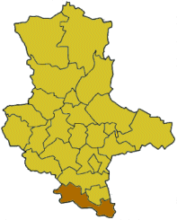
The Burgenlandkreis was a district (Kreis) in the south of Saxony-Anhalt, Germany. Neighboring districts are (from north clockwise) Merseburg-Querfurt, Weißenfels, Leipziger Land, Aschersleben-Staßfurt, Altenburger Land, Greiz, district-free Gera, Saale-Holzland, Weimarer Land, Sömmerda and the Kyffhäuserkreis.
History
The district was created in 1994 when the districts Naumburg, Nebra and Zeitz were merged.
Geography
Main rivers in the district are the Saale and its affluent Unstrut, and also in the south of the district the Weiße Elster. The highest elevation is the Seeligenbornberg (355 m), the lowest elevation is in the Saale valley near Gosek (97.8m).
Coat of arms
.png) |
The coat of arms show a city wall in the bottom part, symbolizing the many castles in the district which also gave it its name. The six grapes symbolize the viticulture in the area around Freyburg, one of the northernmost wine areas of Europe. The sword and key in the top part are the symbols of St. Peter and Saint Paul, the patrons of the cathedrals in Naumburg and Zeitz. These two symbols were taken from the coat of arms of the Zeitz district when it was incorporated into the Burgenlandkreis. |
Towns and municipalities
| Towns | Verwaltungsgemeinschaften | Free municipalities |
|---|---|---|
|
External links
- Official website (German)
| Urban districts | |
|---|---|
| Rural districts | |
| Former districts | |
Coordinates: 51°10′N 11°45′E / 51.17°N 11.75°E
This article is issued from Wikipedia - version of the 8/26/2016. The text is available under the Creative Commons Attribution/Share Alike but additional terms may apply for the media files.