Burford, Ontario
| Burford | |
|---|---|
|
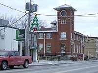
Canada Post Office in Burford's downtown | |
| Coordinates: 43°6′7.92″N 80°25′44.4″W / 43.1022000°N 80.429000°W | |
| Country | Canada |
| Province | Ontario |
| County | Brant |
| Settled | 1793[1] |
| Area | |
| • Total | 7.76 km2 (3.00 sq mi) |
| Population (2011) | |
| • Total | 1,952 |
| • Density | 241.7/km2 (626/sq mi) |
| Time zone | Eastern (UTC-5) |
| Area code(s) | 519 and 226 |
Burford is a rural community and is part of the County of Brant, in central southwestern Ontario. It has 1,952 residents (2011 Census). It is located eight kilometers west of the City of Brantford along Highway 53, and seventy kilometers east of London, Ontario. It is approximately 100 km southwest of Toronto.
Burford is home to the Burford Bulldogs, a junior hockey team that plays in the Southern Ontario Junior Hockey League.
Burford has a local golf course, Burford Golf Links, which was founded in 1980. It has gone through a number of different owners and is now part of the GolfNorth group of golf courses.
History
Burford was the largest town of the former Burford Township, which included Cathcart, Harley and Princeton. Burford's ‘downtown’, the intersection of Maple Avenue and King Street (Highway 53), includes a stop light, several small businesses and a post office. The community was founded by Canadians of German, Dutch and British backgrounds. Shortly after the Rebellion of 1837, Burford was the centre of an abortive rebellion in the Western District of Upper Canada led by Charles Duncombe. In 1999, Burford became part of the County of Brant, an amalgamation of several local municipalities including Brantford Township, the town of Paris, Oakland Township, Onondaga Township and South Dumfries Township. The current mayor of the County of Brant is Ron Eddy.
Historically, when tobacco was lucrative, the farms and families surrounding Burford were relatively prosperous. However, when smoking habits began to change in the 1980s, the economy slipped into decline. Currently, farmers are more likely to be growing ginseng for oriental markets than tobacco. Dairy, poultry, hog and fish farming persist and range from large scale commercial operations to subsistence type family farms. The community has lost population since the 1970s and is eager to attract new investment.
Education
Burford District High School was the only secondary institution for eighty years, opening in 1922 and closing in June 2002 due to low enrollment. The building was then revamped to become Burford District Elementary School and drew students from three elementary schools which were closed around the same time: Maple Avenue, Coronation and Harley-Northfield. The Maple Avenue School was also home to the Burford Islamic School or Darul Uloom Al Islamiah Burford, a private school with a Muslim based education.[2] The building is now for sale after multiple incidents of defacement resulted in the closure of the school. Most high school age students now attend Paris District High School, Brantford Collegiate Institute or Assumption College and St. John’s College Catholic schools.
Service Clubs
- Kinsmen Club of Brantford
- Kinsmen Club of Brantford (Kin Canada Bursaries)
Photo gallery
-
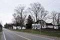
Entering Burford along Highway 53.
-
Burford Arena, home of the Bulldogs
-

King Street (Hwy 53)
-
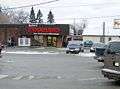
Burford's local grocery store.
-
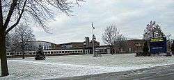
Burford's public school.
-
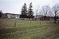
Burford's public school and community centre share a field.
-
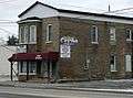
Burford's downtown has several restaurants.formerly home of the Burford Advance Weekly Newspaper and printer. Original owner, the Messecar Family.
-
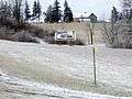
Evidence of "small town ethics" along Hwy. 53 between Burford and Cathcart.
-
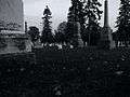
The Burford Congregational Cemetery
-
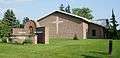
Blessed Sacrament Roman Catholic Church
-
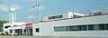
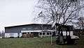
Home Hardware Paint Plant
See also
References
- ↑ Robertson, Mel. "Buford's First Families". Our Ontario. Vita Digital Tool Kit. Retrieved 1 April 2015.
- ↑ http://www.brantfordexpositor.ca/ArticleDisplay.aspx?archive=true&e=1678533
External links
- Burford Times, local weekly newspaper
- Kinsmen Club of Brantford, a Service Club active in Burford area.
- Burford Bulldogs online stats and schedule.
- County of Brant's website.
- The Early Political and Military History of Burford
- GolfNorth
Coordinates: 43°06′08″N 80°25′44″W / 43.1022°N 80.429°W