Burbank, Oklahoma
| Burbank, Oklahoma | |
|---|---|
| Town | |
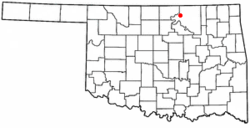 Location of Burbank, Oklahoma | |
| Coordinates: 36°41′46″N 96°43′41″W / 36.69611°N 96.72806°WCoordinates: 36°41′46″N 96°43′41″W / 36.69611°N 96.72806°W | |
| Country | United States |
| State | Oklahoma |
| County | Osage |
| Area | |
| • Total | 0.3 sq mi (0.9 km2) |
| • Land | 0.3 sq mi (0.9 km2) |
| • Water | 0.0 sq mi (0.0 km2) |
| Elevation | 1,027 ft (313 m) |
| Population (2010) | |
| • Total | 141 |
| • Density | 458.8/sq mi (177.1/km2) |
| Time zone | Central (CST) (UTC-6) |
| • Summer (DST) | CDT (UTC-5) |
| ZIP code | 74633 |
| Area code(s) | 539/918 |
| FIPS code | 40-09950[1] |
| GNIS feature ID | 1090702[2] |
Burbank is a town in western Osage County, Oklahoma, United States. The population was 141 at the 2010 census, a 9 percent decrease from 155 at the 2000 census.[3]
History
Burbank was founded in 1903 on the Osage Indian Reservation. The founder was Anthony "Gabe" Carlton, a mixed-blood Osage and a Chouteau family descendant, who owned the townsite and named it after the artist Elbridge Ayer Burbank (1858-1949) who spent his life painting the Indians of over 125 tribes.
Burbank had about 200 residents and an economy based on farming and ranching until May 1920 when E.W. Marland discovered petroleum northeast of the town. Burbank became a boom town, and other towns in the area such as Whizbang sprang up overnight to exploit the rich petroleum resources. The Burbank field was mostly located in Osage County but extended into Kay County. The Burbank field extended over an area about 20 miles (32 km) long and 10 miles (16 km) wide. Burbank quickly grew into a town of 3,000 people.[4]
Several major petroleum companies participated in the exploitation of the Burbank Field. Leases of oil land were obtained from the Osage Indians, usually by auction under the "Million Dollar Elm" tree in Pawhuska, the county seat and capital of the Osage Indians. Colonel Ellsworth Walters was the auctioner and more than a million dollars was often bid for the mineral rights to 160 acre (65 ha) tracts in the Burbank Field. Rich and famous oilmen such as Marland, Frank Phillips, L. E. Phillips, Waite Phillips, and William G. Skelly stood in the shade of the Elm tree and bid in the auctions. Oil production in the Burbank field expanded from 134,408 barrels in 1920 to a peak production of 26,206,741 barrels in 1923. Production dropped by one-half in 1926 and by 1930 the boom period was over. Burbank’s population dropped to 372 in 1930. The value of the 160 million barrels the Burbank field produced during its heyday was almost 286 million dollars.[5]
The Osage tribe and its members received $45 million in royalties from the Burbank field in the 1920s.[6] The Osage, unlike many tribes, had retained collective ownership of mineral rights on their former reservation. Osage with a full headright (those on the 1906 tribal roll) received up to $15,000 each annually in oil royalties, the equivalent of more than $150,000 in 2010 dollars.[7] The Osage were the "richest people in the world."[8]
Elbridge Ayer Burbank (1858-1949) was an American artist born on in Harvard, Illinois. A painter of portraits of Native Americans whose work is represented in the Field Museum, the Newberry Library in Chicago, and the Smithsonian Institution in Washington, D.C. In his first job for Northwest Magazine, after graduating from the Chicago Art Academy, Burbank traveled along the territory of the Northern Pacific Railway, across the Rockies to the Pacific Coast, painting scenes which would sell the area to potential homesteaders. He then studied in Munich, Germany under Paul Nauen and Frederic Fehr in 1886, alongside Leigh, Sharp, and Rosenthal. Returning to Chicago in 1892. In 1895, Edward E. Ayer of Chicago, first president of the Field Columbian Museum, and E. A. Burbank's uncle commissioned a series of Western Indian portraits. Burbank finished the commission and for years continued through the tribes of the Southwest, the West and the Pacific coastland. In 1899 Burbank painted the first portrait of Geronimo at Fort Sill, he was the only artist to paint Geronimo from life. Burbank depicted the leaders of 125 tribes in more than 1,200 works including Chiefs Joseph, Sitting Bull, Rain-in-the-Face, Curley, and Red Cloud. Given the Indian name Many Brushes, his autobiography was Burbank among the Indians. E. A. Burbank died on April 21, 1949 in San Francisco, California after being struck by a cable car. Burbank's work is regarded as historically important.
Geography
Burbank is located at 36°41′46″N 96°43′41″W / 36.69611°N 96.72806°W (36.695983, -96.727978).[9] It is 22 miles (35 km) west of Pawhuska and 122 miles (196 km) northeast of Oklahoma City.[4]
According to the United States Census Bureau, the town has a total area of 0.3 square miles (0.78 km2), all of it land.
Demographics
| Historical population | |||
|---|---|---|---|
| Census | Pop. | %± | |
| 1930 | 372 | — | |
| 1940 | 329 | −11.6% | |
| 1950 | 268 | −18.5% | |
| 1960 | 238 | −11.2% | |
| 1970 | 188 | −21.0% | |
| 1980 | 161 | −14.4% | |
| 1990 | 165 | 2.5% | |
| 2000 | 155 | −6.1% | |
| 2010 | 141 | −9.0% | |
| Est. 2015 | 139 | [10] | −1.4% |
As of the census[1] of 2000, there were 155 people, 63 households, and 40 families residing in the town. The population density was 458.8 people per square mile (176.0/km²). There were 77 housing units at an average density of 227.9 per square mile (87.4/km²). The racial makeup of the town was 70.32% White, 20.00% Native American, 0.65% from other races, and 9.03% from two or more races. Hispanic or Latino of any race were 1.29% of the population.
There were 63 households out of which 31.7% had children under the age of 18 living with them, 52.4% were married couples living together, 6.3% had a female householder with no husband present, and 36.5% were non-families. 33.3% of all households were made up of individuals and 19.0% had someone living alone who was 65 years of age or older. The average household size was 2.46 and the average family size was 3.20.
In the town the population was spread out with 33.5% under the age of 18, 3.9% from 18 to 24, 26.5% from 25 to 44, 21.9% from 45 to 64, and 14.2% who were 65 years of age or older. The median age was 36 years. For every 100 females there were 82.4 males. For every 100 females age 18 and over, there were 87.3 males.
The median income for a household in the town was $20,000, and the median income for a family was $30,750. Males had a median income of $25,000 versus $21,250 for females. The per capita income for the town was $13,686. About 17.1% of families and 24.1% of the population were below the poverty line, including 42.5% of those under the age of eighteen and 8.0% of those sixty five or over.
Notable natives
- Hub Andrews, baseball player
See also
References
- 1 2 "American FactFinder". United States Census Bureau. Archived from the original on 2013-09-11. Retrieved 2008-01-31.
- ↑ "US Board on Geographic Names". United States Geological Survey. 2007-10-25. Retrieved 2008-01-31.
- ↑ MuniNet Guide: Burbank, Oklahoma Archived October 7, 2012, at the Wayback Machine.
- 1 2 Jon D. May, "Burbank," Encyclopedia of Oklahoma History and Culture. Accessed 31 Oct 2011
- ↑ Franks, Kenny A. The Oklahoma Petroleum Industry. Norman:U of OK Press,1980, pp 103-104
- ↑ Franks, p. 104
- ↑ Corey Bone,"Osage Oil" Encyclopedia of Oklahoma History and Culture. Accessed 31 Oct 2011.
- ↑ The New York Times, June 25, 1921, page 3
- ↑ "US Gazetteer files: 2010, 2000, and 1990". United States Census Bureau. 2011-02-12. Retrieved 2011-04-23.
- ↑ "Annual Estimates of the Resident Population for Incorporated Places: April 1, 2010 to July 1, 2015". Retrieved July 2, 2016.
- ↑ "Census of Population and Housing". Census.gov. Archived from the original on May 11, 2015. Retrieved June 4, 2015.
External links
- Encyclopedia of Oklahoma History and Culture - Burbank
- Encyclopedia of Oklahoma History and Culture - Burbank Field
Municipalities and communities of Osage County, Oklahoma, United States | ||
|---|---|---|
| Cities | 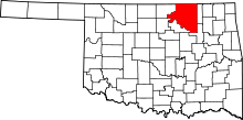 | |
| Towns | ||
| CDP | ||
| Unincorporated communities |
| |
| Footnotes | ‡This populated place also has portions in an adjacent county or counties | |