Buraidah
| Buraydah بريدة | |
|---|---|
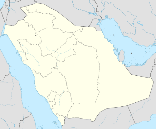 Buraydah Location in Saudi Arabia | |
| Coordinates: 26°20′N 43°58′E / 26.333°N 43.967°E | |
| Country |
|
| Region | Al-Qassim Region |
| Area | |
| • City | 1,291 km2 (498.3 sq mi) |
| • Metro | 1,290.6 km2 (498.3 sq mi) |
| Population (2010) | |
| • City | 614,093 |
| • Density | 480/km2 (1,200/sq mi) |
| Time zone | EAT (UTC+3) |
| Website |
www |
Buraydah (Arabic: بريدة Burayda) is the capital of Al-Qassim Region in northcentral Saudi Arabia in the heart of the Arabian Peninsula. Buraydah lies equidistant from the Red Sea to the west and the Persian Gulf to the east. It has a population of 614,093 (2010 census).
Buraydah, the regional capital of Al-Qassim Region, is located on the edge of the Wadi Al-Rummah. Buraydah has a typical desert climate, with hot summers, cold winters and low humidity.
In Buraydah, agriculture is still the cornerstone of the economy. The traditional oasis products of dates, lemon, orange and other fruits are still important. Modern introduction of wheat production has become so successful that Buraydah is one of the largest producers in the kingdom, important in making Saudi Arabia a net exporter of cereal.
In 1987 Sandra Mackey, author of The Saudis: Inside the Desert Kingdom, said that Buraydah was "a hotbed of fundamentalism even in the most normal of circumstances."[1]
Notable landmarks
- Museum of Buraydah: it is on King Abdul Aziz Road next to King Khaled Beridp civilization, and there are days devoted for families and days for young people, and it has on display the area's heritage from all different aspects of life.
- Market trades and handicrafts
- King Khalid Park and Garden: in the vicinity of the Museum, a major Buraydah gardens open to visitors every day and in meetings and places for children is innocent and is in the summer, the administration of the summer activities for families and children.
- Buraydah, a water tower: and opened to visitors in the summer (festival).
Roads and transport
Highways link Buraydah to the major cities surrounding it. It is 317 kilometers by highway to get to Riyadh, 450 km to get to Medina, and 250 kilometers to get to Hail. One can travel up to the border of Jordan, through a single region of Mecca, in a dual network of roads linking it with the rest of the provinces of Qassim. Buraydah is historically one of the old pilgrim routes coming from Iraq through Zubaydh. There is now a proposed railway line that would go through the city and greatly increase mobility for its citizens.
Qassim Regional Airport is the city's principal airport, connecting the city to several domestic and international cities such as Dubai and Cairo.
Climate
| Climate data for Buraidah | |||||||||||||
|---|---|---|---|---|---|---|---|---|---|---|---|---|---|
| Month | Jan | Feb | Mar | Apr | May | Jun | Jul | Aug | Sep | Oct | Nov | Dec | Year |
| Average high °C (°F) | 19.2 (66.6) |
22.3 (72.1) |
26.5 (79.7) |
32.4 (90.3) |
38.5 (101.3) |
42.1 (107.8) |
43.2 (109.8) |
43.4 (110.1) |
40.9 (105.6) |
35.3 (95.5) |
26.7 (80.1) |
21.3 (70.3) |
32.65 (90.77) |
| Daily mean °C (°F) | 12.8 (55) |
15.2 (59.4) |
19.2 (66.6) |
24.9 (76.8) |
30.6 (87.1) |
33.5 (92.3) |
34.5 (94.1) |
34.8 (94.6) |
32.1 (89.8) |
26.9 (80.4) |
19.8 (67.6) |
14.7 (58.5) |
24.92 (76.85) |
| Average low °C (°F) | 6.3 (43.3) |
8.1 (46.6) |
11.9 (53.4) |
17.4 (63.3) |
22.7 (72.9) |
24.9 (76.8) |
25.7 (78.3) |
26.1 (79) |
23.3 (73.9) |
18.5 (65.3) |
12.8 (55) |
8.0 (46.4) |
17.14 (62.85) |
| Average rainfall mm (inches) | 21.2 (0.835) |
10.8 (0.425) |
26.7 (1.051) |
28.8 (1.134) |
13.9 (0.547) |
0 (0) |
0 (0) |
0.1 (0.004) |
0.1 (0.004) |
4.3 (0.169) |
24.2 (0.953) |
15.6 (0.614) |
145.7 (5.736) |
| Average precipitation days | 6.2 | 3.0 | 6.3 | 8.1 | 3.5 | 0.0 | 0.0 | 0.1 | 0.1 | 1.4 | 5.3 | 4.5 | 38.5 |
| Source: [2] | |||||||||||||
Population
The city has experienced very high rates of population growth. Its officially counted population in the city limits in 2010 was 614,093.[3]
| Historical population | ||
|---|---|---|
| Year | Pop. | ±% p.a. |
| 1888 | 10,000 | — |
| 1935 | 35,000 | +2.70% |
| 1960 | 45,000 | +1.01% |
| 1970 | 56,000 | +2.21% |
| 1972 | 60,000 | +3.51% |
| 1974 | 69,000 | +7.24% |
| 1992 | 248,000 | +7.37% |
| 2004 | 378,422 | +3.58% |
| 2010 | 467,410 | +3.58% |
Citypopulation.de For 1992-2010
Notes
- ↑ Mackey, p. 234.
- ↑ "Weather Information for Buraydah".
- ↑ "Saudi Arabia: Regions & Major Cities - Statistics & Maps on City Population". Citypopulation.de. 2010-04-28. Retrieved 2012-11-08.
References
- Mackey, Sandra. The Saudis: Inside the Desert Kingdom. Updated Edition. Norton Paperback. W.W. Norton and Company, New York. 2002 (first edition: 1987). ISBN 0-393-32417-6 pbk.
Coordinates: 26°20′N 43°58′E / 26.333°N 43.967°E