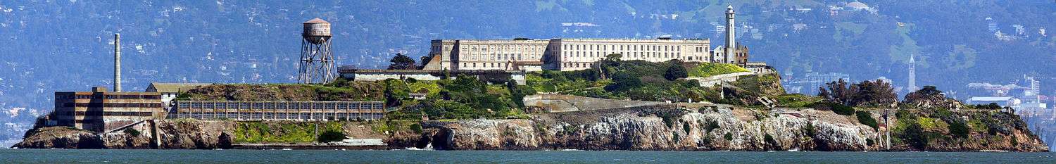
Building 64

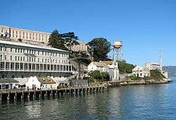

Building 64, also known as the 64 building, building # 64 or the Building 64 Residential Apartments, was the first building constructed on the island of Alcatraz off the coast of San Francisco, USA, entirely for the purpose of accommodating the military officers and their families living on the island.[1] Located next to the dock on the southeastern side of the island below the Warden's House,[2] the three-story apartment block was built in 1905 on the site of a U.S. Army barracks which had been there from the 1860s. It functioned as the Military Guard Barracks from 1906 until 1933. One of its largest apartments in the southwest corner was known as the "Cow Palace" and a nearby alleyway was known as "Chinatown".[1]

During Federal prison times from 1934, the building gradually fell into a shabby state, and new quarters were built on the Parade Grounds, but most families arriving on the island stayed in Building 64 until a room in the newer quarters was available.[3] Most of the other residential quarters have since been demolished, but Building 64 remains and has since been renovated.[4] During the Occupation of Alcatraz, in 1970 the Native Americans drew graffiti in red around the "United States Penitentiary" sign saying "Indians welcome" and "Indian land". There is a book store on the ground floor on the left side of the building.
References
- 1 2 Jr, Jerry Lewis Champion (27 January 2011). The Fading Voices of Alcatraz. AuthorHouse. p. 91. ISBN 978-1-4567-1488-8. Retrieved 31 August 2012.
- ↑ MacDonald, Donald; Nadel, Ira (15 February 2012). Alcatraz: History and Design of a Landmark. Chronicle Books. p. 13. ISBN 978-1-4521-0153-8. Retrieved 31 August 2012.
- ↑ Dunbar, Richard (1 January 1999). Alcatraz. Casa Editrice Bonechi. p. 71. ISBN 978-88-8029-940-0. Retrieved 31 August 2012.
- ↑ Wellman, Gregory L. (28 May 2008). A History of Alcatraz Island:: 1853-2008. Arcadia Publishing. p. 118. ISBN 978-0-7385-5815-8. Retrieved 31 August 2012.
Coordinates: 37°49′36″N 122°25′18″W / 37.82667°N 122.42167°W