Budd Lake, New Jersey
| Budd Lake, New Jersey | |
|---|---|
| Census-designated place | |
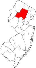
 Map of Budd Lake CDP in Morris County. Inset: Location of Morris County in New Jersey. | |
| Coordinates: 40°52′25″N 74°44′13″W / 40.873494°N 74.736828°WCoordinates: 40°52′25″N 74°44′13″W / 40.873494°N 74.736828°W | |
| Country |
|
| State |
|
| County | Morris |
| Township | Mount Olive |
| Named for | John Budd |
| Area[1] | |
| • Total | 6.424 sq mi (16.640 km2) |
| • Land | 5.443 sq mi (14.099 km2) |
| • Water | 0.981 sq mi (2.541 km2) 15.27% |
| Elevation[2] | 928 ft (283 m) |
| Population (2010 Census)[3] | |
| • Total | 8,968 |
| • Density | 1,647.5/sq mi (636.1/km2) |
| Time zone | Eastern (EST) (UTC-5) |
| • Summer (DST) | Eastern (EDT) (UTC-4) |
| ZIP code | 07828[4] |
| Area code(s) | 862/973 |
| FIPS code | 3408620[1][5] |
| GNIS feature ID | 2389258[1][6] |
Budd Lake is an unincorporated community and census-designated place (CDP) located within Mount Olive Township, in Morris County, New Jersey, United States.[7][8][9] As of the 2010 United States Census, the CDP's population was 8,968.[3] Budd Lake was named for John Budd.[10] Prior to that, it was called Hattacawanna Lake.[11]
Geography
According to the United States Census Bureau, the CDP had a total area of 6.424 square miles (16.640 km2), including 5.443 square miles (14.099 km2) of land and 0.981 square miles (2.541 km2) of water (1.74%).[1][12]
Budd Lake
Budd Lake, the largest natural lake in New Jersey that the community is named after, is the source of the South Branch Raritan River.
A glacial lake at an elevation of 933 feet (284 m), Budd Lake has a surface area of 374 acres (1.51 km2), making it the largest natural lake in New Jersey.[13] It is 7–12 feet deep, and can have large algal blooms. The bog, created by thousands of years of decaying plant material, supports wetland plants such as black spruce and tamarack, which grow on the floating mass.[13] The lake is recharged through groundwater seepage through a series of wetlands, and serves as the headwaters of the Raritan River's South Branch.[14] It is closely bordered by U.S. Route 46 to the south, and Sand Shore Road to the east.[15]
Budd Lake was named for John Budd, who acquired 1,300 acres (530 ha) of land in the area in 1714.[16] Prior to that, it was called Hattacawanna Lake.[17]
Demographics
| Historical population | |||
|---|---|---|---|
| Census | Pop. | %± | |
| 1960 | 1,520 | — | |
| 1970 | 3,168 | 108.4% | |
| 1980 | 6,523 | 105.9% | |
| 1990 | 7,272 | 11.5% | |
| 2000 | 8,100 | 11.4% | |
| 2010 | 8,968 | 10.7% | |
| Population sources:1960-1980[18] 1990-2010[9] 2000[19] 2010[3] | |||
Census 2010
At the 2010 United States Census, there were 8,968 people, 3,232 households, and 2,385 families residing in the CDP. The population density was 1,647.5 per square mile (636.1/km2). There were 3,423 housing units at an average density of 628.8 per square mile (242.8/km2). The racial makeup of the CDP was 80.88% (7,253) White, 6.39% (573) Black or African American, 0.16% (14) Native American, 7.71% (691) Asian, 0.09% (8) Pacific Islander, 2.39% (214) from other races, and 2.40% (215) from two or more races. Hispanics or Latinos of any race were 13.08% (1,173) of the population.[3]
There were 3,232 households, of which 39.6% had children under the age of 18 living with them, 59.0% were married couples living together, 10.2% had a female householder with no husband present, and 26.2% were non-families. 20.9% of all households were made up of individuals, and 4.9% had someone living alone who was 65 years of age or older. The average household size was 2.77 and the average family size was 3.24.[3]
In the CDP, 26.4% of the population were under the age of 18, 8.1% from 18 to 24, 29.1% from 25 to 44, 28.7% from 45 to 64, and 7.7% who were 65 years of age or older. The median age was 37.6 years. For every 100 females there were 100.6 males. For every 100 females age 18 and over, there were 95.0 males.[3]
.jpg)
Census 2000
As of the 2000 United States Census[5] there were 8,100 people, 2,851 households, and 2,169 families residing in the CDP. The population density was 534.6/km2 (1,383.8/mi2). There were 2,994 housing units at an average density of 197.6/km2 (511.5/mi2). The racial makeup of the CDP was 87.11% White, 3.54% African American, 0.07% Native American, 5.80% Asian, 1.47% from other races, and 2.00% from two or more races. Hispanic or Latino of any race were 6.62% of the population.[19]
There were 2,851 households out of which 43.7% had children under the age of 18 living with them, 62.7% were married couples living together, 9.4% had a female householder with no husband present, and 23.9% were non-families. 18.4% of all households were made up of individuals and 3.9% had someone living alone who was 65 years of age or older. The average household size was 2.83 and the average family size was 3.25.[19]
In the CDP the population was spread out with 28.7% under the age of 18, 6.9% from 18 to 24, 37.5% from 25 to 44, 21.2% from 45 to 64, and 5.8% who were 65 years of age or older. The median age was 34 years. For every 100 females there were 99.0 males. For every 100 females age 18 and over, there were 96.5 males.[19]
The median income for a household in the CDP was $62,540, and the median income for a family was $70,585. Males had a median income of $44,631 versus $35,316 for females. The per capita income for the CDP was $24,581. About 1.9% of families and 3.3% of the population were below the poverty line, including 2.4% of those under age 18 and 3.9% of those age 65 or over.[19]
Transportation
New Jersey Transit offers local bus service on the MCM5 route.[20]
References
- 1 2 3 4 Gazetteer of New Jersey Places, United States Census Bureau. Accessed July 21, 2016.
- ↑ U.S. Geological Survey Geographic Names Information System: Budd Lake Census Designated Place, Geographic Names Information System. Accessed July 11, 2012.
- 1 2 3 4 5 6 DP-1 - Profile of General Population and Housing Characteristics: 2010 Demographic Profile Data for Budd Lake CDP, New Jersey, United States Census Bureau. Accessed July 11, 2012.
- ↑ Look Up a ZIP Code for Keyport, NJ, United States Postal Service. Accessed July 11, 2012.
- 1 2 American FactFinder, United States Census Bureau. Accessed September 4, 2014.
- ↑ US Board on Geographic Names, United States Geological Survey. Accessed September 4, 2014.
- ↑ GCT-PH1 - Population, Housing Units, Area, and Density: 2010 - County -- County Subdivision and Place from the 2010 Census Summary File 1 for Morris County, New Jersey, United States Census Bureau. Accessed December 23, 2012.
- ↑ 2006-2010 American Community Survey Geography for New Jersey, United States Census Bureau. Accessed December 23, 2012.
- 1 2 New Jersey: 2010 - Population and Housing Unit Counts - 2010 Census of Population and Housing (CPH-2-32), United States Census Bureau, August 2012. Accessed December 23, 2012.
- ↑ The History of Mt. Olive, accessed July 17, 2006
- ↑ Manuscript Group 1187, Forest House Hotel, Hattacawanna Lake, NJ, accessed July 17, 2006
- ↑ US Gazetteer files: 2010, 2000, and 1990, United States Census Bureau. Accessed September 4, 2014.
- 1 2 Budd Lake Bog Preserve, New Jersey Natural Lands Trust. Accessed August 17, 2011. "Curving along the northern end of New Jersey's largest naturally formed lake, Budd Lake Bog supports a wetland habitat rare in New Jersey.... Budd Lake is considered the headwater source for the South Branch of the Raritan River."
- ↑ Voyce, Lisa. "Protecting Water Quality in the Highlands (and Elsewhere)", ANJEC Report, Fall 2002 (PDF). Accessed August 17, 2011.
- ↑ Google Maps Google. Accessed July 15, 2007.
- ↑ The History of Mt. Olive, Mount Olive Township. Accessed August 17, 2011.
- ↑ Manuscript Group 1187, Forest House Hotel, Hattacawanna Lake, NJ, New Jersey Historical Society. Accessed August 17, 2011.
- ↑ Staff. 1980 Census of Population: Number of Inhabitants United States Summary, p. 1-141. United States Census Bureau, June 1983. Accessed January 12, 2012.
- 1 2 3 4 5 DP-1 - Profile of General Demographic Characteristics: 2000 from the Census 2000 Summary File 1 (SF 1) 100-Percent Data for Budd Lake CDP, New Jersey, United States Census Bureau. Accessed December 23, 2012.
- ↑ Morris County Bus / Rail Connections, New Jersey Transit, backed up by the Internet Archive as of May 22, 2009. Accessed December 23, 2012.