Bubaque
| Bubaque | |
|---|---|
|
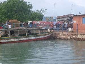
Port area of Bubaque | |
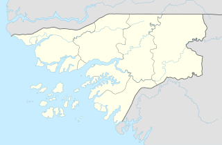 Bubaque Location in Guinea-Bissau | |
| Coordinates: 11°17′N 15°50′W / 11.283°N 15.833°W | |
| Country |
|
| Region | Bolama Region |
| District | Bubaque District |
| Area | |
| • Land | 28 sq mi (70 km2) |
| Population (2008) | |
| • Total | 9,244 |
Coordinates: 11°17′N 15°50′W / 11.283°N 15.833°W
Bubaque (B idyogo: Bubake or Bubaki) is one of the Bijagós Islands in Guinea-Bissau, and is also the name of its main town. Population 9,244 (2008 est).[1] The area is 75 km² and is 13.6 km long and 8 km wide
The island is known for its wildlife and is heavily forested. It is linked by ferry to Bissau and has an airstrip. It is also where the Unesco nature reserve headquarters is situated, as well as a museum.[2] In the colonial times, the island was affected by the presence of Europeans chosen by German settlers before World War I and Portuguese government up to the end of Portuguese rule. In the early 20th century, the Germans built a factory used for oil palm extraction[3] and an 18 km long paved road, probably the first in the Bijagos Archipelago. Its ruins of the oil palm factory are now used for a market hall.[4]
Transportation
The Bubaque airport serves the island.
Notable People
- Stefanie Gercke (b. 1941), German-South African writer
- Juvêncio Gomes (b. 1944), fighter for the PAIGC and later mayor of Bissau
References
- ↑ World Gazetteer Archived October 5, 2008, at the Wayback Machine., Retrieved on June 16, 2008
- ↑ http://www.guardian.co.uk/travel/2011/may/21/guinea-bissau-beach-holidays Retrieved on July 18, 2012
- ↑ Luigi Scantamburlo, Etnologia dos bijagós da Ilha de Bubaque. (Bijagan (Bidyogo) Ethnology of Bubaque Island)
- ↑ "Auf den Spuren der Deutschen in Bubaque" (in German). Blog at the Bolama page. April 27, 2010.
External links
Bolama (capital) | ||
| Sectors | ||
| Islands |
| |
| Parks | ||