Bryndwr
| Bryndwr | |
|---|---|
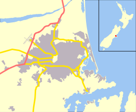 Bryndwr Location of Bryndwr within Christchurch | |
| Coordinates: 43°30′13″S 172°35′38″E / 43.5035°S 172.5940°ECoordinates: 43°30′13″S 172°35′38″E / 43.5035°S 172.5940°E | |
| Area | |
| • Total | 1.2086 km2 (0.4666 sq mi) |
| Population (2006 census) | |
| • Total | 3,084 |
| • Density | 2,600/km2 (6,600/sq mi) |
Bryndwr (/ˈbrɪndwər/ BRIND-wər; Welsh: [brənˈduːr][1][2]) is a suburb in the north-west of Christchurch, New Zealand. Like all suburbs in Christchurch, it has no defined boundaries and is a general area.
Development
Bryndwr, meaning 'hillside by water' (from Bryn "hillside" + dŵr "by water"), and probably named for the slopes beside the Wairarapa and Wai iti streams which run through the suburb, is one of the few places in New Zealand with a name of Welsh origin. It was given this name by Charles Alured Jeffreys, (1821-1904) of Glandyfi, Machynlleth, Wales. He farmed this area after being given 100 acres (40 ha) freehold by his father-in-law Thomas Parr in 1851, who was granted Rural Section 188 from the Canterbury Association.[3] Jeffreys also took a further 100 acres (40 ha) leasehold.[4] He and his wife Clara Ellen emigrated on the Tasmania arriving in Lyttelton in 1853.[5]
His land, sections 503 and 504,[6] was known as Bryndwr Farm, Fendall Town. Jeffreys subdivided the land, selling 180 lots at auction as the "valuable suburb of Bryndwr", in 1880.[7] Many streets he named in the area have Welsh associations including Jeffreys, Plynlimon, Penhelig, Glandovey (Anglicised over time from Glandyfi), Idris, (from Cadair Idris),[8] Snowdon, Garreg, and Bryndwr Road. Jeffreys, his wife and daughter returned to Glandyfi castle after his elder brother, Edward, died in 1888.[9]
A 1922 map of Christchurch shows "Bryndwr Station" railway station north of the intersection of Normans Road and Wairakei Road (then Wairarapa Road).[10] The farm owned by William Warner of Warner's Hotel in the Norman's Road area of Bryndwr was subdivided, and the Normans Road shops included the Warner farmhouse. In about 1957, the Roper's Foodmarket in this group of shops was designed by local architect Paul Pascoe.[11]
Land was further subdivided during the 1940s, 1950s and 1960s, and these streets were laid out in the sinuous nested form of the Radburn design. The subdivision included the land that was the Bateman farm, on Greers Road,[12] and extended between what is now Memorial Avenue, and Wairakei Road, and north of Wairakei Road including around the Greer homestead built in 1878, at what is now 302 Greers Road,[13] and land owned by Christ's College, Christchurch.[12] Street names from this period of subdivision included notable politicians (Attlee, Truman, Evatt, Eden), Otago landmarks (Earnslaw, Hollyford, Hooker, Aorangi, Lyall, Sealy), names associated with Christ's College, (Blanch, Bourne, Condell, Hudson, Flower, Harris, Merton, Moreland, Richards, Tothill), and the HMS Bounty, (Bounty, Resolution, Pitcairn, Christian).[12] The houses along Wayside Avenue included exhibition homes.[13]
Demographics
According to the 2006 census, Bryndwr has a more multicultural demographic than the average for the Canterbury region, with slightly higher percentages of Asian, Middle eastern, and Pacific ethnicity, a higher proportion of people born overseas, and of those who speak a second language. There is also a higher proportion of professional people, as well as single parents and unemployed people.[14] Bryndwr includes a small pocket of low socio-economic households,[15] within which approximately half the houses are state houses. The remainder of Bryndwr is similar in socio-economic status to the adjacent suburbs of Merivale, Fendalton, Burnside and Papanui, but this pocket contrasts in particular with the neighbouring suburbs of Fendalton to the south and Merivale to the East, which are two of the highest socio-economic areas.
Facilities
As an older suburb, Bryndwr has well established cultural, sporting and commercial facilities, including a Council Service Centre, several schools and parks, and two supermarkets.
Shopping areas
- "Elmwood Village" at the intersection of Norman's Road and Wairakei Road, (which in 1938 included the Bryndwr Bakery[16] and the Bryndwr Butchery[17])
- "Fendalton Village" at the intersection of Ilam Road and Clyde Road,
- shops at the intersection of Wairakei Road and Aorangi Road,
- the Wairakei Road shopping centre, at the intersection of Greers Road and Wairakei Road,
- shops at the intersection of Harris Crescent and Blanch Street.
Community
- The Christchurch City Council Fendalton Service Centre and Public Library are at the intersection of Jeffreys Road and Clyde Road.[18]
Parks, sports and recreation
- 26 acres (11 ha) of land for Jellie Park, in the Bryndwr/Burnside area, were donated in 1960 to the Waimairi County Council by James Jellie.[13] The park, now 12 ha in area, has a large pond, sports fields, a skate park, and a swimming and gym complex, and a High Performance Sports Centre[19] within a setting of lawn and large trees.[20]
- Edgar MacIntosh Park has sports fields, a playground, and an open-air paddling pool.[20]
- Derwent Reserve on Derwent Street is a local reserve with playground equipment.[20]
- Morley Reserve on the corner of Morley Street and Clyde Road is a local reserve with playground equipment, a Community Garden and a hall.[20]
- Pitcairn Playground on Pitcairn Crescent is a local reserve with playground equipment.[20]
- Jeffreys Reserve on Jeffreys Road has sports fields, playground equipment and tennis courts.[20]
- Otara Reserve on Clyde Road is a small reserve that provides a pedestrian connection between Otara Street and Clyde Road.
- Plynlimon Park on Plynlimon Street has sports fields and playground equipment.[20]
Schools
- Wairakei School on Wairakei Road, is located in Bryndwr, and teaches children from Year 1 to Year 6.
- Cobham Intermediate School at 294 Ilam Road teaches children from Years 7-8.
- The nearby Burnside High School teaches Years 9-13
- Allenvale School at 14A Aorangi Road teaches children from throughout Christchurch from Years 1-13 for those with specialist needs requiring Ongoing Resourcing under the Ongoing Resourcing Scheme (ORS)
- Aorangi School, a primary school that was closed by the government in early 2010, was located in Bryndwr.[21]
- Saint Patrick's School, 57 Plynlimon Road, Catholic state-integrated teaching for Years 1-8
- Christ the King School, 92 Greers Road, Catholic state-integrated teaching for Years 1-8
Elderly housing and care
There are several privately owned rental developments in Bryndwr available to residents 60 years old and over, as well as:
- Aorangi Courts, 110 Aorangi Road, has Council owned rentable retirement housing
- Jennifer Street, 21 Jennifer Street, has Council owned rentable retirement housing
- Manor Place, 22a Manor Place, has Council owned rentable retirement housing
- Torquay Place, 28 & 29 Torquay Place, has Council owned rentable retirement housing
- Resolution Courts, 5 Resolution Place, has Council owned rentable retirement housing
- Elmswood Retirement Village, 131 Wairakei Road, has Rest home care and purchasable residential units
- Fendalton Retirement Village, 73 Bryndwr Road, has Rest home care and purchasable residential units
- Saint Winifred's, 10 St Winifreds Place, has hospital residential care, and specialist hospital and dementia residential care
Churches
- Bryndwr Baptist Church, 309 Clyde Road
- Bryndwr Chapel, 179 Idris Road
- Christchurch Chinese Church, 286 Greers Road
- Christ the King Catholic Church, 90 Greers Road
- Elim Church, 193 Grahams Road
- Saint Aidan's Anglican Church, 63 Brookside Terrace
- St John's Methodist Church, at 49 Bryndwr Road, built in 1927, was most recently used by the Moraia Fijian Congregation, as part of the Christchurch North Methodist Parish, but has been closed because of damage in the 2011 Christchurch earthquake.[13][22][23][24]
- Saint Matthew’s Catholic Church, 108 Jeffreys Road, which features a maquette "Angel of St Matthew" (1967) by Ria Bancroft[25]
- Saint Stephen's Presbyterian Church, 365A Ilam Road
- Saint Thomas's Anglican Church, 17 Strowan Road
Waterways
Waterways that begin in or pass through the suburb are tributaries to the Avon River. They include:
- Dudley Creek which begins in the suburb of Bishopdale, crosses Greers Road and parallels Condell Avenue while meandering toward the suburb of Papanui[26]
- Wai iti Stream which begins near Sealy Place, parallels Brookside Terrace and Wai iti Terrace, crossing Clyde Road to join the Wairarapa Stream
- Hewlings Stream which passes through the Burnside High School grounds, crosses Greers Road to Jellie Park where it swells to become the lake, then joins Wairarapa Stream
- Jellie Park artesian bore that spills through a water feature into Jellie Park Lake[27]
- Jellie Park Lake fed by the bore and Hewlings Stream
- Wairarapa Stream which runs from the west side of Grahams Road, paralleling Wayside Avenue and crossing Greers Road to parallel Truman Road beside the north side of Jellie Park then crosses and briefly parallels Ilam Road, runs alongside the Cobham Intermediate School grounds, crosses Clyde Road, runs to the Waiwetu reserve then turns to cross Glandovey Road then Idris Road.[28]
Notable residents
- C. E. Beeby ONZ CMG, educationalist, lived at 15 Wairarapa Tce. [29]
- Wing Commander Johnny Checketts,[30] RNZAF
- John Key, Prime Minister of New Zealand (2008–present), grew up in a state house on Hollyford Avenue in Bryndwr.[31]
References
- ↑ "Bryn pronunciation: How to pronounce Bryn in Welsh, Swedish, Norwegian Bokmål". Forvo.com. 2009-10-17. Retrieved 2015-11-26.
- ↑ "dŵr pronunciation: How to pronounce dŵr in Welsh". Forvo.com. 2009-01-26. Retrieved 2015-11-26.
- ↑ "Archived copy" (PDF). Archived from the original (PDF) on 2012-02-22. Retrieved 2012-07-11. Archived February 22, 2012, at the Wayback Machine.
- ↑ Electoral Roll for the District of Christchurch, July 5th, 1853, Lyttelton Times, Volume III, Issue 132, 16 July 1853, Page 8
- ↑ Retrieved 26 July 2012
- ↑ Electoral Roll for the District of Christchurch, July 5th, 1853, The Press, Volume IV, Issue 454, 13 April 1864, Page 3
- ↑ The Press, Volume XXXIV, Issue 4703, 28 August 1880, Page 4
- ↑ Tee A. Corinne, Athel, Mabel, and Marjorie Meares, Wolf Creek, OR: Pearlchild, revised version, 1999
- ↑ "Archived copy". Archived from the original on 2012-09-06. Retrieved 2012-07-26. Archived September 6, 2012, at the Wayback Machine.
- ↑ Map of Christchurch and Suburbs, Simpson and Williams Ltd. Christchurch City Libraries Digital Maps, CCLMaps 141654, Retrieved 17 September 2012
- ↑ "Full Record Display - Web2". Librarydata.christchurch.org.nz. Retrieved 2015-11-26.
- 1 2 3 "Christchurch City Libraries Street names" (PDF). Christchurchcitylibraries.com. Retrieved 8 August 2012.
- 1 2 3 4 "Bryndwr and Burnside". Christchurch City Libraries. 2015-11-20. Retrieved 2015-11-26.
- ↑ "Exploring the Bryndwr Community's Strengths, Needs & Potential for a Community Hub Facility" (PDF). Uppersouthisland.ps.org.nz. Retrieved 2015-11-26.
- ↑ John Wilson. 'Canterbury region', Te Ara – the Encyclopedia of New Zealand, updated 2-Mar-09. URL: http://www.TeAra.govt.nz/en/canterbury-region/13/3 Retrieved 25 July 2012
- ↑ "The house belonging to the Woodham family, Normans Road, Bryndwr: [ca. 1940] - Christchurch City Libraries Heritage Photograph Collection". Christchurchcitylibraries.com. Retrieved 2015-11-26.
- ↑ "Bryndwr Butchery, Normans Road, Bryndwr: [ca. 1938] - Christchurch City Libraries Heritage Photograph Collection". Christchurchcitylibraries.com. Retrieved 2015-11-26.
- ↑ "Contact us : Christchurch City Council". Ccc.govt.nz. Archived from the original on 2015-05-15. Retrieved 2015-11-26.
- ↑ "New Christchurch training base important for elite athletes | High Performance Sport New Zealand". Hpsnz.org.nz. 2012-10-18. Retrieved 2015-11-26.
- 1 2 3 4 5 6 7 "Archived copy". Archived from the original on 2012-07-29. Retrieved 2012-07-26. Archived July 29, 2012, at the Wayback Machine.
- ↑ Law, Tina (22 December 2009). "Judge shuts door on Aorangi". Stuff.co.nz. Retrieved 22 September 2011.
- ↑ "After the Earthquakes | Durham Street Methodist Church". Durhamstreetmethodist.wordpress.com. 2011-06-12. Retrieved 2015-11-26.
- ↑ "Google Sites". Sites.google.com. Retrieved 2015-11-26.
- ↑ "Google Sites". Sites.google.com. Retrieved 2015-11-26.
- ↑ Ria Bancroft: Three decades of Sculpture, Robert MacDougall Art Gallery ,1988 ISBN 0-908874-32-4
- ↑ "Dudley Creek". Christchurch City Libraries. 2015-11-20. Retrieved 2015-11-26.
- ↑ "Jellie Park's Important Water Cascade | Discover The Delights Of Peeling Back History". Peelingbackhistory.co.nz. Retrieved 2015-11-26.
- ↑ http://www.cityplan.ccc.govt.nz/NXT/gateway.dll/Christchurch%20CIty%20Plan/836/2922/3137?fn=document-frameset.htm$f=templates$3.0. Retrieved March 28, 2013. Missing or empty
|title=(help) - ↑ Noeline Alcorn, To the Fullest Extent of His Powers: C.E. Beeby's Life in Education, Victoria University Press ISBN 9780864733535
- ↑ Obituary, The Weekend Herald, 29 April 2006 NZPA
- ↑ "Archived copy". Archived from the original on 2011-09-21. Retrieved 2010-03-08. Archived September 21, 2011, at the Wayback Machine.
External links
- History of Bryndwr and Burnside - Christchurch City Libraries
- Wairakei School
- Burnside High School
- Cobham Intermediate School
- Jellie Park Recreation and Sport Centre - Christchurch City Council