Brumbaugh Bridge
|
Brumbaugh Bridge | |
|
Formerly listed on the U.S. National Register of Historic Places | |
  | |
| Nearest city | Cottage Grove |
|---|---|
| Coordinates | 43°47′20.87″N 123°01′28.88″W / 43.7891306°N 123.0246889°WCoordinates: 43°47′20.87″N 123°01′28.88″W / 43.7891306°N 123.0246889°W |
| Built | 1948 |
| Architectural style | Howe truss |
| MPS | Oregon Covered Bridges (TR)[1] |
| NRHP Reference # | 79002101[2] |
| Significant dates | |
| Listed | November 29, 1979 |
| Removed from NRHP | after demolition in 1979 |
The Brumbaugh Bridge was a covered bridge in Lane County in the U.S. state of Oregon. Built in 1948, the structure originally carried Row River Road over Mosby Creek near Cottage Grove.[3] It was added to the National Register of Historic Places in 1979 and was subsequently delisted.[1]
The bridge was demolished in 1979. Some of its timbers were combined with timbers from Meadows Bridge, also demolished in 1979, to construct a covered pedestrian bridge, Centennial Covered Bridge, over the Coast Fork Willamette River in Cottage Grove.[4]
The Howe truss structure, 90 feet (27 m) long, was the second covered bridge at this location.[5] The first Brumbaugh Bridge was a 92-foot (28 m) Howe truss structure built in 1925.[5]
See also
- List of bridges on the National Register of Historic Places in Oregon
- List of Oregon covered bridges
References
- 1 2 "Oregon Historic Sites Database:Brumbaugh Bridge". Oregon Parks Department. Retrieved February 5, 2016.
- ↑ "Oregon National Register List" (PDF). Oregon City County Management Association. November 10, 2005. p. 21. Retrieved January 23, 2016.
- ↑ Luta, Larry (May 10, 1979). "Brumbaugh Bridge to Move: Meadows Fate Uncertain". Eugene Register-Guard. Retrieved February 4, 2016 – via Google News.
- ↑ "Centennial Covered Bridge". Lane County, Oregon. Retrieved February 4, 2016.
- 1 2 Cockrell, Bill (2008). Images of America: Oregon's Covered Bridges. Charleston, South Carolina: Arcadia Publishing. p. 76. ISBN 978-0-7385-5818-9.
| Lists by county |  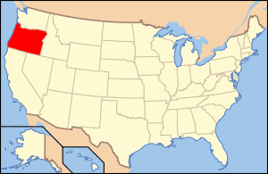 | |
|---|---|---|
| Portland lists | ||
| Other lists |
| |
This article is issued from Wikipedia - version of the 12/2/2016. The text is available under the Creative Commons Attribution/Share Alike but additional terms may apply for the media files.