Bronington
| Bronington | |
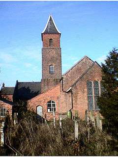 Holy Trinity Church |
|
 Bronington |
|
| Population | 1,242 (2011 Census) |
|---|---|
| OS grid reference | SJ484395 |
| Community | Bronington |
| Principal area | Wrexham |
| Ceremonial county | Clwyd |
| Country | Wales |
| Sovereign state | United Kingdom |
| Post town | WHITCHURCH |
| Postcode district | SY13 |
| Dialling code | 01948 |
| Police | North Wales |
| Fire | North Wales |
| Ambulance | Welsh |
| EU Parliament | Wales |
| UK Parliament | Clwyd South |
| Welsh Assembly | Clwyd South |
Coordinates: 52°57′00″N 2°46′08″W / 52.950°N 2.769°W
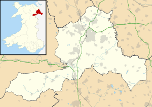
Bronington is a local government community, the lowest tier of local government, part of Wrexham County Borough in Wales. The community has an area of 3,482 hectares and a population of 1,228 (2001 Census),[1] increasing to 1,242 at the 2011 Census.[2]
The village church, Holy Trinity, was converted from a former brick tithe barn in 1836.[3] To the north-east of the village is Iscoyd Hall, a stately home with surrounding parkland which was built around 1740 and enlarged in the 19th century. South of the village is Fenn's Moss, an area of peat bog stretching over into Shropshire, which was declared a national nature reserve in 1996 because of its importance for wildlife.
Governance
An electoral ward in the same name exists. This ward stretches north-west to Bangor-on-Dee with a total population at the 2011 Census of 3,179.[4]
References
Notes
- ↑ "2001 Census: Bronington". Office for National Statistics. Retrieved 19 October 2008.
- ↑ "community population 2011". Retrieved 17 November 2015.
- ↑ "Holy Trinity Church". Wrexham County Borough Council. Retrieved 2 June 2008.
- ↑ "Ward population 2011". Retrieved 17 November 2015.
Sources
- Davies, John; Jenkins, Nigel; Baines, Menna & Lynch, Peredur I. (2008) The Welsh Academy Encyclopaedia of Wales, University of Wales Press, Cardiff.
External links
| Wikimedia Commons has media related to Bronington. |
| Principal settlements | 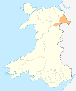 | |
|---|---|---|
| Communities |
| |
| Other villages and areas |
| |
| Castles | ||
| Buildings and structures | ||
| Rivers | ||
| Geographical features | ||
| Topics | ||