Brickell Avenue
| |
|---|---|
| Route information | |
| Length: | 1.5 mi (2.4 km) |
| Existed: | 1898[1] – present |
| Major junctions | |
| South end: |
|
| North end: |
|
| Location | |
| Counties: | Miami-Dade |
| Highway system | |

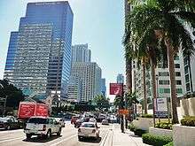
Brickell Avenue is the name given to a north–south road, formerly part of U.S. Route 1, in Miami, Florida just south of the Miami River.[2] North of the Brickell Avenue Bridge, U.S. Route 1 is known as Biscayne Boulevard. Brickell Avenue is the main road through the Brickell financial district of Downtown Miami, and is considered a desirable address associated with business and finance. Brickell Avenue is lined with high-rise office buildings and residential condominiums, as well as many banks and restaurants.
It is an off-grid plan main north–south thoroughfare through the south part of Miami's central business district.
Route description
From the Miami River south it continues south-southwest and upon crossing Broadway/SE 15th Street it curves southwest and continues in that direction until it terminates at Southeast 26th Road/Rickenbacker Causeway, becoming South Federal Highway for a short distance (about 1/4 mile) until it becomes South Dixie Highway - US1. The portion north of the one-way pair of 7th and 8th Streets carries U.S. Route 41.
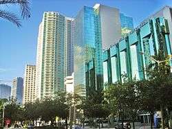
Gallery
-
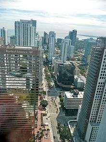
Aerial view of Brickell Avenue, as seen from the Viceroy Tower's skydeck.
-
-
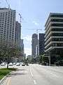
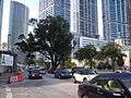
Looking south
-
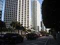
Looking north
-
-

South end of Brickell Avenue
See also
References
- ↑ Arva Moore Parks; Sarah E. Eaton (June 17, 1997). George E. Nolan House, 1548 Brickell Avenue: Designation Report (PDF) (Report). City of Miami. p. 7. Retrieved November 18, 2012.
By the time the railroad arrived in 1896, spurred in part by the Brickells’ gift of land to Henry Flagler, the Brickells had already paved a rock road, known as the Coconut Grove Trail, through their property. In 1898, the trail became a 145 foot wide roadway called Brickell Avenue and extended from the Miami River to Broadway (15th Road).
- ↑ Brickell Avenue Neighborhood Guide
Coordinates: 25°45′58″N 80°11′27″W / 25.766233°N 80.190711°W