Brentwood, New York
| Brentwood, New York | |
|---|---|
| Hamlet and census-designated place | |
| Nickname(s): The Jewel of Long Island | |
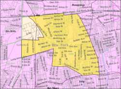 U.S. Census map | |
 Brentwood, New York location within the state of New York | |
| Coordinates: 40°46′54″N 73°14′39″W / 40.78167°N 73.24417°WCoordinates: 40°46′54″N 73°14′39″W / 40.78167°N 73.24417°W | |
| Country | United States |
| State | New York |
| County | Suffolk |
| Area | |
| • Total | 11.0 sq mi (28.4 km2) |
| • Land | 11.0 sq mi (28.4 km2) |
| • Water | 0.0 sq mi (0.0 km2) |
| Elevation | 79 ft (24 m) |
| Population (2010) | |
| • Total | 60,664 |
| • Density | 5,500/sq mi (2,100/km2) |
| Time zone | Eastern (EST) (UTC-5) |
| • Summer (DST) | EDT (UTC-4) |
| ZIP code | 11717 |
| Area code(s) | 631 |
| FIPS code | 36-08026 |
| GNIS feature ID | 0944688 |
Brentwood is a hamlet in the Town of Islip in Suffolk County, New York, United States. As of the 2010 Census, the population of Brentwood was 60,664.[1]
History
Early history
In 1844, Brentwood began as Thompson Station and Suffolk Station, two new stations on the expansion of the mainline of the Long Island Rail Road.[2]
Modern Times
On March 21, 1851, it became the utopian community named Modern Times. The colony was established on 750 acres (3.0 km2) of land by Josiah Warren and Stephen Pearl Andrews. In 1864, it was renamed Brentwood after the town of Brentwood, Essex, in England.
By contract, all the land in the colony was bought and sold at cost, with 3 acres (12,000 m2) being the maximum allowable lot size. The community was said to be based on the idea of individual sovereignty and individual responsibility. Individuals were encouraged to pursue their self-interest as they saw fit. All products of labor were considered private property. The community had a local private currency based upon labor exchange in order to trade goods and services (see Mutualism (economic theory)). All land was private property, with the exception of alleys which were initially considered common property but later converted to private property. Initially, no system of authority existed in the colony; there were no courts, jails or police. This appears to have given some credence to Warren's theories that the most significant cause of violence in society was most attributable to policies and law which did not allow complete individuality in person and property. However, the modest population of the colony might be considered a factor in this characteristic. The Civil War, as well as new residents that did not share the colony's philosophy, are said to have contributed to its eventual dissolution. Almost all of the original buildings that existed in Modern Times have been destroyed, aside from two Octagon houses, the original schoolhouse and a residence.
Brentwood
During the first half of the 20th century, Brentwood was home to the Ross Health Resort Onehtah. Managed by Dr. William H. Ross, Onehtah was a place where a person could escape the pollution of the city. It was thought that the smell of pine needles brought a person good health.
Brentwood is the site of Pilgrim State Hospital (once one of the world's largest hospitals and psychiatric institutions), now known as Pilgrim Psychiatric Center. A 52-acre (0.21 km2) portion of the psychiatric center was converted into the Brentwood State Park athletic field complex, which officially opened in 2009.[3]
Brentwood's Centennial Celebration was on June 16–17, 1950.[4] The 150th anniversary of the community was commemorated on May 9–11, 2007.
Geography
Brentwood is located at 40°46′54″N 73°14′39″W / 40.78167°N 73.24417°W (40.781805, −73.244060).[5]
According to the United States Census Bureau, the CDP has a total area of 10.1 square miles (26.1 km²).
Demographics for the CDP
As of the census[6] of 2010, there were 60,664 people, 12,580 households, and 10,894 families residing in the CDP. The population density was 6028 per square mile (2,069.3/km²). There were 13,039 housing units at an average density of 1,295.6/sq mi (500.4/km²). The racial makeup of the CDP was 15% White, 20.06% African American, 0.57% Native American, 2.01% Asian, 0.11% Pacific Islander, 25.44% from other races, and 6.07% from two or more races. Hispanic or Latino of any race were 54.25% of the population. Brentwood over the years has become an ethnic enclave especially of/for Salvadoran Americans.
There were 12,580 households, out of which 46.6% had children under the age of 18 living with them, 61.2% were married couples living together, 17.4% had a female householder with no husband present, and 13.4% were non-families. 9.5% of all households were made up of individuals and 4.4% had someone living alone who was 65 years of age or older. The average household size was 4.23 and the average family size was 4.19.
In the CDP the population was spread out with 29.9% under the age of 18, 10.6% from 18 to 24, 32.8% from 25 to 44, 18.5% from 45 to 64, and 8.2% who were 65 years of age or older. The median age was 31 years. For every 100 females there were 100.2 males. For every 100 females age 18 and over, there were 97.5 males.
The median income for a household in the CDP was $68,314, and the median income for a family was $57,047. Males had a median income of $31,022 versus $25,946 for females. The per capita income for the CDP was $15,833. About 7.5% of families and 11.3% of the population were below the poverty line, including 13.7% of those under age 18 and 10.6% of those age 65 or over.
As of 2010, the population was as follows:[7]
- 15.8% Non Hispanic white
- 65.1% Hispanic or Latino of any race
- 14.7% Black
- 0.1% Native American
- 2.6% Asian
- 0.0% Native Hawaiian
- 0.5% Some Other Race
- 1.1% Two or More Races
Emergency services
Brentwood is protected by the Brentwood Fire Department, a volunteer fire department in Suffolk County, New York. The department provides emergency fire rescue service to those within the political boundaries of the Brentwood Fire District. The area of responsibility spans 24 square miles (62 km2) and covers the areas of Brentwood, North Bay Shore, and Baywood. The Brentwood Fire Department is regularly recognized as one of the busiest fire departments in Suffolk County and responds to an average of 1,500 calls for assistance annually. The department does not provide Emergency Medical Service.
The Brentwood Fire Department is part of the Suffolk County Fire Rescue and Emergency Services (FRES) system. It holds department identifier number 3-2-0.
History
The Brentwood Fire Department was started in 1898 when local residents banded together to combat brush and forest fires that threatened their homes and farm land. On August 28, 1899, land was purchased from Mrs. Elvira S. Studley and the Brentwood Fire District was incorporated. The Department was first known as the Brentwood Hook and Ladder Company. A firehouse was built in 1900 and a used fire apparatus was purchased from the Islip Fire Department.
In 1926 the department was reorganized and Theodore Freund was elected as the first Fire Chief. On March 30, 1928 the original firehouse burned down and many records were destroyed. The old building was replaced with a two story brick house on the same site which is still in use today as the department gym. In 1932 the name "Brentwood Fire Department" was formally adopted and In 1937 the hamlet's first fire hydrants were installed and the fire district's political boundaries were enlarged a year later. In 1955 a new fire house was built on Fourth Street, around the corner from the old firehouse. The Brentwood Fire Department continues to serve the residents of the Brentwood community, answering an average of 1,500 calls a year.[8]
Brentwood Fire District
The Brentwood Fire District (District) is a district corporation of the State, distinct and separate from the Town of Islip and the County of Suffolk in which it is located. The District covers nearly 24 square miles and services approximately 16,000 residential properties and 2,300 commercial properties. It has a wide variety of structures including; single and multiple family dwellings, Suffolk Community College Campus, C.W. Post, Pilgrim State Psychiatric Facility which has 25 to 30 non fire proof buildings with many converted into private businesses, 20 Brentwood Public School buildings, many taxpayers and commercial structures, nine garden apartment complexes and the St. Josephs Academy Complex.
The District is governed by an elected five-member Board of Fire Commissioners (Board). The Board is responsible for the overall financial management of the District, including establishing policies and procedures to ensure that assets are properly safeguarded. Additionally, the Board is responsible for approving an annual budget to ensure the District’s resources are efficiently used. The District Treasurer is the District’s chief fiscal officer, appointed by the Board, and is responsible for the receipt, custody, disbursement, and accounting of District funds. The District’s total expenditures for 2010 were approximately $5.8 million.[9]
Firehouses within the district include Quanahasset Engine Company #1, Pines Engine Company #2, Ames & Elliott R.A.C. Company #3, Sagtikos Engine Company #4, Central Engine Company #5 and Edgewood Engine Company #6. There is also a Hook and Ladder Company #1 and the Fire Prevention Company #9.
Transportation
Brentwood is served by the Brentwood station on the Long Island Rail Road. That station also serves as a hub for buses to feed into:[10]
- 3A: Hauppauge – South Shore Mall via Manituck Road
- 3B: Hauppauge – South Shore Mall via Broadway
- 3D: Brentwood – Stony Brook
- S27: Babylon – Hauppauage
- S41: Bay Shore – Northport
- S45: Bay Shore – Smithtown
The S33 (from Sunrise Mall to Hauppauge) also passes through the northwestern portion of Brentwood while serving Suffolk County Community College.
Notable residents
- Richard M. Dolan (1962–), UFO historian and television personality
- EPMD, hip-hop pioneers, raised in Brentwood
- Reggie Fils-Aime (1961–), President and chief operating officer of Nintendo of America (graduated Brentwood HS in 1979)
- Robert Gallucci (1946–), former US Ambassador at Large (1994–96), currently Dean of the Edmund A. Walsh School of Foreign Service, Georgetown University (graduated Brentwood HS in 1962) He is currently the President of the John D & Catherine MacArthur Foundation
- Andrew Jean-Baptiste (1992–), player for the Portland Timbers of Major League Soccer
- Mitch Kupchak (1954–), athlete and general manager of the NBA's Los Angeles Lakers
- Craig Mack (1971–), hip-hop musician
- Buddy McGirt (1964–), boxing champion and trainer
- Jef Raskin (Jeffrey Frank Raskin, 1943–2005), widely acknowledged as the "Father of the Macintosh", computer scientist and expert on the human/computer interface, inventor, conductor, artist, writer and businessman (graduated Brentwood HS 1960)
- Jai Rodriguez (1979–), actor and musician, born in Brentwood
- Cletus Seldin (1986–), boxing champion
- Leonard H. Tower, Jr. (1949–), free software activist, software hacker, and founding member of the Board of Directors of the Free Software Foundation (graduated Brentwood HS in 1967)
Churches
- Christ Episcopal Church, circa 1850, Third Ave
- Church of the Nazarene, Madison Ave
- Church of the Nazarene "Restauración", Second Ave
- First Baptist Church of Brentwood, Suffolk Ave
- Hope Baptist Church,
- Independent Fundamental Baptist Church of Bayshore,
- New Jerusalem Baptish Church, MacArthur Ave
- Prince of Peace Lutheran Church, Candlewood Road
- St. Anne's R.C. Church, Second Ave
- St. Luke's R.C. Church, Wicks Rd
- Spanish Church of God, Brentwood Rd
See also
- Academy of Saint Joseph
- Brentwood High School (Brentwood, New York)
- Maslow-Toffler School of Futuristic Education
References
- Dyson, Verne (1950). A Century of Brentwood. Brentwood, Long Island, NY: Brentwood Village Press.
- Dyson, Verne (1953). A Century of Brentwood, with the Afterpiece: Supplement and Index. Brentwood, Long Island, NY: Brentwood Village Press.
- Freeman, Christian. 1852. Letter from Rev. B. F. Bowles. Brentwood History Collection Part 1, Part 2, and Part 3
- Spurlock, John Calvin. “Anarchy and Community at Modern Times, 1851–1863,” Communal Societies 3 (1983), 29–47.
- Wunderlich, Roger. Low Living and High Thinking at Modern Times, N.Y. Syracuse: Syracuse University Press, 1992. ISBN 0-8156-2554-5
- ↑ "Geographic Identifiers: 2010 Demographic Profile Data (G001): Brentwood CDP, New York". U.S. Census Bureau, American Factfinder. Retrieved December 24, 2012.
- ↑ Dyson (1950) Chapter I = Before Brentwood, pp 1–23
- ↑ Lauren Cioffi (September 25, 2009). "Brentwood State Park Athletic Field Complex opens". Newsday. Retrieved June 3, 2015.
- ↑ Dyson (1953) pp 1–44 in the Supplement
- ↑ "US Gazetteer files: 2010, 2000, and 1990". United States Census Bureau. February 12, 2011. Retrieved April 23, 2011.
- ↑ "American FactFinder". United States Census Bureau. Archived from the original on September 11, 2013. Retrieved January 31, 2008.
- ↑ "2010 Census data for BRENTWOOD, NY". Zip-codes.com. Datasheer, L.L.C. Retrieved March 24, 2014.
- ↑ "Brentwood Fire Department - Brentwood History Wiki". Brentwoodpubliclibrary.wetpaint.com. Retrieved 2013-10-02.
- ↑ "Brentwood Fire District : Board Oversight and Information Technology" (PDF). Osc.state.ny.us. Retrieved 2013-10-02.
- ↑ http://www.sct-bus.org/assets/sct_systemmap.pdf
External links
| Wikimedia Commons has media related to Brentwood, New York. |
- Brentwood Chamber of Commerce
- Brentwood Historical Society
- Long Island History: Brentwood
- Brentwood Fire Department (Official Site)
- "A History of Modern Times". Brentwood Public Library.
- Elizabeth Moore. "An Experiment in Anarchy: Modern Times, the notorious and short-lived utopian village that preceded Brentwood".
- Carol Strickland (June 30, 1989). "Legacy of Modern Times, an L.I. Utopia". New York Times.