Brazos Mountains
Coordinates: 36°49′53″N 106°24′27″W / 36.8314021°N 106.4075307°W
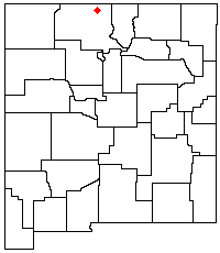
The Brazos Mountains is a range in far northern Rio Arriba County, in northern New Mexico in the southwestern United States. A high crest runs from the border with Colorado for over 20 miles (32 km) in a south-southeasterly direction. The high point of the range at 11,405 feet (3,476 m) is on Grouse Mesa,[1] at the Brazos Benchmark.[2] Two miles (3 km) to the southeast is the more distinctive Brazos Peak, at 11,288 feet (3440 m).
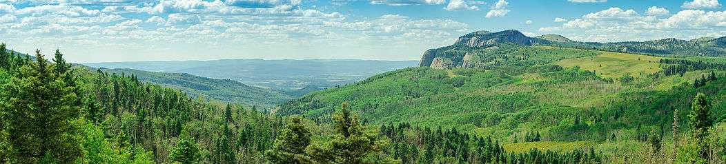
The range is mostly located in the privately held Tierra Amarilla Land Grant (the Carson National Forest is to the east and south). It is a distinctive part of the view from the west, including from Heron Lake. U.S. Route 64 crosses the southern end of the range at a 10,481 foot (3194 m) pass. Nearby are the photogenic Brazos Cliffs, headwaters of the Rio Brazos and part of the Rio Chama river system. These mountains overlook the Chama River, the largest tributary of the Rio Grande which lies to the east. In essence, these mountains are the southern extension of the South San Juan Range that lies in Colorado.

Geology
The Brazos Mountains are the southwestern remnants of a Laramide peneplain resulting from the erosion of mountains formed 80 to 55 million years ago during the Laramide orogeny. To the east and northeast lie the Sangre de Cristo Mountains which share a similar geological history.[3] The Brazos Cliffs, which form a dramatic backdrop to Tierra Amarilla, are formed of Precambrium rock.
References
- ↑ "Grouse Mesa, New Mexico". Peakbagger.com. Retrieved 2009-01-19.
- ↑ "Brazos". NGS data sheet. U.S. National Geodetic Survey. Retrieved 2009-01-19.
- ↑ Brister, B.S.; Gries, R.R. (1994). "Tertiary stratigraphy and tectonic development of the Alamosa basin (northern San Luis Basin), Rio Grande rift, south-central Colorado." (PDF). Basins of the Rio Grande Rift: Structure, Stratigraphy, and Tectonic Setting. Geological Society of America Special Paper 291. pp. 39–58. Retrieved September 11, 2011.
External links
- "Grouse Mesa". Geographic Names Information System. United States Geological Survey. Retrieved 2009-01-19.
- "The Tusas Mountains, Northern New Mexico". Sangres.com. Retrieved 2009-01-19.