Brahmapur railway station
Brahmapur ବ୍ରହ୍ମପୁର | |
|---|---|
| Regional rail and Light rail station | |
 Brahmapur Station Entrance | |
| Location |
Brahmapur, Odisha, PIN-760001 India |
| Coordinates | 19°17′48″N 84°47′48″E / 19.2966°N 84.7968°ECoordinates: 19°17′48″N 84°47′48″E / 19.2966°N 84.7968°E |
| Elevation | 43 m (141 ft) |
| Line(s) | Khurda Road-Visakhapatnam section |
| Platforms | 4 |
| Tracks | 5 |
| Connections | Taxi Stand, Auto Stand |
| Construction | |
| Structure type | Standard (on ground station) |
| Parking | Available |
| Other information | |
| Status | Functioning |
| Station code | BAM |
| Zone(s) | East Coast Railway zone |
| Division(s) | Khurda Road |
| History | |
| Opened | 1896 |
| Electrified | Yes |
| Previous names | East Coast State Railway, Bengal Nagpur Railway |
| Location | |
 Brahmapur railway station Location in Odisha | |
Brahmapur (or Berhampur) is a major and one of the oldest railway stations in the Indian State of Odisha. It is administered under Khurda Road Railway Division of East Coast Railway zone. It serves Brahmapur city, Ganjam district and 10 other districts of South Odisha and other districts of neighboring Andhra Pradesh.
History
During the period of 1893 to 1896, (1,287 km (800 mi) of East Coast State Railway) this historic Brahmapur station was built and opened to traffic in 1896. Bengal Nagpur Railway’s line to Brahmapur (Berhampur) was opened on 1 January 1899.[1]
The 514 km (319 mi) long northern section of the East Coast State Railway was merged with BNR in 1902.[2]
Railway reorganization
The Bengal Nagpur Railway was nationalized in 1944.[3]Eastern Railway was formed on 14 April 1952 with the portion of East Indian Railway Company east of Mughalsarai and the Bengal Nagpur Railway.[4] In 1955, South Eastern Railway was carved out of Eastern Railway. It comprised lines mostly operated by BNR earlier.[4][5] Amongst the new zones started in April 2003 were East Coast Railway and South East Central Railway. Both these railways were carved out of South Eastern Railway.[4]
Platforms
The station has 4 platforms.
Accessibility
- Distance from City Bus Stand 3 kilometres (1.9 mi)
- Distance from New Bus Stand(Haldiapadar) 5 kilometres (3.1 mi)
- Distance from MKCG Hospital 3 kilometres (1.9 mi)
- Distance from Berhampur University 11 kilometres (6.8 mi)
- Distance from Army AD College 14 kilometres (8.7 mi)
- Distance from Gopalpur Sea Beach 16 kilometres (9.9 mi)
The nearest international airport is Biju Patnaik International Airport (172 km)
Gallery
-
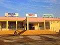
Newly Inaugurated Entrance and Booking Office
-

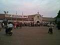
Early Morning at Brahmapur Railway Station
-

Brahmapur Railway station on a rainy day
-
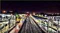
Railway Station at Dusk
-
View from foot over bridge on a rainy day
References
- ↑ "Major Events in the Formation of S.E. Railway". South Eastern Railway. Archived from the original on 1 April 2013. Retrieved 2013-01-02.
- ↑ "History". East Coast Railway. Retrieved 2013-01-02.
- ↑ "IR History: Part - III (1900 - 1947)". IRFCA. Retrieved 2012-11-21.
- 1 2 3 "Geography – Railway Zones". IRFCA. Retrieved 2012-11-21.
- ↑ "IR History: Part - IV (1947 - 1970)". IRFCA. Retrieved 2012-11-21.
External links
- Trains at Brahmapur
-
 Brahmapur travel guide from Wikivoyage
 - Gopalpur-on-sea travel guide from Wikivoyage
| Preceding station | Indian Railways | Following station | ||
|---|---|---|---|---|
Jagannathpur | East Coast Railway zone | Golanthara |
| ECoR |
| ||||||||||
|---|---|---|---|---|---|---|---|---|---|---|---|
| SER |
| ||||||||||
| SECR |
| ||||||||||