Bozeat
| Bozeat | |
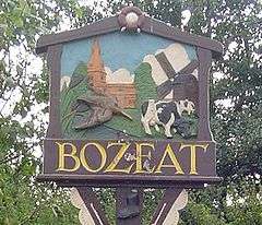 Village sign |
|
 Bozeat |
|
| Population | 2,051 (2011 Census) |
|---|---|
| OS grid reference | SP9158 |
| – London | 65 miles (105 km) |
| District | Wellingborough |
| Shire county | Northamptonshire |
| Region | East Midlands |
| Country | England |
| Sovereign state | United Kingdom |
| Post town | Wellingborough |
| Postcode district | NN29 |
| Dialling code | 01933 |
| Police | Northamptonshire |
| Fire | Northamptonshire |
| Ambulance | East Midlands |
| EU Parliament | East Midlands |
| UK Parliament | Wellingborough |
|
|
Coordinates: 52°13′02″N 0°39′44″W / 52.2173°N 0.6621°W
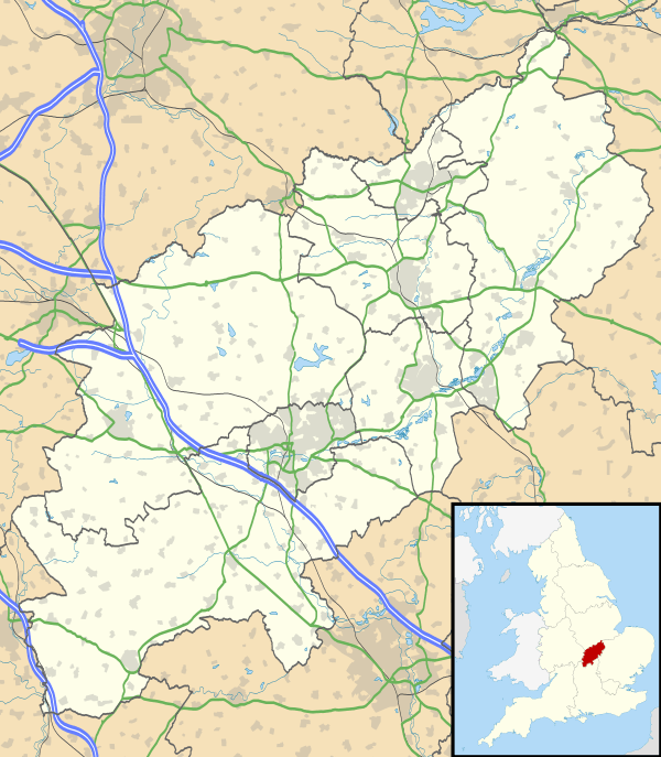
Bozeat local /ˈboʊʒət/ is a village and civil parish in the Wellingborough borough of Northamptonshire, England, about 6 miles (10 km) south of Wellingborough on the A509 road, near Wollaston. At the time of the 2011 census, Bozeat's population (including Easton Maudit) was 2,052.[1]
Origin of the name
Rev Joseph Horace Marlow[2] gives two possible origins of Bozeat's name:
- Bozeat probably existed in Saxon times - Saxon coins have been found - and an early spelling of Bozeat was Bosgate, suggesting Bozeat may have meant Bosa(s) gate. Bosa was a common Saxon name and a Saxon Earl Bosa held land near here. In a similar way Strixton is named after the Saxon thane Strix. In Old English geat/gaet, and in Middle English yatt and zett are all recognised as meaning gate, opening or entrance to woods or land. All the various spellings of Bozeat over the years show some link to both Bosa and gate.
One possible French influence is shown in the Domesday Book (1086) spelling Bosiete and it is possible that the Normans slightly altered the name to make it more French. There may even be a link with the French Bosquet (small wood) or Latin Boscus (wood). With all the vagaries of spelling and spoken English over the centuries it is unlikely that Bozeat is still pronounced in the same way it was originally.
- A second explanation of the name Bozeat meaning beautiful spring, from the French Beau-jet, assumes that the pronunciation of Bozeat was the same centuries ago as it is now. So although this theory is very appealing it does not have the same historical credibility as the first - Bosa's Gate.
The Oxford Dictionary of English Place-names says that Bozeat is derived from the "Gate or gap of a man called Bosa."[3]
History
A little north-west of Bozeat a 48 ft circular Roman building was excavated in 1964-65. Two Roman kilns and five other buildings were also found during work on a housing estate.[4]
Before the Norman Conquest, the Saxon thane, Strix (of Strixton) held some of the land here under Earl Waltheof, a powerful Saxon Earl of Northumbria. At the Norman Conquest, William I gave most of the land locally to his niece Judith, who became the first Countess of Northampton. Judith married Earl Waltheof, so the Saxon Earl and the Norman Lady became joint owners.
The Norman parish church dedicated to St Mary, built about 1130, is older than both Easton Maudit and Wollaston churches, and survived the 1729 Great Fire of Bozeat in 1729. It was rebuilt in 1880-83.[4]
In the 15th century there was a thriving weaving industry within the farming community, but by the beginning of the 20th century the population had risen to 1,200 and boasted a cottage lace-making industry, a shoe industry and a windmill, with many independent tradesmen, making a very self-reliant village. At this time Bozeat had at least 20 shops, a school, five pubs and four churches.
There are many wells in the village, one of the most important being the communal 'Town Well', which came from a jet of water coming out of the side of a bank in Dychurch Lane. A charity was registered to pay for its upkeep.
Bozeat's shoe trade dates back to the middle of the 17th century but until the middle of the 18th century, it was considered a cottage industry. Men made and mended shoes in small buildings near their homes which were called 'shops', but although some remain today, they now serve a different purpose. The population grew rapidly when large shoe factories were built, providing much-needed employment for both men and women, and these remained Bozeat’s main trade until 1982 when the last shoe factory closed.[5]
The sports brand Gola was based in the village and was then known as the Bozeat Boot Company.
Transport
In January 1989 a by-pass was built west of the village to take the increasing traffic to Milton Keynes. In spring 2001, with more traffic passing the village and a number of accidents, a new roundabout was constructed to replace the junction of the A509 Wollaston Road. It made access into and out of the village safer.
Amenities
The village has a number of retail outlets, a post office, bus service, several industrial and commercial businesses, with clubs, associations and youth organisations. The 20th century brought the utilities to Bozeat. Mains electricity was installed in 1925, mains water in 1949, sewerage in 1950, and gas in 1990. Three private housing estates were built during the 1960s and 1970s and 2004 saw the demolition of an old factory and a dozen or so more families settled into village life.
The village sign was erected in the millennium year after some months of dedicated fund-raising. It represents a number of aspects of village life that have continued over the years.
References
- ↑ Office for National Statistics: 2011 Census: Bozeat CP: Parish headcounts. Retrieved 16 July 2015
- ↑ Marlow, Joseph Horace (1936). The History of Bozeat Village.
- ↑ Mills, A.D. (1998). A Dictionary of English Place-names. Second Edition. Oxford University Press, Oxford. p48. ISBN 0-19-280074-4
- 1 2 Pevsner, Nikolaus; Cherry, Bridget (revision) (1961). The Buildings of England – Northamptonshire. London and New Haven: Yale University Press. pp. 306–7. ISBN 978-0-300-09632-3.
- ↑ Bozeat.info: Our village Archived 7 January 2010 at the Wayback Machine.. Retrieved 6 November 2009
- Bozeat 2000: The story of a Northamptonshire village, compiled by Philip Bligh, giving a history of Bozeat. ISBN 1-899597-13-1
External links
| Wikimedia Commons has media related to Bozeat. |
| Settlements |  | |
|---|---|---|
| Places of interest |
| |
| Constituencies | ||
| Sport |
| |
| Transport | ||
| Education |
| |
| ||