Boyne River (Grey County)
| Boyne River | |
| River | |
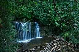 The river passing over Hoggs Falls | |
| Country | Canada |
|---|---|
| Province | Ontario |
| Region | Southwestern Ontario |
| County | Grey |
| Municipality | Grey Highlands |
| Part of | Great Lakes Basin |
| Tributaries | |
| - right | Flesherton Creek |
| Source | Wilcox Lake |
| - elevation | 469 m (1,539 ft) |
| - coordinates | 44°13′52″N 80°33′30″W / 44.23111°N 80.55833°W |
| Mouth | Beaver River |
| - elevation | 295 m (968 ft) |
| - coordinates | 44°18′53″N 80°32′22″W / 44.31472°N 80.53944°WCoordinates: 44°18′53″N 80°32′22″W / 44.31472°N 80.53944°W |
 Location of the mouth of the Boyne River in southern Ontario
| |
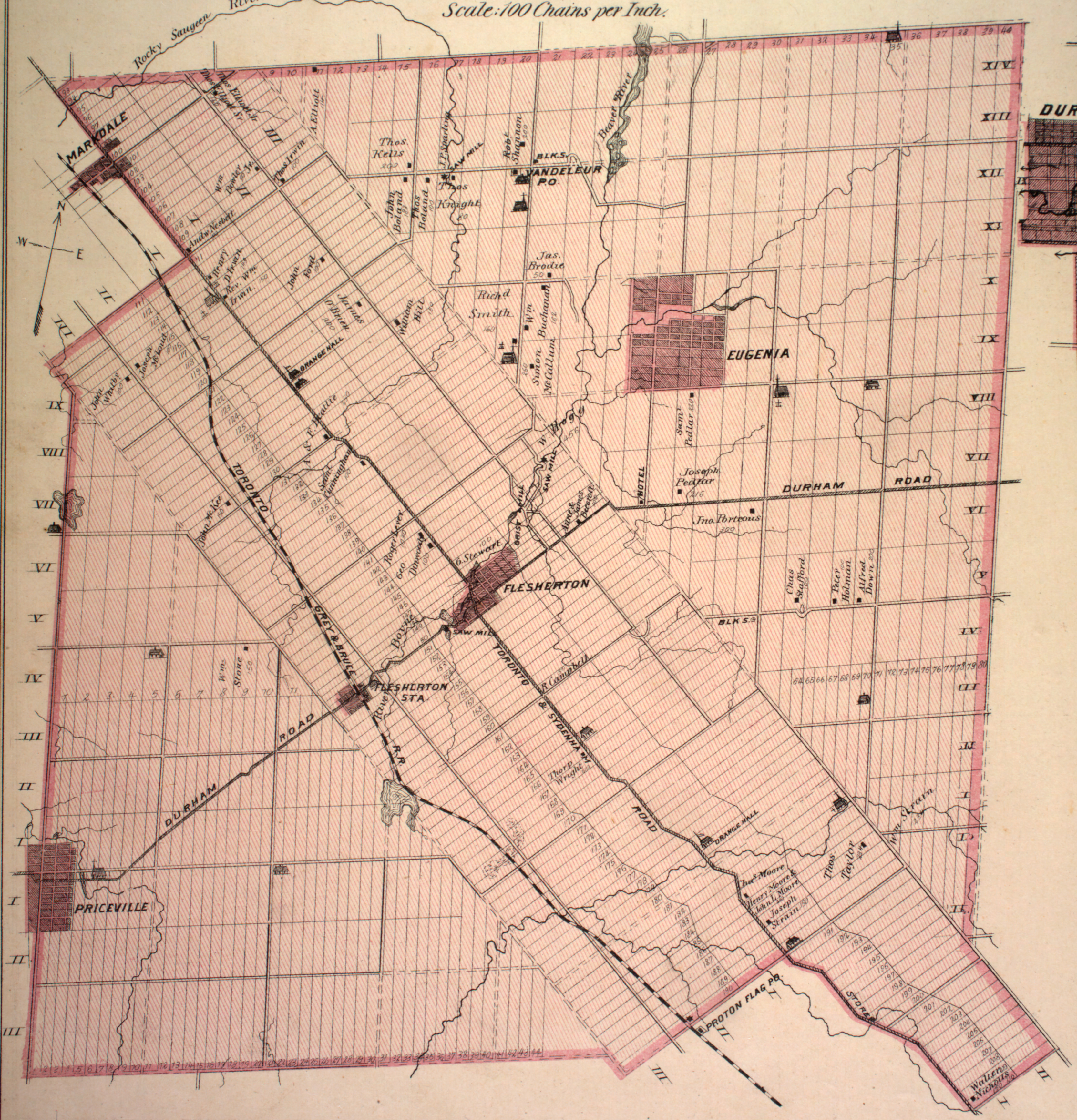
The Boyne River is a river in the municipality of Grey Highlands, Grey County in Southwestern Ontario, Canada.[1] It is part of the Great Lakes Basin, and lies entirely within geographic Artemesia Township.[2]
Course
The river begins at Wilcox Lake and flows north under the Toronto, Grey and Bruce Railway line. It passes through Flesherton Community Pond at the community of Flesherton, then exits the pond over a weir and passes under Ontario Highway 10. It continues north and starts to descend the Niagara Escarpment by passing over the Hoggs Falls,[3] named after William Hogg, takes in the right tributary Flesherton Creek, and continues downhill to its mouth at the Beaver River west of the community of Eugenia. The Beaver River flows to Georgian Bay on Lake Huron.
Tributaries
- Flesherton Creek (right)
References
- ↑ "Boyne River". Geographical Names Data Base. Natural Resources Canada. Retrieved 2014-04-19.
- ↑ "Township of Artemesia" (JPG). Canadian County Atlas Project. McGill University. 2001. Retrieved 2014-04-19.
- ↑ "Hoggs Falls". County of Grey. Retrieved 2014-04-19.
Other map sources:
- Map 4 (PDF) (Map). 1 : 700,000. Official road map of Ontario. Ministry of Transportation of Ontario. 2010-01-01. Retrieved 2014-04-19.
- Restructured municipalities - Ontario map #6 (Map). Restructuring Maps of Ontario. Ontario Ministry of Municipal Affairs and Housing. 2006. Retrieved 2014-04-19.