Boyes Hot Springs, California
| Boyes Hot Springs | |
|---|---|
| Census designated place | |
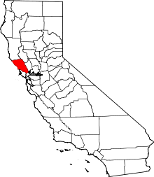
 Location in Sonoma County and the state of California | |
 Boyes Hot Springs Location in the United States | |
| Coordinates: 38°18′40″N 122°29′2″W / 38.31111°N 122.48389°WCoordinates: 38°18′40″N 122°29′2″W / 38.31111°N 122.48389°W[1] | |
| Country |
|
| State |
|
| County | Sonoma |
| Area[2] | |
| • Total | 1.059 sq mi (2.742 km2) |
| • Land | 1.059 sq mi (2.742 km2) |
| • Water | 0 sq mi (0 km2) 0% |
| Elevation[3] | 135 ft (41 m) |
| Population (April 1, 2010) | |
| • Total | 6,656 |
| • Density | 6,300/sq mi (2,400/km2) |
| Time zone | Pacific (UTC-8) |
| • Summer (DST) | PDT (UTC-7) |
| ZIP code | 95416 (PO boxes), 95476 (Street addresses) |
| Area code | 707 |
| FIPS code | 06-07848 |
| GNIS feature ID | 1658122 |
Boyes Hot Springs (also called Boyes Springs or The Springs[4])is a census-designated place (CDP) in Sonoma Valley, Sonoma County, California, United States. The population was 6,656 people at the 2010 census. Resorts in Boyes Hot Springs, El Verano, Fetters Hot Springs, and Agua Caliente were popular health retreats for tourists from San Francisco and points beyond until the middle of the 20th century because of the geothermic hot springs that still well up from deep within the earth.
History
The area was first occupied by Indigenous peoples who discovered and used the hot springs that the area is named after. Eventually, in 1840, the area was developed for commercial use by T.M. Leavenworth, who came from San Francisco.[5] In 1889, property was being sold in the area as being near the "celebrated old Indian Medicine Spring."[4] Captain H.E. Boyes discovered hot springs in 1895 in the central part of the area. He and his wife called the area Agua Rica.[4][5] and started the Boyes Hot Springs Hotel, which is now the site of the Fairmont Hotels and Resorts' Sonoma Mission Inn and Spa.[5] The area became popular with tourists, with over 70,000 visiting each year. A railroad serviced the area during this period.[6]
During the Great Depression, the area's tourism business stopped and the hotel closed.[5] During that period, the Oakland Oaks and San Francisco Seals did their spring training in Boyes Hot Springs.[4] Tourism became the region's main economic focus again in the 1930s. The area was then taken over by the United States Navy during World War II, who sent sailors to the area for recreation.[5] Railroad service stopped in 1942.[4]
Today, the area is primarily residential with a large Latino population. Boyes Hot Springs is part of an area called "The Springs," which comprises Boyes and Fetters Hot Springs-Agua Caliente.[6]
Geography
According to the United States Census Bureau, the CDP has a total area of 1.1 square miles (2.8 km2), all of it land. Boyes Hot Springs is known for, and named after, the hot springs that run 1,100 feet below the surface. Today, the springs are accessible through the Fairmont Hotel and Spa located in the area. The springs run at 135 degrees.[7]
Infrastructure
Transportation
The Valley of the Moon Commuter Club provides express service to San Francisco.
Geography
Climate
This region experiences hot and dry summers, with average summer temps between 85-110 degrees. According to the Köppen Climate Classification system, Boyes Hot Springs has a warm-summer Mediterranean climate, abbreviated "Csb" on climate maps.[8]
Demographics
2010
The 2010 United States Census[9] reported that Boyes Hot Springs had a population of 6,656. The population density was 6,286.3 people per square mile (2,427.2/km²). The racial makeup of Boyes Hot Springs was 4,505 (67.7%) White, 48 (0.7%) African American, 91 (1.4%) Native American, 84 (1.3%) Asian, 9 (0.1%) Pacific Islander, 1,674 (25.2%) from other races, and 245 (3.7%) from two or more races. Hispanic or Latino of any race were 3,270 persons (49.1%).
The Census reported that 99.9% of the population lived in households and 0.1% lived in non-institutionalized group quarters.
There were 2,322 households, out of which 888 (38.2%) had children under the age of 18 living in them, 1,082 (46.6%) were opposite-sex married couples living together, 267 (11.5%) had a female householder with no husband present, 162 (7.0%) had a male householder with no wife present. There were 190 (8.2%) unmarried opposite-sex partnerships, and 28 (1.2%) same-sex married couples or partnerships. 598 households (25.8%) were made up of individuals and 195 (8.4%) had someone living alone who was 65 years of age or older. The average household size was 2.86. There were 1,511 families (65.1% of all households); the average family size was 3.46.
The population was spread out with 1,763 people (26.5%) under the age of 18, 654 people (9.8%) aged 18 to 24, 1,957 people (29.4%) aged 25 to 44, 1,664 people (25.0%) aged 45 to 64, and 618 people (9.3%) who were 65 years of age or older. The median age was 34.0 years. For every 100 females there were 103.3 males. For every 100 females age 18 and over, there were 104.0 males.
There were 2,508 housing units at an average density of 2,368.7 per square mile (914.6/km²), of which 53.7% were owner-occupied and 46.3% were occupied by renters. The homeowner vacancy rate was 1.6%; the rental vacancy rate was 3.6%. 46.6% of the population lived in owner-occupied housing units and 53.3% lived in rental housing units.
2000
As of the census[10] of 2000, there were 6,665 people, 2,256 households, and 1,495 families residing in the CDP. The population density was 6,329.9 people per square mile (2,450.8/km²). There were 2,395 housing units at an average density of 2,274.6 per square mile (880.7/km²). The racial makeup of the CDP was 74.99% White, 0.42% African American, 0.72% Native American, 0.92% Asian, 0.09% Pacific Islander, 18.24% from other races, and 4.62% from two or more races. Hispanic or Latino of any race were 41.67% of the population.
There were 2,256 households out of which 37.7% had children under the age of 18 living with them, 49.5% were married couples living together, 11.0% had a female householder with no husband present, and 33.7% were non-families. 25.0% of all households were made up of individuals and 6.4% had someone living alone who was 65 years of age or older. The average household size was 2.95 and the average family size was 3.53.
In the CDP the population was spread out with 28.5% under the age of 18, 10.7% from 18 to 24, 32.8% from 25 to 44, 20.2% from 45 to 64, and 7.8% who were 65 years of age or older. The median age was 32 years. For every 100 females there were 104.4 males. For every 100 females age 18 and over, there were 105.7 males.
The median income for a household in the CDP was $50,668, and the median income for a family was $54,469. Males had a median income of $35,085 versus $28,951 for females. The per capita income for the CDP was $20,115. About 8.6% of families and 12.0% of the population were below the poverty line, including 16.0% of those under age 18 and 9.9% of those age 65 or over.
Economy
Historically, tourism has been a major economic factor for the area, focusing around the attraction of the naturally occurring hot springs. The springs were not only used for bathing, but, also for bottling. Electricity ran bottling plants, which bottled carbonated and still water for consumption.[11]
Tourism and food
Boyes Hot Springs is the site of the third Fairmont Hotel and Resorts property in Northern California, the Fairmont Sonoma Mission Inn & Spa. The high end hotel is located on a historic hotel site that served as a popular getaway for tourists in the 1920s who used the hot springs located in the area. The spa on-site uses the hot springs that the area is named after.[5] The restaurant El Molino Central serves Mexican street food and is known for its house made tortillas.[6] The Italian restaurant Mary's Pizza Shack opened its first restaurant in Boyes Hot Springs.[4] Boyes Hot Springs is also known for having one of the first Michelin Guide star rated restaurants in the area, Santé, which is located in the Fairmont.[12]
Government
In the California State Legislature, Boyes Hot Springs is in the 2nd Senate District, represented by Democrat Mike McGuire, and in the 4th Assembly District, represented by Democrat Cecilia Aguiar-Curry.[13]
In the United States House of Representatives, Boyes Hot Springs is in California's 5th congressional district, represented by Democrat Mike Thompson.[14]
References
- ↑ "US Gazetteer files: 2010, 2000, and 1990". United States Census Bureau. 2011-02-12. Retrieved 2011-04-23.
- ↑ "2010 Census U.S. Gazetteer Files – Places – California". United States Census Bureau.
- ↑ "Boyes Hot Springs". Geographic Names Information System. United States Geological Survey. Retrieved April 6, 2015.
- 1 2 3 4 5 6 Kathleen Thompson Hill; Gerald Hill (1 July 2005). Sonoma Valley: The Secret Wine Country. Globe Pequot Press. p. 282. ISBN 978-0-7627-3444-3.
- 1 2 3 4 5 6 "Hotel History". Fairmont Sonoma Mission Inn & Spa. Fairmont. Retrieved 10 July 2014.
- 1 2 3 Sweet, Carey (26 April 2013). "Boyes Hot Springs' water draws visitors". Travel. San Francisco Chroncile. SFGate. Retrieved 10 July 2014.
- ↑ Rodriguez, Suzie (23 March 2012). "Feel the heat of Agua Caliente's mineral waters". Sonoma. Press-Democrat. Retrieved 10 July 2014.
- ↑ Climate Summary for Boyes Hot Springs, California
- ↑ "2010 Census Interactive Population Search: CA - Boyes Hot Springs CDP". U.S. Census Bureau. Retrieved July 12, 2014.
- ↑ "American FactFinder". United States Census Bureau. Archived from the original on 2013-09-11. Retrieved 2008-01-31.
- ↑ Walter Wadsworth Bradley; California State Mining Bureau (1915). Mines and mineral resources of the counties of Colusa, Glenn, Lake, Marin, Napa, Solano, Sonoma, Yolo. California State Printing Office. pp. 163–164.
- ↑ Inc. Staff Fodor's Travel Publications (1 November 2009). California 2010. Fodor's Travel Publications. p. 560. ISBN 978-1-4000-0859-9.
- ↑ "Statewide Database". UC Regents. Retrieved December 5, 2014.
- ↑ "California's 5th Congressional District - Representatives & District Map". Civic Impulse, LLC. Retrieved March 3, 2013.
External links
| Bodies of water |
|  |
|---|---|---|
| Counties | ||
| Major cities | ||
| Cities and towns 100k–250k | ||
| Cities and towns 50k–99k | ||
| Cities and towns 25k-50k | ||
| Cities and towns 10k–25k |
| |
| Sub-regions | ||