Boulevard East
 | |
| Location | Weehawken, West New York, Guttenberg and North Bergen, New Jersey |
|---|---|
| North | Kennedy Boulevard at Nungessers |
| South | Park Avenue in Hoboken |


Boulevard East is a two-way, mostly two lane, scenic thoroughfare in the North Hudson, New Jersey municipalities of Weehawken, West New York, Guttenberg and North Bergen. Apart from small sections at either end, the road runs along the crest of the Hudson Palisades, affording it views of the Hudson River and the New York City skyline. Developed at the turn of the century,[1][2] the residential road is characterized by an eclectic mix of 20th-century architecture, including private homes as well as mid and high-rise apartment buildings, mostly on its western side, with a promenade and parks along its eastern side. It is also the setting for Edward Hopper's 1934 painting East Wind Over Weehawken, which is considered one of his best works.
Name
Boulevard East is so named in reference to the other major boulevard in Hudson County to which it is connected, Kennedy Boulevard. Prior to being renamed in honor of John F. Kennedy in the 1960s, the street was known as Hudson Boulevard. While there was discussion of building a county long road as early as the 1870s,[3] parts of Hudson County Boulevard were officially opened in 1896.[4][5][6] By 1913 it was completed, and considered to be fine for "motoring".[7] Taken as a single road, the circuitous route of west and east sections of the entire boulevard runs from the southern tip of the county at Bergen Point to its northern border with Bergen County and south again to the Hoboken city line.[8] In local nomenclature, signage, addresses, transportation, and postal delivery, the name Boulevard East is used.[9][10][11]
Route
Much of Boulevard East runs parallel to the edge of a sheer escarpment and offers expansive views the iconographic Manhattan skyline. Since 2009, when Macy's began to launch its annual Fourth of July fireworks from the Hudson River,[12] portions of The Boulevard are closed to allow spectators to view the display.[13][14][15] The Boulevard will be part of the Port Imperial Street Circuit of the Grand Prix of America.[16][17]
The southern end of the road is an important component of local access to the Lincoln Tunnel, running past its Art Deco toll plaza and passing twice under the helix which descends to meet it. Entering a residential district of Weehawken the boulevard steeply ascends northward until reaching the Boulevard Curve where it curves east, then north again and begins travelling along the edge of the Hudson Palisades. Just to the south of the curve is the Hamilton Memorial, relocated from the Burr-Hamilton duel site at the foot of the cliffs below Kings Bluff, named for James Gore King whose 19th century estate, Highwood, once stood there, and is now a residential neighborhood.
The road then passes Hamilton Plaza where for a brief time in the 1890s stood El Dorado, a pleasure garden offering theatrical spectacles, casinos, and exotic gardens. At Liberty Place it crosses over a now defunct cut through which once ran streetcars operated by North Hudson County Railway that connected to a massive elevator and ferries at Weehawken Terminal. Pershing Road is one of the few roads which connect the waterfront to the Boulevard and the top of the cliffs, and was once part of the Lincoln Highway.[18] At the southwest corner of 49th Street stands the gabled house depicted in East Wind Over Weehawken, a 1934 painting by Edward Hopper, which is considered one of his best works.[19]
Old Glory Park is near the town line of West New York where of the much boulevard is abutted by parks and scenic overlooks. A statue of Thomas M. Donnelly, instrumental in the preservation of the Palisades, is located in the park named for him. The trap rock walls that line much of the overlook come from quarry operations that he and the NJ Federation of Women's Clubs were able curtail at the beginning of the 20th century.[20] 60th Street, the main crosstown street for the town became Hillside Road (officially renamed for Anthony DeFino, who was mayor for 24 years[21]) connecting the boulevard to River Road. One of the few residential neighborhoods on the cliff side of the boulevard is found north of the major crossroad at one of its more severe curves. It is here that the road reaches a height of nearly 260 feet near the highest point in Hudson County.[22] The park on 60th Street features a fountain erected in tribute to the victims of the September 11 Attacks.[23]
The three block section of the boulevard in Guttenberg is dominated by the Galaxy Towers, a Brutalist trio of octagonal buildings, which rise from the foot of the palisades and soar above them. Ferry Road passes underneath the complex. The Woodcliff Section of North Bergen, once known as Hudson Heights, is characterized by a combination of family homes and modernist high-rises, notably the round Stonehenge. Near the point where the road bears west and enters North Hudson Park the original Bulls Ferry Road makes a steep descent to the east. It is in the park, also named for famous son James J. Braddock, that Boulevard East intersects with Palisades Avenue, which continues north along the cliffs, and soon after ends at Bergenline in Nungessers.[24]
There are numerous bridges along Boulevard East crossing over clefts in the cliffs, many approaching 100 years in age.[25] A portion of the road was closed for six months in 2013 to replace one located in North Bergen.[26][27]
Transportation
| |
|---|---|
| Location: | Weehawken–North Bergen |


Boulevard East carries three county route designations. County Route 677[28] begins as Park Avenue in Hoboken, becoming Boulevard East after crossing the viaduct over the Hudson Bergen Light Rail tracks. At Highwood Terrace in Weehawken it becomes part of County Route 505. From 60th Street in West New York it is designated County Route 693[29] until joining its western counterpart, designated County Route 501. In total the route is slightly more than three miles long.
Addresses ascend from the first at number 300.[30] In Weehawken the numbers rise to 1055. At the border with West New York at 51st Street, the addresses jump to 5101, following the custom of taking the building number from the lower cross street. This system was jointly adopted by the North Hudson towns after streets were re-numbered after the opening of the Lincoln Tunnel in 1937.
New Jersey Transit bus routes 128, 165, 166, 168 travel along the boulevard between the Port Authority Bus Terminal and locations in Bergen County. NJT 23[31] provides local service. Dollar vans, many of which originate at Nungesser's, also travel along the street to 42nd Street in Manhattan. Pershing Road and public stairs connect the road to Weehawken Port Imperial, where ferries and light rail are available.
Gallery
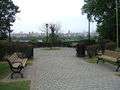 The thoroughfare is lined with many parks and scenic outlooks.
 Bust of Thomas M. Donnelly, whose contributions helped save the Palisades.
 In West New York at 60th Street, one of the few streets which connects it to the Hudson River waterfront.
 Art-Deco-era apartment buildings and promenade in North Bergen.
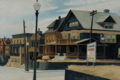
References
- ↑ "Blasts Injure Boulevard". The New York Times. New York City. May 5, 1905. Retrieved 2010-11-22.
- ↑ "New Jersey Towns May Consolidate". The New York Times. June 18, 1911
- ↑ "The old and the New - The Opposition and the Proposed Route". The New York Times. August 12, 1873. Retrieved March 29, 2010.
- ↑ "JERSEY CITY'S BICYCLE PARADE.; It Was Held Yesterday on the Hudson Boulevard and Was a Big Thing.". The New York Times. August 30, 1896. Retrieved March 26, 2010.
- ↑ "The old and the New - The Opposition and the Proposed Route". The New York Times. August 12, 1873. Retrieved March 29, 2010.
- ↑ "Opening the Boulevard". The New York Times. 1896. Retrieved 2010-07-02.
- ↑ "Short Runs Near Town Pleasant Now". The New York Times. March 23, 1913.
- ↑ "Save the Palisades Cyclists to work for this purpose and the Hudson County Boulevard". The New York Times. November 11, 1895. Retrieved 2010-12-06.
- ↑ Review of Boulevard East Archived July 3, 2009, at the Wayback Machine.
- ↑ 07086 USPS Box
- ↑ "Welcome to Hudson County". United Brokers. Accessed July 7, 2010
- ↑ Sulzberger, A.G. (May 4, 2009). "July 4 Fireworks Show Moves to Hudson River". The New York Times. Retrieved 2011-07-07.
- ↑ Kaulessar, Ricardo (June 27, 2010). The Union City Reporter. p. 17
- ↑ Kocieniewski, David (July 1, 2009). "Relishing the View to a Spectacle on the Hudson". The New York Times.
- ↑ Wright, E. Assata. "Where to see Fourth of July fireworks". The Union City Reporter, pp. 1, 10 and 11
- ↑ Meinis, John (October 26, 2011), "Formula One racing coming to Weehawken, West New York", The Jersey Journal, retrieved 2011-10-27
- ↑ Schultz, Johnathon (October 26, 2011), "Plan for a New York Area Formula One Race Announced in New Jersey", The New York Times, retrieved 2011-10-27
- ↑ Sherman, Lauren; Gaulkin, Ellen Robb (February 2009). Weehawken (paper). Images of America (1st ed.). Arcadia Publishing. ISBN 978-0-7385-6268-1.
- ↑ Schwartz, Art (December 29, 2013). "Hopper comes home Woman buys modern version of $40M painting depicting her house on Boulevard East". The Hudson Reporter. Retrieved 2013-01-07.
- ↑ Hague, Jim (November 15, 2002). "Saving the Palisades Documentary, shown at Weehawken Public Library, portrays women's role in preserving cliffs". Hudson Reporter.
- ↑ Gibson, Denise. "Late West New York mayor inducted into Hall of Fame". NJ.com. January 12, 2009.
- ↑ "Hudson County High Point, New Jersey". Peakbagger.com. Retrieved July 7, 2010.
- ↑ "Moments of silence". The Union City Reporter. September 11, 2005. p. 1
- ↑ Hudson County New Jersey Street Map. Hagstrom Map Company, Inc. 2008. ISBN 0-88097-763-9.
- ↑ "Historic Bridge Survey (1991-1994)" (PDF). NJDOT. 2001. Retrieved 2013-03-26.
- ↑ Tat, Linh (March 25, 2013). "6-month 'headache' due on Boulevard East in North Bergen". The Record. Retrieved 2013-03-26.
- ↑ Conte, Michaelangelo (March 26, 2013). "A section of Boulevard East shutting down for four months during replacement of supporting arch". The Jersey Journal. Retrieved 2013-03-27.
- ↑ "Hudson County 677 II straight line diagram" (PDF). New Jersey Department of Transportation. Retrieved 2009-09-14.
- ↑ "Hudson County 693 straight line diagram" (PDF). New Jersey Department of Transportation. Retrieved 2014-11-27.
- ↑ "300 Boulevard East". Telx. Retrieved October 26, 2011.
- ↑ "North Bergen-Weehawken-Port Imperial-Hoboken". New Jersey Transit. August 31, 2013. Retrieved January 5, 2014.
Coordinates: 40°47′07″N 74°00′31″W / 40.785139°N 74.008627°W
External links
 Media related to Boulevard East at Wikimedia Commons