Bouar
| Bouar Buar[1] | |
|---|---|
|
The Bouar Megaliths on a 1967 Central African stamp | |
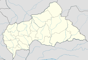 Bouar Location in Central African Republic | |
| Coordinates: 5°57′N 15°36′E / 5.950°N 15.600°E | |
| Country | Central African Republic |
| Prefecture | Nana-Mambéré |
| Elevation | 1,046 m (3,432 ft) |
| Population (2012)[2] | |
| • Total | 39,205 |

Bouar is a market town in the western Central African Republic, lying on the main road from Bangui (437 km) to the frontier with Cameroon (210 km). The city is the capital of Nana-Mambéré prefecture, has a population of 40,353, while the whole sous-préfecture has a population of 96,595 (2003 census). Bouar lies on a plateau almost 1000m above sea level and is known as the site of Camp Leclerc, a French military base.
About seventy groups of megaliths lie in the town and to its north and east. The Bouar Megaliths, dating back to the very late Neolithic Era (c. 3500–2700 BC) were added to the UNESCO World Heritage Tentative List on April 11, 2006 in the Cultural category.[3]
History
Bouar was ceded by France to Germany under the terms of the 1911 Morocco-Congo Treaty, becoming part of the German colony of Neukamerun until it was reconquered by the French during World War I. The town was occupied and burned down in the late 1920s by Gbaya rebels during the Kongo-Wara rebellion.
In 1978 the city was made the seat of the Roman Catholic Diocese of Bouar. Bouar is also the headquarters of the Eglise Evangelique Lutherienne en la Republique Centrafricaine (Evangelical Lutheran Church in the Central African Republic).
Ethnic cleansing in 2013-2014
As of February 2014 the town and region around Bouar were experiencing ethnic cleansing, principally against Muslim civilians.[4] A French journalist, Camille Lepage, was also killed and her body found in the car of Anti-balaka troops in the Bouar region in May, 2014.[5][6]
Climate
Köppen-Geiger climate classification system classifies its climate as tropical wet and dry (Aw).[7]
| Climate data for Bouar | |||||||||||||
|---|---|---|---|---|---|---|---|---|---|---|---|---|---|
| Month | Jan | Feb | Mar | Apr | May | Jun | Jul | Aug | Sep | Oct | Nov | Dec | Year |
| Average high °C (°F) | 31 (88) |
32.2 (90) |
31 (88) |
29.8 (85.6) |
28.2 (82.8) |
27 (81) |
26 (79) |
25.5 (77.9) |
26.4 (79.5) |
27.8 (82) |
30.2 (86.4) |
30.7 (87.3) |
28.82 (83.96) |
| Daily mean °C (°F) | 24.4 (75.9) |
25.5 (77.9) |
25.2 (77.4) |
24.2 (75.6) |
23.4 (74.1) |
22.5 (72.5) |
21.9 (71.4) |
21.4 (70.5) |
22 (72) |
22.8 (73) |
23.9 (75) |
23.8 (74.8) |
23.42 (74.18) |
| Average low °C (°F) | 17.8 (64) |
18.9 (66) |
19.5 (67.1) |
19.2 (66.6) |
18.7 (65.7) |
18.1 (64.6) |
17.9 (64.2) |
17.4 (63.3) |
17.7 (63.9) |
17.9 (64.2) |
17.6 (63.7) |
16.9 (62.4) |
18.13 (64.64) |
| Average precipitation mm (inches) | 4 (0.16) |
15 (0.59) |
72 (2.83) |
109 (4.29) |
144 (5.67) |
170 (6.69) |
198 (7.8) |
258 (10.16) |
251 (9.88) |
176 (6.93) |
36 (1.42) |
5 (0.2) |
1,438 (56.62) |
| Source: Climate-Data.org, altitude: 969m[7] | |||||||||||||
See also
References
- ↑ Buar (Variant) at GEOnet Names Server, United States National Geospatial-Intelligence Agency
- ↑ "World Gazetteer". Archived from the original on 2013-01-11.
- ↑ Les mégalithes de Bouar - UNESCO World Heritage Centre
- ↑ MSF, Trapped By Violence in Bouar, Central African Republic, (video) February 2014, https://www.youtube.com/watch?v=LfQuJnpVZvE
- ↑ Camerpost, Centrafrique : une journaliste française « assassinée » dans la région de Bouar – 13/05/2014, http://www.camerpost.com/centrafrique-une-journaliste-francaise-assassinee-dans-la-region-de-bouar-13052014/
- ↑ Paris confirms French journalist murdered in CAR, DW, Date 13.05.2014 , http://www.dw.de/paris-confirms-french-journalist-murdered-in-car/a-17633357
- 1 2 "Climate: Bouar - Climate graph, Temperature graph, Climate table". Climate-Data.org. Retrieved 9 October 2013.
Coordinates: 5°57′N 15°36′E / 5.950°N 15.600°E