Bostonia, California
| Bostonia | |
|---|---|
| Census designated place | |
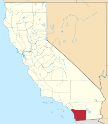
 Location in San Diego County and the state of California | |
 Bostonia Location in the United States | |
| Coordinates: 32°49′8″N 116°57′37″W / 32.81889°N 116.96028°WCoordinates: 32°49′8″N 116°57′37″W / 32.81889°N 116.96028°W | |
| Country |
|
| State |
|
| County | San Diego |
| Area[1] | |
| • Total | 1.929 sq mi (4.996 km2) |
| • Land | 1.929 sq mi (4.996 km2) |
| • Water | 0 sq mi (0 km2) 0% |
| Elevation[2] | 486 ft (148 m) |
| Population (April 1, 2010) | |
| • Total | 15,379 |
| • Density | 8,000/sq mi (3,100/km2) |
| Time zone | Pacific (UTC-8) |
| • Summer (DST) | PDT (UTC-7) |
| ZIP code | 92021 |
| Area code | 619 |
| FIPS code | 06-07624 |
| GNIS feature IDs | 1656442, 2407889 |
Bostonia is a census-designated place (CDP) in San Diego County, California. A neighborhood comprising areas within the city limits of northeast El Cajon, as well as areas of unincorporated San Diego County bears the same name. The population of the CDP was 15,379 at the 2010 census, up from 15,169 at the 2000 census (these figures do not include people living within the city of El Cajon).
Geography
According to the USGS, Bostonia is located at 32°48′27″N 116°56′11″W / 32.80750°N 116.93639°W (32.8075509, -116.9364153).[3] This is near the intersection of North 2nd Street and Broadway in the city of El Cajon. Bostonia Street, the Bostonia Post Office, the former Bostonia Ballroom, Bostonia Elementary School and the Bostonia Fire Station are all within 2,000 feet (610 m) of this location and all, except the fire station, are within the city of El Cajon. This is the area identified on most maps as Bostonia. However, the census-designated place of Bostonia is entirely outside the city limits of El Cajon, in an unincorporated area of County. The CDP comprises most of unincorporated El Cajon north of Broadway and east of State Route 67, and a small area west of State Route 67. Mail sent to all parts of Bostonia is addressed to El Cajon.
According to the United States Census Bureau Bostonia is located at 32°49′18″N 116°57′0″W / 32.82167°N 116.95000°W (32.821612, -116.949905).[4] This is approximately one mile northwest of where the USGS places Bostonia, near the geographic center of the CDP. The CDP has a total area of 1.9 square miles (4.9 km2), all land.
Demographics
| Historical population | |||
|---|---|---|---|
| Census | Pop. | %± | |
| 1990 | 13,670 | — | |
| 2000 | 15,169 | 11.0% | |
| 2010 | 15,379 | 1.4% | |
| source:[5] | |||
The part of Bostonia within the city limits of El Cajon is not included in the demographics for the census-designated place cited here.
2010
The 2010 United States Census[6] reported that Bostonia had a population of 15,379. The population density was 7,973.4 people per square mile (3,078.6/km²). The racial makeup of Bostonia was 10,891 (70.8%) White, 1,011 (6.6%) African American, 102 (0.7%) Native American, 375 (2.4%) Asian, 89 (0.6%) Pacific Islander, 1,781 (11.6%) from other races, and 1,130 (7.3%) from two or more races. Hispanic or Latino of any race were 3,941 persons (25.6%).
The Census reported that 15,272 people (99.3% of the population) lived in households, 55 (0.4%) lived in non-institutionalized group quarters, and 52 (0.3%) were institutionalized.
There were 5,573 households, out of which 2,028 (36.4%) had children under the age of 18 living in them, 2,381 (42.7%) were opposite-sex married couples living together, 976 (17.5%) had a female householder with no husband present, 405 (7.3%) had a male householder with no wife present. There were 416 (7.5%) unmarried opposite-sex partnerships, and 47 (0.8%) same-sex married couples or partnerships. 1,338 households (24.0%) were made up of individuals and 545 (9.8%) had someone living alone who was 65 years of age or older. The average household size was 2.74. There were 3,762 families (67.5% of all households); the average family size was 3.25.
The population was spread out with 3,813 people (24.8%) under the age of 18, 1,820 people (11.8%) aged 18 to 24, 4,157 people (27.0%) aged 25 to 44, 3,832 people (24.9%) aged 45 to 64, and 1,757 people (11.4%) who were 65 years of age or older. The median age was 33.8 years. For every 100 females there were 94.6 males. For every 100 females age 18 and over, there were 90.9 males.
There were 5,893 housing units at an average density of 3,055.3 per square mile (1,179.7/km²), of which 2,342 (42.0%) were owner-occupied, and 3,231 (58.0%) were occupied by renters. The homeowner vacancy rate was 2.9%; the rental vacancy rate was 5.5%. 6,071 people (39.5% of the population) lived in owner-occupied housing units and 9,201 people (59.8%) lived in rental housing units.
2000
As of the census[7] of 2000, there were 15,169 people, 5,640 households, and 3,778 families residing in the CDP. The population density was 7,810.2 inhabitants per square mile (3,019.0/km²). There were 5,819 housing units at an average density of 2,996.1 per square mile (1,158.1/km²). The racial makeup of the CDP was 79.81% White, 3.98% African American, 0.90% Native American, 1.48% Asian, 0.36% Pacific Islander, 7.79% from other races, and 5.68% from two or more races. Hispanic or Latino of any race were 16.63% of the population.
There were 5,640 households out of which 37.0% had children under the age of 18 living with them, 47.0% were married couples living together, 14.2% had a female householder with no husband present, and 33.0% were non-families. 24.3% of all households were made up of individuals and 10.5% had someone living alone who was 65 years of age or older. The average household size was 2.67 and the average family size was 3.19.
In the CDP the population was spread out with 28.3% under the age of 18, 10.7% from 18 to 24, 31.8% from 25 to 44, 17.7% from 45 to 64, and 11.6% who were 65 years of age or older. The median age was 32 years. For every 100 females there were 96.2 males. For every 100 females age 18 and over, there were 91.9 males.
The median income for a household in the CDP was $37,148, and the median income for a family was $41,727. Males had a median income of $32,240 versus $26,335 for females. The per capita income for the CDP was $17,328. About 9.1% of families and 12.5% of the population were below the poverty line, including 14.9% of those under age 18 and 7.4% of those age 65 or over.
Government
In the California State Legislature, Bostonia is in the 38th Senate District, represented by Republican Joel Anderson, and in the 71st Assembly District, represented by Republican Randy Voepel.[8]
In the United States House of Representatives, Bostonia is in California's 50th congressional district, represented by Republican Duncan D. Hunter.[9]
External links
- ↑ "2010 Census U.S. Gazetteer Files – Places – California". United States Census Bureau.
- ↑ "Bostonia". Geographic Names Information System. United States Geological Survey. Retrieved October 20, 2014.
- ↑ "Geographic Names Information System". United States Geological Survey. Retrieved 2008-01-31.
- ↑ "US Gazetteer files: 2010, 2000, and 1990". United States Census Bureau. 2011-02-12. Retrieved 2011-04-23.
- ↑ "CENSUS OF POPULATION AND HOUSING (1790-2000)". U.S. Census Bureau. Retrieved 2010-07-17.
- ↑ "2010 Census Interactive Population Search: CA - Bostonia CDP". U.S. Census Bureau. Retrieved July 12, 2014.
- ↑ "American FactFinder". United States Census Bureau. Archived from the original on 2013-09-11. Retrieved 2008-01-31.
- ↑ "Statewide Database". UC Regents. Retrieved November 17, 2014.
- ↑ "California's 50th Congressional District - Representatives & District Map". Civic Impulse, LLC.