Bosa, Bogotá
| Bosa | |
|---|---|
| Locality of Bogotá | |
 Location of the locality in the city of Bogotá | |
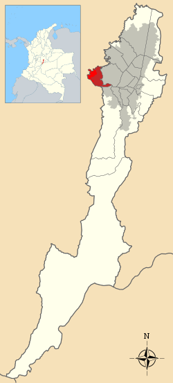 Location of the locality in the Capital District of Bogotá | |
| Country |
|
| City | Bogotá D.C. |
| Area | |
| • Total | 23.93 km2 (9.24 sq mi) |
| Elevation | 2,600 m (8,500 ft) |
| Population (2007)[1] | |
| • Total | 546,809 |
| • Density | 23,000/km2 (59,000/sq mi) |
| Time zone | Colombia Standard Time (UTC-5) |
| Website | Official website |
Bosa is the 7th locality of the Capital District of the Colombian capital city, Bogotá. Bosa is located in the southwestern part of Bogotá and is the 8th largest locality and 9th most populated.
Geography
Bosa limits to the north with the Tunjuelo River and the Camino de Osorio neighborhood in the locality of Kennedy. To the south with the Autopista Sur (South highway) bordering the localitity of Ciudad Bolívar and the municipality of Soacha in Cundinamarca Department. To the east Bosa borders again with the Tunjuelo river and the locality of Kennedy and to the west with the Bogotá River and the municipalities of Soacha and Mosquera.
Besides being crossed by the Tunjuelo and Bogotá rivers Bosa also has the Tunjuelito river and numerous creeks and streams which include the Quebradas Limas (Limas Stream), Trompeta stream, La Estrella stream and El Infierno, Quiba, Calderón, Bebedero and Aguas Calientes creeks.
History
Bosa was once the site of an important Muisca village. During the Pre-Columbian era the area was governed by caciques, among them and at the moment of the Spanish arrival; the cacique Techovita. The name of Bosa in Chibcha means "enclosure of the one that guards and defends the cornfields".[2]
Early in 1538, Bosa witnessed one of the most dramatic chapters in the history of the Muisca. The zipa or ruler Sagipa (also called Saquesazipa among other names) was hung by Gonzalo Jiménez de Quesada when his subjects failed to fill up a room with the amount of gold the conquistador asked as ransom for his freedom. At the same time, Cuxinimpaba and Cuxinimegua, the legitimate heirs to the throne of Tisquesusa, the second-last Muisca ruler who had been assassinated in Facatativá in 1537 by Jiménez de Quesada's soldiers, were hanged. This way the conquistador put end to the lineage of the Muisca rulers.

In 1538 Bosa became a meeting place for Gonzalo Jiménez de Quesada, Nicolás de Federmán and Sebastián de Belalcázar during the conquest of the Americas. The exact location of their encounter was marked with stone cross, today located on the east side of Bosa's main square.
The 4th article of the June 22, 1850 Law dissolved the resguardo for indigenous peoples in an effort to drive them away from the villages. These process ended in 1886.
On November 22, 1853 a battle took place in Bosa between the forces of Tomás Cipriano de Mosquera, José Hilario López and Pedro Alcántara Herrán against the forces of Dictator Jose Maria Melo, this became known as the Battle of Bosa.
Until the mid 20th Century Bosa was a relatively small municipality formed by five neighborhoods and a population inferior to 20,000 people dedicated to rural agricultural activities. by 1954 the government of Gustavo Rojas Pinilla annexed Bosa to the Special District of Bogotá, which triggers a demographic expansion. Bosa then became a commuter town for Bogotá.
In the Colombian Constitution of 1991 Bogotá was rearranged and became the Capital District and Bosa became its 7th locality. in 1992 and 2000 the Cabildos of Suba and Bosa were officially recognized by the Government of Bogotá as estipulated in Law 89 of 1890.
Sites of interest
- San Bernardino Church, the construction of this church began in 1618 and was declared a National Monument by the Colombian government. In front of it a stone cross marks the exact place where the three conquistadores met.
- El Humilladero Hermitage
Neighborhoods and veredas
Barrios
- Among the most important neighborhoods are : La Libertad, Palestina, Bosa Brasil, Bosa La Independencia, Piamonte, Jiménez De Quesada, Despensa, Laureles, La Estación, La Azucena, La Amistad, El Motorista, Antonia Santos, Naranjos, Olarte and Downtown Bosa.
Veredas
The San Bernardino vereda, is inhabited by direct descendants of the Muisca who used as last name the name of the tribe, such as Neuta, Chiguasque, Tunjo, Orobajo and Fitata.
Transport
Locally Bosa has very few access points due to the presence of large slums which do not have paved roads besides "Bosa Avenue". Public transportation from Bogotá arrives through the City of Cali Avenue and the May 1st Avenue and the 86th Diagonal. Bosa is served by two Transmilenio stations; Portal del Sur (line G) and Portal de Las Américas (line F) and their support routes.
References
- ↑ (Spanish) Population 2007 - DANE
- ↑ (Spanish) Etymology localities of Bogotá
External links
Coordinates: 4°37′01″N 74°11′24″W / 4.61694°N 74.19000°W
 | Administrative subdivision in 19 localities | 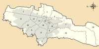 | |
|---|---|---|---|
| Metropolitan Area | |||
| Geography | |||
| |||