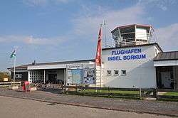
Borkum Airfield
| Borkum Airfield Flugplatz Borkum | |||||||||||||||||||
|---|---|---|---|---|---|---|---|---|---|---|---|---|---|---|---|---|---|---|---|
 | |||||||||||||||||||
| IATA: BMK – ICAO: EDWR | |||||||||||||||||||
| Summary | |||||||||||||||||||
| Airport type | Public | ||||||||||||||||||
| Operator | Wirtschaftsbetriebe der Stadt Borkum GmbH | ||||||||||||||||||
| Serves | Borkum, Germany | ||||||||||||||||||
| Elevation AMSL | 3 ft / 1 m | ||||||||||||||||||
| Coordinates | 53°35′44″N 006°42′33″E / 53.59556°N 6.70917°E | ||||||||||||||||||
| Website | borkum.de | ||||||||||||||||||
| Map | |||||||||||||||||||
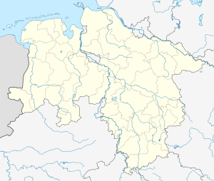 BMK Location of the airport in Lower Saxony | |||||||||||||||||||
| Runways | |||||||||||||||||||
| |||||||||||||||||||
Borkum Airfield (German: Flugplatz Borkum) (IATA: BMK, ICAO: EDWR) is an airfield serving Borkum, an island and a municipality in the Leer district in the German state of Lower Saxony.
Facilities
The airport lies at an elevation of 3 feet (1 m) above mean sea level. It has one asphalt-paved runway designated 13/31 which measures 1,000 by 20 metres (3,281 ft × 66 ft). It also has two grass runways: 12/30 is 870 by 40 metres (2,854 ft × 131 ft) and 05/23 is 810 by 40 metres (2,657 ft × 131 ft).[2]
Airlines and destinations
The following airlines offer regular scheduled and charter flights at Borkum Airfield:[4]
| Airlines | Destinations |
|---|---|
| OFD Ostfriesischer-Flug-Dienst | Emden |
See also
References
- ↑ Borkum - Flugplatz at AIRPORTS.DE
- 1 2 Airport information for EDWR from DAFIF (effective October 2006)
- ↑ Airport information for BMK at Great Circle Mapper. Source: DAFIF (effective October 2006).
- ↑ Flugplan OFD Sommer 2015
External links
This article is issued from Wikipedia - version of the 11/25/2016. The text is available under the Creative Commons Attribution/Share Alike but additional terms may apply for the media files.