Bonasila River
| Bonasila River | |
| Country | United States |
|---|---|
| State | Alaska |
| Census Area | Yukon–Koyukuk |
| Source | Nulato Hills |
| - elevation | 1,783 ft (543 m) [1] |
| - coordinates | 62°56′26″N 161°12′18″W / 62.94056°N 161.20500°W [2] |
| Mouth | Yukon River [3] |
| - location | Bonasila Slough near Elkhorn Island, 27 miles (43 km) northwest of Holy Cross |
| - elevation | 26 ft (8 m) [2] |
| - coordinates | 62°31′58″N 160°12′34″W / 62.53278°N 160.20944°WCoordinates: 62°31′58″N 160°12′34″W / 62.53278°N 160.20944°W [2] |
| Length | 125 mi (201 km) [3] |
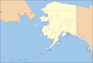 Location of the mouth of the Bonasila River in Alaska
| |
The Bonasila River is a 125-mile (201 km) tributary of the Yukon River in the U.S. state of Alaska.[3] It heads in the Nulato Hills and flows generally southeast to the Bonasila Slough, an anabranch of the larger river.[3] The slough flows around the west side of Elkhorn Island, which is about 27 miles (43 km) northwest of Holy Cross, further downstream on the Yukon.[3]
See also
References
- ↑ Derived by entering source coordinates in Google Earth.
- 1 2 3 "Bonasila River". Geographic Names Information System. United States Geological Survey. March 31, 1981. Retrieved September 30, 2013.
- 1 2 3 4 5 Orth, Donald J.; United States Geological Survey (1971) [1967]. Dictionary of Alaska Place Names: Geological Survey Professional Paper 567 (PDF). University of Alaska Fairbanks. United States Government Printing Office. p. 152. Retrieved October 1, 2013.
This article is issued from Wikipedia - version of the 9/10/2016. The text is available under the Creative Commons Attribution/Share Alike but additional terms may apply for the media files.