Bojkovice
| Bojkovice | |||
| Town | |||
|
|||
| Country | Czech Republic | ||
|---|---|---|---|
| Region | Zlín | ||
| District | Uherské Hradiště | ||
| Commune | Uherský Brod | ||
| Municipality | Bojkovice | ||
| Elevation | 272 m (892 ft) | ||
| Coordinates | CZ 49°2′20″N 17°48′40″E / 49.03889°N 17.81111°ECoordinates: CZ 49°2′20″N 17°48′40″E / 49.03889°N 17.81111°E | ||
| Area | 41.85 km2 (16.16 sq mi) | ||
| Population | 4,662 (2006-08-28) | ||
| Density | 111/km2 (287/sq mi) | ||
| First mentioned | 1362 | ||
| Mayor | Josef Slavíček | ||
| Timezone | CET (UTC+1) | ||
| - summer (DST) | CEST (UTC+2) | ||
| Postal code | 687 71 | ||
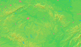  Location in the Czech Republic
| |||
| Wikimedia Commons: Bojkovice | |||
| Statistics: statnisprava.cz | |||
| Website: www.bojkovice.cz | |||

Bojkovice (Czech pronunciation: [ˈbojkovɪtsɛ]) is a town in the Zlín Region of the Czech Republic. It is part of the region of Slovácko, which is more a traditional than administrative unit. With its population of 4760 people it ranks among the smaller towns of the Czech Republic. It lies in the White Carpathian Mountains, which has the status of a protected landscape area.
History
The settlement was a small village in the 11th century. It was promoted to the status of a town in 1449. In the 16th century, the town was attacked and plundered by the Hungarians, bringing periods of famine.
The 19th century brought greater prosperity, as railroads and electrical grids entered the area. During World War II, it was occupied by Nazi Germany, who converted the local factory to war-materials production.
The town received its present status in 1965.
Places of interest
- Castle Nový Světlov: the original fort was built in the 1480s to protect the town from the attacks of Hungarians. Later it was converted into a castle in the Neo-gothic style. There are only two other castles built in the same style - Hluboká nad Vltavou Castle in the Czech Republic and Miramare in Italy.
- Museum of local folklore and traditions.
External links
- Official site Bojkovice city
- Photogallery of Bojkovice
- Slovácko Official Site - also in English, German, Polish and Slovak
- Folklore ensemble Svetlovanek- Official Site - also in English, German
| Wikimedia Commons has media related to Bojkovice. |