Boa Vista, Cape Verde (municipality)
| Boa Vista | |
|---|---|
| Municipality | |
 | |
| Coordinates: 16°06′N 22°49′W / 16.10°N 22.82°WCoordinates: 16°06′N 22°49′W / 16.10°N 22.82°W | |
| Country | Cape Verde |
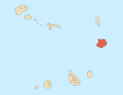
| Island | Boa Vista |
| Area | |
| • Total | 631.1 km2 (243.7 sq mi) |
| Population (2010)[1] | |
| • Total | 8,698 |
| • Density | 14/km2 (36/sq mi) |
Boa Vista is a concelho (municipality) of Cape Verde. It covers the whole island of Boa Vista. Its capital is the town Sal Rei. The municipality consists of two freguesias (civil parishes):
Demography
| Population of Boa Vista, Cape Verde (municipality) (1940—2010) | |||||||
|---|---|---|---|---|---|---|---|
| 1940[2] | 1950[2] | 1960[2] | 1970[2] | 1980[2] | 1990[2] | 2000[3] | 2010[4] |
| 2779 | 2985 | 3263 | 3569 | 3372 | 3452 | 4209 | 8696 |
Politics
The Movement for Democracy is the ruling party of the municipality which won 58.6% in the last election.
Municipal assembly
| 2004 % | 2004 seats | 2008 % | 2008 seats | 2012 % | 2012 seats | |
|---|---|---|---|---|---|---|
| Movement for Democracy | 64.78 | 8 | 62.6 | - | 58.6 | 8 |
| PAICV | 35.22 | 5 | 34 | - | 29 | 4 |
| FV.BV | - | - | - | - | 9.5 | 1 |
Municipality
| 2004 % | 2004 seats | 2008 % | 2008 seats | 2012 % | 2012 seats | |
|---|---|---|---|---|---|---|
| Movement for Democracy | 65.04 | 5 | 65.6 | 5 | 59.3 | 5 |
| PAICV | 34.96 | 0 | 31.3 | 0 | 28.5 | 0 |
| FV.BV | - | - | - | - | 8.9 | 0 |
Sister city
- Zocca, since May 9, 2014
References
- ↑ "2010 Census results". Instituto Nacional de Estatística Cabo Verde (in Portuguese). 17 March 2014.
- 1 2 3 4 5 6 Source: Statoids
- ↑ Source: Instituto Nacional de Estatísticas.
- ↑ "2010 Census results Boa Vista". Instituto Nacional de Estatística Cabo Verde (in Portuguese). 18 March 2014.
This article is issued from Wikipedia - version of the 11/19/2016. The text is available under the Creative Commons Attribution/Share Alike but additional terms may apply for the media files.