Blackstone, Massachusetts
| Blackstone, Massachusetts | ||
|---|---|---|
| Town | ||
|
Rolling Dam on the Blackstone River | ||
| ||
| Motto: "Do well and doubt not." | ||
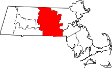
 Location in Worcester County and the state of Massachusetts. | ||
| Coordinates: 42°01′04″N 71°32′30″W / 42.01778°N 71.54167°WCoordinates: 42°01′04″N 71°32′30″W / 42.01778°N 71.54167°W | ||
| Country | United States | |
| State | Massachusetts | |
| County | Worcester | |
| Settled | 1662 | |
| Incorporated | 1845 | |
| Government | ||
| • Type | Open town meeting | |
| • Town Administrator | Daniel M. Keyes | |
| • Board of Selectmen |
Robert Dubois, Chairman Margo Bik, Vice-Chairman Paul Haughey, Clerk Michael Catalano Jr. Daniel Keefe | |
| Area | ||
| • Total | 11.2 sq mi (29.1 km2) | |
| • Land | 10.9 sq mi (28.2 km2) | |
| • Water | 0.3 sq mi (0.9 km2) | |
| Elevation | 186 ft (57 m) | |
| Population (2010) | ||
| • Total | 9,026 | |
| • Density | 810/sq mi (310/km2) | |
| Time zone | Eastern (UTC-5) | |
| • Summer (DST) | Eastern (UTC-4) | |
| ZIP code | 01504 | |
| Area code(s) | 508 / 774 | |
| FIPS code | 25-06015 | |
| GNIS feature ID | 0619477 | |
| Website | www.townofblackstone.org | |


Blackstone is a town in Worcester County, Massachusetts, United States. The population was 9,026 at the 2010 census. It is formally a part of the Providence metropolitan area.[1]
History
This region was originally inhabited by the Nipmuc. Blackstone was first settled in 1662 and was officially incorporated in 1845. Initially, the town was part of Mendon, Massachusetts, before becoming a separate municipality. Prior to 1915, Blackstone contained the area to the west that would break away and become Millville, Massachusetts. Blackstone is within the area of the John H. Chaffee Blackstone River Valley National Heritage Corridor of Massachusetts and Rhode Island.
Geography
According to the United States Census Bureau, the town has a total area of 11.2 square miles (29 km2), of which 10.9 square miles (28 km2) is land and 0.3 square miles (0.78 km2), or 2.94%, is water. The Blackstone River, birthplace of the Industrial Revolution in the United States,[2] meanders west to southeast, on the south border of town.
The town is bordered by North Smithfield, Rhode Island and Woonsocket, Rhode Island to the south; Millville, Massachusetts to the west; Mendon, Massachusetts to the north, and Bellingham, Massachusetts (Norfolk County) to the east.
Named places in the town include:[3]
- Blackstone Village
- Central Village
- East Blackstone
- Farnum's Gate
- Five Corners
- High Rocks
- Millerville
- New City
- Privilege
- Rural District
- Waterford
- Wheelockville
- Woonsocket Junction (New York and New England Railroad junction)
An East Blackstone railroad station was formerly located in Bellingham.
Demographics
| Historical population | ||
|---|---|---|
| Year | Pop. | ±% |
| 1850 | 4,391 | — |
| 1860 | 5,453 | +24.2% |
| 1870 | 5,421 | −0.6% |
| 1880 | 4,907 | −9.5% |
| 1890 | 6,138 | +25.1% |
| 1900 | 5,721 | −6.8% |
| 1910 | 5,648 | −1.3% |
| 1920 | 4,299 | −23.9% |
| 1930 | 4,674 | +8.7% |
| 1940 | 4,566 | −2.3% |
| 1950 | 4,968 | +8.8% |
| 1960 | 5,130 | +3.3% |
| 1970 | 6,566 | +28.0% |
| 1980 | 6,570 | +0.1% |
| 1990 | 8,023 | +22.1% |
| 2000 | 8,804 | +9.7% |
| 2010 | 9,026 | +2.5% |
| * = population estimate. Source: United States Census records and Population Estimates Program data.[4][5][6][7][8][9][10][11][12][13] | ||
As of the census[14] of 2000, there were 8,804 people, 3,235 households, and 2,355 families residing in the town. The population density was 807.4 people per square mile (311.9/km²). There were 3,331 housing units at an average density of 305.5 per square mile (118.0/km²). The racial makeup of the town was 97.39% White, 0.33% African American, 0.24% Native American, 0.76% Asian, 0.01% Pacific Islander, 0.24% from other races, and 1.03% from two or more races. Hispanic or Latino of any race were 1.03% of the population.
There were 3,235 households out of which 38.2% had children under the age of 18 living with them, 58.9% were married couples living together, 9.9% had a female householder with no husband present, and 27.2% were non-families. 22.4% of all households were made up of individuals and 8.5% had someone living alone who was 65 years of age or older. The average household size was 2.71 and the average family size was 3.20.
In the town the population was spread out with 27.7% under the age of 18, 7.5% from 18 to 24, 33.7% from 25 to 44, 20.9% from 45 to 64, and 10.1% who were 65 years of age or older. The median age was 35 years. For every 100 females there were 98.2 males. For every 100 females age 18 and over, there were 94.5 males.
The median income for a household in the town was $55,163, and the median income for a family was $61,633. Males had a median income of $42,100 versus $27,448 for females. The per capita income for the town was $20,936. About 1.8% of families and 3.7% of the population were below the poverty line, including 2.2% of those under age 18 and 12.0% of those age 65 or over.
Education
Blackstone, being part of the broader Blackstone-Millville Regional School District, is home to the Blackstone-Millville Regional High School, serving both the town of Blackstone and its western neighbor, Millville. The school mascot is the Charger. 54% of graduating students have attended a 4-year college or university, while another 26% have attended a junior college or other institution. 60% of high school juniors take the SAT, scoring an averages of 505 for verbal and 496 for math.
The high school is known in the region for its successful music program, including its competitive marching band. The Blackstone-Millville Regional High School Chargers Marching Band has traveled throughout North America for a variety of national competitions and parades, including the National Cherry Blossom Festival, the Rose Parade, as well as the Macy's Thanksgiving Day Parade. In 2000 and 2001, they won 1st place at the United States Scholastic Band Association national finals in their division, led by then-drum major Nadiene Jacques.[15] On April 7, 2013, the Blackstone-Millville Winter Percussion Ensemble won 1st place in their division at the New England Scholastic Band Association winter percussion finals. Additionally, in November 2015 the marching band took first place in the Division 4 Open USBands National Championship in East Rutherford, New Jersey.
In 2003, a new middle school was constructed, the Frederick W. Hartnett Middle School, named after former superintendent of schools, Fred Hartnett. Blackstone is also home to the Augustine F. Maloney Elementary School, as well as the John F. Kennedy Elementary School.[16]
Adjacent city and towns
- Woonsocket, Rhode Island
- Millville, Massachusetts
- North Smithfield, Rhode Island
- Mendon, Massachusetts
- Bellingham, Massachusetts
Government
| County-level state agency heads | |
|---|---|
| Clerk of Courts: | Dennis P. McManus (D) |
| District Attorney: | Joseph D. Early, Jr. (D) |
| Register of Deeds: | Anthony J. Vigliotti (D) |
| Register of Probate: | Stephanie K. Fattman (R) |
| County Sheriff: | Lew Evangelidis (R) |
| State government | |
| State Representative(s): | Kevin Kuros (R) |
| State Senator(s): | Ryan Fattman (R) |
| Governor's Councilor(s): | Jen Caissie (R) |
| Federal government | |
| U.S. Representative(s): | James P. McGovern (D-2nd District), |
| U.S. Senators: | Elizabeth Warren (D), Ed Markey (D) |
Notable people
- Con Daily, baseball player
- Bob Stewart, baseball umpire.
- Fernand St. Germain, politician
References
- ↑ "Update of Statistical area Definitions and Guidance on Their Uses" (PDF). whitehouse.gov. pp. 52, 108, 150. Archived from the original (PDF) on 2007-06-04. Retrieved 2007-06-11.
- ↑ "Blackstone River Valley National Heritage Corridor - History & Culture". National Park Service.
- ↑ CIS: Unincorporated and Unofficial Names of Massachusetts Communities
- ↑ "TOTAL POPULATION (P1), 2010 Census Summary File 1". American FactFinder, All County Subdivisions within Massachusetts. United States Census Bureau. 2010.
- ↑ "Massachusetts by Place and County Subdivision - GCT-T1. Population Estimates". United States Census Bureau. Retrieved July 12, 2011.
- ↑ "1990 Census of Population, General Population Characteristics: Massachusetts" (PDF). US Census Bureau. December 1990. Table 76: General Characteristics of Persons, Households, and Families: 1990. 1990 CP-1-23. Retrieved July 12, 2011.
- ↑ "1980 Census of the Population, Number of Inhabitants: Massachusetts" (PDF). US Census Bureau. December 1981. Table 4. Populations of County Subdivisions: 1960 to 1980. PC80-1-A23. Retrieved July 12, 2011.
- ↑ "1950 Census of Population" (PDF). Bureau of the Census. 1952. Section 6, Pages 21-10 and 21-11, Massachusetts Table 6. Population of Counties by Minor Civil Divisions: 1930 to 1950. Retrieved July 12, 2011.
- ↑ "1920 Census of Population" (PDF). Bureau of the Census. Number of Inhabitants, by Counties and Minor Civil Divisions. Pages 21-5 through 21-7. Massachusetts Table 2. Population of Counties by Minor Civil Divisions: 1920, 1910, and 1920. Retrieved July 12, 2011.
- ↑ "1890 Census of the Population" (PDF). Department of the Interior, Census Office. Pages 179 through 182. Massachusetts Table 5. Population of States and Territories by Minor Civil Divisions: 1880 and 1890. Retrieved July 12, 2011.
- ↑ "1870 Census of the Population" (PDF). Department of the Interior, Census Office. 1872. Pages 217 through 220. Table IX. Population of Minor Civil Divisions, &c. Massachusetts. Retrieved July 12, 2011.
- ↑ "1860 Census" (PDF). Department of the Interior, Census Office. 1864. Pages 220 through 226. State of Massachusetts Table No. 3. Populations of Cities, Towns, &c. Retrieved July 12, 2011.
- ↑ "1850 Census" (PDF). Department of the Interior, Census Office. 1854. Pages 338 through 393. Populations of Cities, Towns, &c. Retrieved July 12, 2011.
- ↑ "American FactFinder". United States Census Bureau. Archived from the original on 2013-09-11. Retrieved 2008-01-31.
- ↑ "Archived copy". Archived from the original on 2013-10-30. Retrieved 2013-07-18.
- ↑ http://www.bmrsd.info
External links
| Wikivoyage has a travel guide for Blackstone. |
| Wikimedia Commons has media related to Blackstone, Massachusetts. |